Washington Ave + Walnut St stop - Tuesday schedule
| Line | Direction | Time |
|---|---|---|
| 9B | Washington Ave + Lambert St | 5:44 AM |
| 9B | West Falmouth Hannaford | 6:09 AM |
| 7 | Falmouth Shaw's | 6:14 AM |
| 9B | Washington Ave + Lambert St | 6:44 AM |
| 7 | Falmouth Shaw's | 6:59 AM |
| 9B | West Falmouth Hannaford | 7:09 AM |
| 9B | Washington Ave + Lambert St | 7:16 AM |
| 7 | Falmouth Shaw's | 7:39 AM |
| 9B | Washington Ave + Lambert St | 7:44 AM |
| 9B | West Falmouth Hannaford | 8:15 AM |
| 7 | Falmouth Shaw's | 8:19 AM |
| 9B | Washington Ave + Lambert St | 8:44 AM |
| 7 | Falmouth Shaw's | 8:54 AM |
| 9B | Washington Ave + Lambert St | 9:20 AM |
| 7 | Falmouth Shaw's | 9:39 AM |
| 9B | West Falmouth Hannaford | 9:45 AM |
| 7 | Falmouth Shaw's | 10:14 AM |
| 9B | Washington Ave + Lambert St | 10:25 AM |
| 9B | Washington Ave + Lambert St | 10:50 AM |
| 7 | Falmouth Shaw's | 11:04 AM |
| 9B | West Falmouth Hannaford | 11:25 AM |
| 7 | Falmouth Shaw's | 11:39 AM |
| 9B | West Falmouth Hannaford | 11:50 AM |
| 7 | Falmouth Shaw's | 12:19 PM |
| 9B | Washington Ave + Lambert St | 12:30 PM |
Directions to Washington Ave + Walnut St stop (Portland, ME) with public transit
The following transit lines have routes that pass near Washington Ave + Walnut St
 Bus: 7, 9A, 9B, 1.
- Train: DOWNEASTER.
- Ferry: DB, IB, PK.
How to get to Washington Ave + Walnut St stop by bus?
Click on the bus route to see step by step directions with maps, line arrival times and updated time schedules.
Bus stops near Washington Ave + Walnut St stop in Portland, ME
- Washington Ave + Fox St, 1 min walk,
- Washington Ave + Eastern Prom., 4 min walk,
- North St + 143 North St, 5 min walk,
Train stations near Washington Ave + Walnut St station in Portland, ME
- Portland Station, 41 min walk,
Ferry stations near Washington Ave + Walnut St station in Portland, ME
- Casco Bay Lines Terminal, 49 min walk,
Bus lines to Washington Ave + Walnut St stop in Portland, ME
- 7, Portland Jetport,
- 9A, Pulse,
- 9B, Washington Ave + Lambert St,
- 1, St John St + 117 St John St,
What are the closest stations to Washington Ave + Walnut St?
The closest stations to Washington Ave + Walnut St are:
- Washington Ave + Fox St is 43 yards away, 1 min walk.
- Washington Ave + Eastern Prom. is 256 yards away, 4 min walk.
- North St + 143 North St is 390 yards away, 5 min walk.
- Portland Station is 3443 yards away, 41 min walk.
- Casco Bay Lines Terminal is 4115 yards away, 49 min walk.
Which bus lines stop near Washington Ave + Walnut St?
These bus lines stop near Washington Ave + Walnut St: 7, 9A, 9B.
What’s the nearest bus station to Washington Ave + Walnut St in Portland, ME?
The nearest bus station to Washington Ave + Walnut St in Portland, ME is Washington Ave + Fox St. It’s a 1 min walk away.
What time is the first train to Washington Ave + Walnut St in Portland, ME?
The DOWNEASTER is the first train that goes to Washington Ave + Walnut St in Portland, ME. It stops nearby at 5:18 AM.
What time is the last train to Washington Ave + Walnut St in Portland, ME?
The DOWNEASTER is the last train that goes to Washington Ave + Walnut St in Portland, ME. It stops nearby at 1:00 AM.
What time is the first bus to Washington Ave + Walnut St in Portland, ME?
The 7 is the first bus that goes to Washington Ave + Walnut St in Portland, ME. It stops nearby at 5:12 AM.
What time is the last bus to Washington Ave + Walnut St in Portland, ME?
The 1 is the last bus that goes to Washington Ave + Walnut St in Portland, ME. It stops nearby at 10:55 PM.
What time is the first ferry to Washington Ave + Walnut St in Portland, ME?
The DB is the first ferry that goes to Washington Ave + Walnut St in Portland, ME. It stops nearby at 5:00 AM.
What time is the last ferry to Washington Ave + Walnut St in Portland, ME?
The PK is the last ferry that goes to Washington Ave + Walnut St in Portland, ME. It stops nearby at 11:10 PM.
Washington Ave + Walnut St station
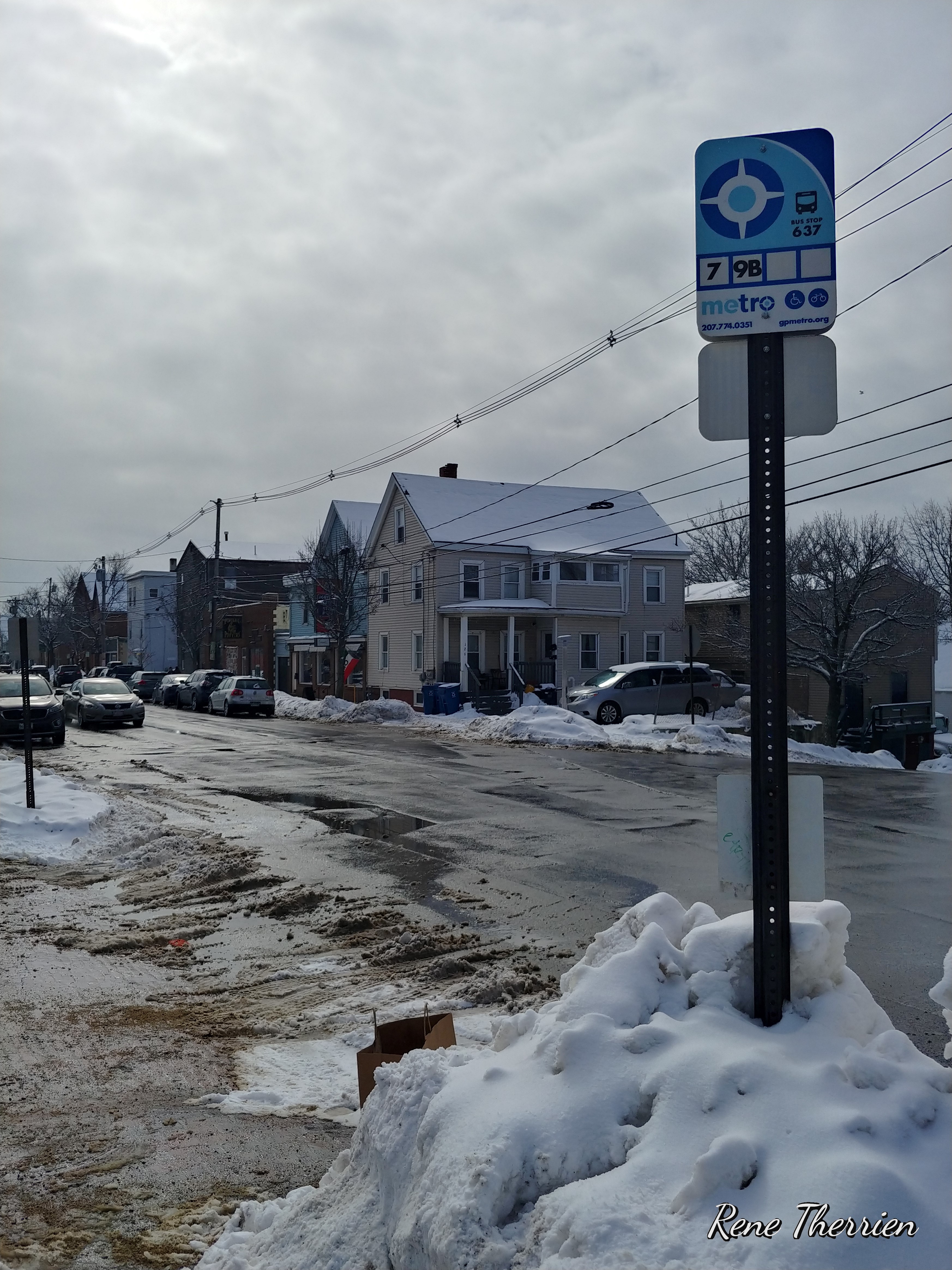 Taken by Rene T.
See Washington Ave + Walnut St stop, Portland, ME, on the map
Public transit to Washington Ave + Walnut St stop in Portland, ME
Looking for directions to Washington Ave + Walnut St in Portland, ME, United States?
Download the Moovit App to find the current schedule and step-by-step directions for Bus routes that pass through Washington Ave + Walnut St.
Looking for the nearest stops closest to Washington Ave + Walnut St ? Check out this list of closest stops to your destination: Washington Ave + Fox St; Washington Ave + Eastern Prom.; North St + 143 North St; Portland Station; Casco Bay Lines Terminal.
Bus: 7, 9A, 9B, 1.Train: DOWNEASTER.Ferry: DB, IB, PK.
We make riding on public transit to Washington Ave + Walnut St easy, which is why over 1.5 million users, including users in Portland, ME trust Moovit as the best app for public transit.
Use the app to navigate to popular places including to the airport, hospital, stadium, grocery store, mall, coffee shop, school, college, and university.
The first line to this stop is 9B, at 5:44 AM, and the last line is 7 at 10:34 PM.
This stop serves Greater Portland Metro’s lines
Popular routes from Washington Ave + Walnut St stop, Portland, ME
- Washington Ave + Fox St,
- Washington Ave + Eastern Prom.,
- North St + 143 North St
Bus stops near Washington Ave + Walnut St stop
- Portland Station
Train station near Washington Ave + Walnut St station
- Casco Bay Lines Terminal
Ferry station near Washington Ave + Walnut St station
- Elm St & Mason St,
- Lincoln St + Church St,
- Route 1 + Foreside Common Rd,
- Preble St Ext + Marginal Way,
- Johnson Rd + Time Warner Cable,
- Spring St + County Rd,
- Campus Dr & Research Dr,
- Forest Ave + 1837 Forest Ave,
- Broadway + Broadway (Shelter),
- 775 Portland Rd,
- Old Blue Point Road,
- Broadway + Clemons St,
- Cumberland Ave,
- Union Ave & West Grand Ave,
- Forest Ave + Allen Ave,
- Stevens Ave + Redlon St,
- Veranda St + Oregon St,
- W Community Center O/B,
- West Myrtle St,
- Irving Gas Station
Popular public transit stations in Portland, ME
Get around Portland, ME by public transit!
Traveling around Portland, ME has never been so easy. See step by step directions as you travel to any attraction, street or major public transit station. View bus and train schedules, arrival times, service alerts and detailed routes on a map, so you know exactly how to get to anywhere in Portland, ME.
When traveling to any destination around Portland, ME use Moovit's Live Directions with Get Off Notifications to know exactly where and how far to walk, how long to wait for your line, and how many stops are left. Moovit will alert you when it's time to get off — no need to constantly re-check whether yours is the next stop.
Wondering how to use public transit in Portland, ME or how to pay for public transit in Portland, ME? Moovit public transit app can help you navigate your way with public transit easily, and at minimum cost. It includes public transit fees, ticket prices, and costs. Looking for a map of Portland, ME public transit lines? Moovit public transit app shows all public transit maps in Portland, ME with all Bus, Train and Ferry routes and stops on an interactive map.
Portland, ME has 3 transit type(s), including: Bus, Train and Ferry, operated by several transit agencies, including Greater Portland Metro, City of South Portland, Biddeford Saco Old Orchard Beach Transit, Casco Bay Lines, Amtrak, Greyhound-us and FlixBus-us