Directions to Washington Building (Richmond) with public transportation
The following transit lines have routes that pass near Washington Building
 Bus: 1B, FLIXBUS N2471, FLIXBUS N2601, GREYHOUND US0670, 14.
- Train: NORTHEAST REGIONAL.
How to get to Washington Building by bus?
Click on the bus route to see step by step directions with maps, line arrival times and updated time schedules.
From Lorton, VA - Amtrak Auto Train Station (LOR), Fairfax County
203 minFrom Lorton, VA, Fairfax County
198 minFrom Hampton University, Hampton
284 minFrom Rose Gaming Resort, Prince William County
213 minFrom Potomac Mills Mall, Prince William County
188 minFrom Busch Gardens Williamsburg (Employee Parking Lot), James City County
132 minFrom Woodbridge, VA, Prince William County
133 minFrom UVA Hospital Medical Center, Charlottesville
298 minFrom Amazon Fulfillment Center-Ric3, Richmond
68 min
How to get to Washington Building by train?
Click on the train route to see step by step directions with maps, line arrival times and updated time schedules.
Bus stops near Washington Building in Richmond
Train station near Washington Building in Richmond
- Pathrichmond Main Street Amtrak Station, 42 min walk,VIEW
Bus lines to Washington Building in Richmond
- 14, Hermitage/Azalea,VIEW
- 29, 29x Gaskins Express(Hrc),VIEW
- 64, 64x Stony Point Express (Ric),VIEW
- 82, 82x Commonwealth 20 (Chf) Downtown (Chf),VIEW
- 95, 95x Richmond-Petersburg Express (Pbg),VIEW
- 1A, Midlothian/Hull/Transfer Station,VIEW
- 1B, Hull/Warwick Via Southside Plaza,VIEW
- 1C, Elkhart/Hull/Transfer Station,VIEW
- 7A, Laburnum/Nine Mile,VIEW
- 7B, Nine Mile,VIEW
- 56, South Laburnum,VIEW
- 2A, Forest Hill/North Ave,VIEW
- 2B, Jahnke/Forest Hill/North Ave,VIEW
- 2C, Midlothian/Semmes/North Ave,VIEW
- 5, Cary/Main/Whitcomb,VIEW
- BRT, Broad/Main/Rocketts,VIEW
What are the closest stations to Washington Building?
The closest stations to Washington Building are:
- Main + 11th is 167 yards away, 3 min walk.
- 14th + Franklin is 243 yards away, 3 min walk.
- Broad + 11th is 395 yards away, 5 min walk.
- 9th + Main is 445 yards away, 6 min walk.
- Vcu Medical Center Eastbound Station is 454 yards away, 6 min walk.
- Pathrichmond Main Street Amtrak Station is 3607 yards away, 42 min walk.
Which bus lines stop near Washington Building?
These bus lines stop near Washington Building: 1B, FLIXBUS N2471, FLIXBUS N2601, GREYHOUND US0670.
Which train line stops near Washington Building?
NORTHEAST REGIONAL (Newport News)
What’s the nearest bus station to Washington Building in Richmond?
The nearest bus stations to Washington Building in Richmond are Main + 11th and 14th + Franklin. The closest one is a 3 min walk away.
What time is the first train to Washington Building in Richmond?
The NORTHEAST REGIONAL is the first train that goes to Washington Building in Richmond. It stops nearby at 5:19 AM.
What time is the last train to Washington Building in Richmond?
The NORTHEAST REGIONAL is the last train that goes to Washington Building in Richmond. It stops nearby at 6:52 PM.
What time is the first bus to Washington Building in Richmond?
The 14 is the first bus that goes to Washington Building in Richmond. It stops nearby at 5:11 AM.
What time is the last bus to Washington Building in Richmond?
The 2C is the last bus that goes to Washington Building in Richmond. It stops nearby at 1:28 AM.
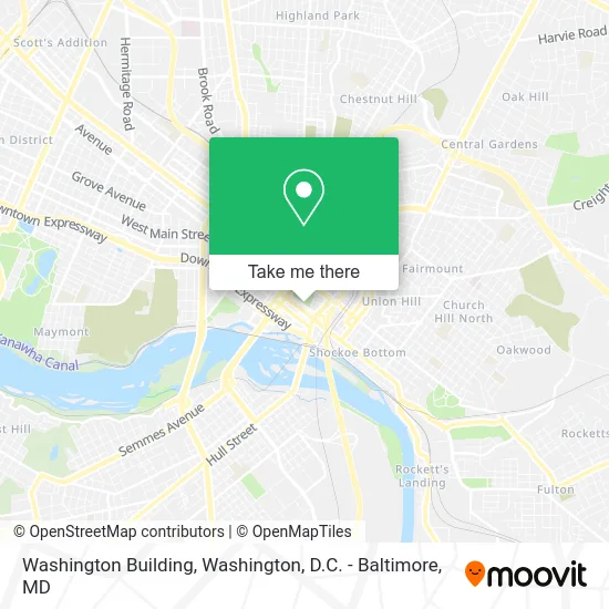
See Washington Building, Richmond, on the map
Public Transit to Washington Building in Richmond
Wondering how to get to Washington Building in Richmond? Moovit helps you find the best way to get to Washington Building with step-by-step directions from the nearest public transit station.
Moovit provides free maps and live directions to help you navigate through your city. View schedules, routes, timetables, and find out how long does it take to get to Washington Building in real time.
Looking for the nearest stop or station to Washington Building? Check out this list of stops closest to your destination: Main + 11th; 14th + Franklin; Broad + 11th; 9th + Main; Vcu Medical Center Eastbound Station; Pathrichmond Main Street Amtrak Station.
Bus: 1B, FLIXBUS N2471, FLIXBUS N2601, GREYHOUND US0670, 14, 29, 64, 82, 95, 1A, 1C, 7A, 7B, 56, 2A, 2B, 2C, 5, BRT.Train: NORTHEAST REGIONAL.
Want to see if there’s another route that gets you there at an earlier time? Moovit helps you find alternative routes or times. Get directions from and directions to Washington Building easily from the Moovit App or Website.
We make riding to Washington Building easy, which is why over 1.5 million users, including users in Richmond, trust Moovit as the best app for public transit. You don’t need to download an individual bus app or train app, Moovit is your all-in-one transit app that helps you find the best bus time or train time available.
For information on prices of bus and train, costs and ride fares to Washington Building, please check the Moovit app.
Use the app to navigate to popular places including to the airport, hospital, stadium, grocery store, mall, coffee shop, school, college, and university.
Washington Building Address: Bank St Richmond, VA 23219 street in Richmond
- Commonwealth of Virginia Capitol Police,
- Virginia Board for People with Disabilities,
- National Criminal Justice Association,
- National Agr Statistics Service,
- Government Offices State Capitol Police,
- Virginia Department of Criminal Justice Services,
- Commonwealth of Virginia Mines Minerals & Energy Dept,
- Capitol Square Parking,
- Maple Bourbon,
- British Embas,
- Thomas Jefferson Building,
- Department of Behavioral Health and Developmental Services,
- Virginia State Library - Oliver Hill Building,
- Vogue Flower Market,
- The Tribe Marketing Group,
- A Squared Asian Restaurant,
- Main Street Coffee,
- Virginia Retirement System,
- Fire and Ice Cafe,
- Capitol Waffle Shop
Places Near Washington Building (Richmond)
- Washington National Cathedral, Washington,
- Capital One Arena, Washington,
- National Museum of African American History and Culture, Washington,
- Camden Yards, Baltimore,
- Museum Of The Bible, Washington,
- National Zoo, Washington,
- Washington DC VA Medical Center, Washington,
- The Anthem, Washington,
- Basilica of the National Shrine, Washington,
- PG Mall, Prince George's County,
- M&T Bank Stadium, Baltimore,
- National Theatre, Washington,
- Marriott Marquis Washington, DC, Washington,
- Amazon Hq2, Arlington County,
- Pennsylvania Ave NW (3rd st and pennsylvania), Washington,
- Rock Creek Tennis Center, Washington,
- Sibley Memorial Hospital, Washington,
- Westfield Montgomery Mall, Montgomery County,
- Warner Theatre, Washington,
- Georgetown, Washington
How to get to popular places in Washington, D.C. - Baltimore, MD with public transit
Get around Richmond by public transit!
Traveling around Richmond has never been so easy. See step by step directions as you travel to any attraction, street or major public transit station. View bus and train schedules, arrival times, service alerts and detailed routes on a map, so you know exactly how to get to anywhere in Richmond.
When traveling to any destination around Richmond use Moovit's Live Directions with Get Off Notifications to know exactly where and how far to walk, how long to wait for your line, and how many stops are left. Moovit will alert you when it's time to get off — no need to constantly re-check whether yours is the next stop.
Wondering how to use public transit in Richmond or how to pay for public transit in Richmond? Moovit public transit app can help you navigate your way with public transit easily, and at minimum cost. It includes public transit fees, ticket prices, and costs. Looking for a map of Richmond public transit lines? Moovit public transit app shows all public transit maps in Richmond with all Bus, Train, Metro, Light Rail and Ferry routes and stops on an interactive map.
Washington, D.C. - Baltimore, MD has 5 transit type(s), including: Bus, Train, Metro, Light Rail and Ferry, operated by several transit agencies, including WMATA, Montgomery County Ride On, Fairfax Connector, TheBus, PRTC, DASH - Alexandria, Arlington Transit (ART), RTA of Central Maryland, MDOT MTA, MDOT MTA Light RailLink, MDOT MTA Commuter Bus, MDOT MTA Local Bus, FXBGO!, Virginia Railway Express (VRE) and MARC