Washington St @ Mcgrath Hwy stop - Wednesday schedule
| Line | Direction | Time |
|---|---|---|
| 220 | Hingham Depot Via Shipyard | 5:16 AM |
| 222 | East Weymouth | 5:37 AM |
| 220 | Hingham Depot Via Shipyard | 6:01 AM |
| 222 | Washington St & Pleasant St Weymouth | 6:16 AM |
| 220 | Hingham Depot Via Shipyard | 6:31 AM |
| 222 | East Weymouth | 6:47 AM |
| 220 | Hingham Depot Via Shipyard | 7:06 AM |
| 222 | Washington St & Pleasant St Weymouth | 7:26 AM |
| 220 | Hingham Depot Via Shipyard | 7:47 AM |
| 222 | East Weymouth | 8:07 AM |
| 220 | Hingham Depot Via Shipyard | 8:27 AM |
| 222 | Washington St & Pleasant St Weymouth | 8:47 AM |
| 220 | Hingham Depot Via Shipyard | 9:12 AM |
| 222 | East Weymouth | 9:37 AM |
| 220 | Hingham Depot Via Shipyard | 9:57 AM |
| 222 | Washington St & Pleasant St Weymouth | 10:17 AM |
| 220 | Hingham Depot Via Shipyard | 10:37 AM |
| 222 | East Weymouth | 10:57 AM |
| 220 | Hingham Depot Via Shipyard | 11:17 AM |
| 222 | Washington St & Pleasant St Weymouth | 11:37 AM |
| 220 | Hingham Depot Via Shipyard | 11:57 AM |
| 222 | East Weymouth | 12:17 PM |
| 220 | Hingham Depot Via Shipyard | 12:37 PM |
| 222 | Washington St & Pleasant St Weymouth | 12:57 PM |
| 220 | Hingham Depot Via Shipyard | 1:17 PM |
Directions to Washington St @ Mcgrath Hwy stop (Quincy) with public transit
The following transit lines have routes that pass near Washington St @ Mcgrath Hwy
 Bus: 210, 215, 220, 222, 216.
- Train: FALL RIVER/NEW BEDFORD, GREENBUSH, CAPEFLYER, KINGSTON.
- Subway: RED LINE.
How to get to Washington St @ Mcgrath Hwy stop by bus?
Click on the bus route to see step by step directions with maps, line arrival times and updated time schedules.
How to get to Washington St @ Mcgrath Hwy stop by train?
Click on the train route to see step by step directions with maps, line arrival times and updated time schedules.
How to get to Washington St @ Mcgrath Hwy stop by subway?
Click on the subway route to see step by step directions with maps, line arrival times and updated time schedules.
Bus stops near Washington St @ Mcgrath Hwy stop in Quincy
- Mcgrath Hwy @ Washington St, 2 min walk,
- Washington St @ Elm St, 2 min walk,
- Hancock St @ Cottage Ave, 7 min walk,
Train stations near Washington St @ Mcgrath Hwy station in Quincy
- Braintree, 26 min walk,
- Weymouth Landing/East Braintree, 61 min walk,
Subway stations near Washington St @ Mcgrath Hwy station in Quincy
- Braintree, 28 min walk,
Bus lines to Washington St @ Mcgrath Hwy stop in Quincy
- 216, Quincy Center Via Mcgrath,
- 220, Quincy Center Via Shipyard,
- 222, East Weymouth,
- 215, East Milton,
- 225, Quincy Center Via Southern Artery,
- 230, Montello,
- 236, South Shore Plaza,
- 238, Quincy Center,
What are the closest stations to Washington St @ Mcgrath Hwy?
The closest stations to Washington St @ Mcgrath Hwy are:
- Mcgrath Hwy @ Washington St is 121 yards away, 2 min walk.
- Washington St @ Elm St is 155 yards away, 2 min walk.
- Hancock St @ Cottage Ave is 506 yards away, 7 min walk.
- Braintree is 2175 yards away, 26 min walk.
- Weymouth Landing/East Braintree is 5206 yards away, 61 min walk.
Which bus lines stop near Washington St @ Mcgrath Hwy?
These bus lines stop near Washington St @ Mcgrath Hwy: 210, 215, 220, 222.
Which train lines stop near Washington St @ Mcgrath Hwy?
These train lines stop near Washington St @ Mcgrath Hwy: FALL RIVER/NEW BEDFORD, GREENBUSH.
Which subway line stops near Washington St @ Mcgrath Hwy?
RED LINE (Ashmont/Braintree)
What’s the nearest subway station to Washington St @ Mcgrath Hwy in Quincy?
The nearest subway station to Washington St @ Mcgrath Hwy in Quincy is Braintree. It’s a 28 min walk away.
What’s the nearest train station to Washington St @ Mcgrath Hwy in Quincy?
The nearest train station to Washington St @ Mcgrath Hwy in Quincy is Braintree. It’s a 26 min walk away.
What’s the nearest bus station to Washington St @ Mcgrath Hwy in Quincy?
The nearest bus stations to Washington St @ Mcgrath Hwy in Quincy are Mcgrath Hwy @ Washington St and Washington St @ Elm St. The closest one is a 2 min walk away.
What time is the first subway to Washington St @ Mcgrath Hwy in Quincy?
The RED LINE is the first subway that goes to Washington St @ Mcgrath Hwy in Quincy. It stops nearby at 5:09 AM.
What time is the last subway to Washington St @ Mcgrath Hwy in Quincy?
The RED LINE is the last subway that goes to Washington St @ Mcgrath Hwy in Quincy. It stops nearby at 1:08 AM.
What time is the first train to Washington St @ Mcgrath Hwy in Quincy?
The KINGSTON is the first train that goes to Washington St @ Mcgrath Hwy in Quincy. It stops nearby at 5:32 AM.
What time is the last train to Washington St @ Mcgrath Hwy in Quincy?
The KINGSTON is the last train that goes to Washington St @ Mcgrath Hwy in Quincy. It stops nearby at 12:25 AM.
What time is the first bus to Washington St @ Mcgrath Hwy in Quincy?
The 216 is the first bus that goes to Washington St @ Mcgrath Hwy in Quincy. It stops nearby at 4:41 AM.
What time is the last bus to Washington St @ Mcgrath Hwy in Quincy?
The 220 is the last bus that goes to Washington St @ Mcgrath Hwy in Quincy. It stops nearby at 1:47 AM.
Washington St @ Mcgrath Hwy station
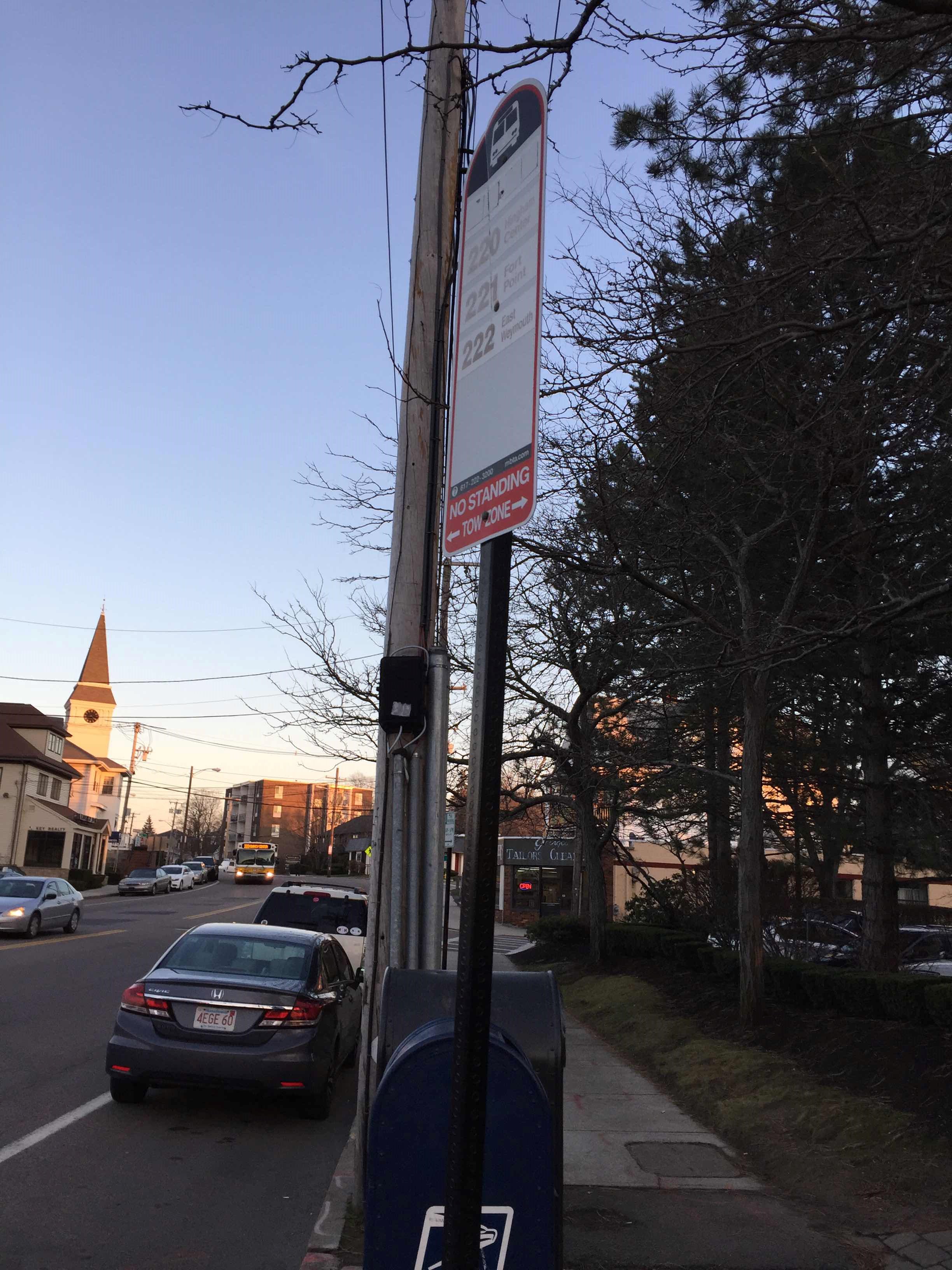 Taken by Ruthann P.
See Washington St @ Mcgrath Hwy stop, Quincy, on the map
Public transit to Washington St @ Mcgrath Hwy stop (ID: 3516) in Quincy
Looking for directions to Washington St @ Mcgrath Hwy in Quincy, United States?
Download the Moovit App to find the current schedule and step-by-step directions for Bus, Subway or Train routes that pass through Washington St @ Mcgrath Hwy.
Looking for the nearest stops closest to Washington St @ Mcgrath Hwy ? Check out this list of closest stops to your destination: Mcgrath Hwy @ Washington St; Washington St @ Elm St; Hancock St @ Cottage Ave; Braintree; Weymouth Landing/East Braintree.
Bus: 210, 215, 220, 222, 216, 225, 230, 236, 238.Train: FALL RIVER/NEW BEDFORD, GREENBUSH, CAPEFLYER, KINGSTON.Subway: RED LINE.
We make riding on public transit to Washington St @ Mcgrath Hwy easy, which is why over 1.5 million users, including users in Quincy trust Moovit as the best app for public transit.
Use the app to navigate to popular places including to the airport, hospital, stadium, grocery store, mall, coffee shop, school, college, and university.
Washington St @ Mcgrath Hwy stop’s code is 3516
The first line to this stop is 220, at 5:16 AM, and the last line is 222 at 4:56 AM.
21 Mayor Thomas J Mcgrath Highway, Quincy, MA, USA
This stop serves MBTA’s lines
- Mcgrath Hwy @ Washington St,
- Washington St @ Elm St,
- Hancock St @ Cottage Ave
Bus stops near Washington St @ Mcgrath Hwy stop
- Braintree,
- Weymouth Landing/East Braintree
Train stations near Washington St @ Mcgrath Hwy station
- Braintree
Subway station near Washington St @ Mcgrath Hwy station
- Salem St @ Cutler Hwy,
- Tremont St @ Huntington Ave,
- Hingham,
- Lincoln Park,
- E Newton St @ Harrison Ave,
- 255 Chelmsford St,
- Washington St @ Washington Terr,
- Maverick St @ Frankfort St,
- Government Center (Congress St @ North St),
- 851 Pleasant St,
- Twin River Casino,
- Government Center,
- Billerica Center,
- Umass Lowell at Cumnock Hall (University Ave),
- Alford St @ Mbta Charlestown Garage,
- Hancock St @ Bowdoin St,
- Anderson/Woburn,
- Coolidge Corner,
- Veterans Hospital West Roxbury,
- Somerville Ave @ Lowell St
Popular public transit stations in Quincy
Get around Quincy by public transit!
Traveling around Quincy has never been so easy. See step by step directions as you travel to any attraction, street or major public transit station. View bus and train schedules, arrival times, service alerts and detailed routes on a map, so you know exactly how to get to anywhere in Quincy.
When traveling to any destination around Quincy use Moovit's Live Directions with Get Off Notifications to know exactly where and how far to walk, how long to wait for your line, and how many stops are left. Moovit will alert you when it's time to get off — no need to constantly re-check whether yours is the next stop.
Wondering how to use public transit in Quincy or how to pay for public transit in Quincy? Moovit public transit app can help you navigate your way with public transit easily, and at minimum cost. It includes public transit fees, ticket prices, and costs. Looking for a map of Quincy public transit lines? Moovit public transit app shows all public transit maps in Quincy with all Bus, Train, Subway and Ferry routes and stops on an interactive map.
Boston has 4 transit type(s), including: Bus, Train, Subway and Ferry, operated by several transit agencies, including MBTA, Southeastern Regional Transit Authority, MetroWest Regional Transit Authority, Rhode Island Public Transit Authority, WRTA, Lowell Regional Transit Authority, Merrimack Valley Transit, Montachusett Regional Transit Authority, Cape Cod Regional Transit Authority, Brockton Area Transit Authority, Martha's Vineyard Transit Authority, the WAVE - Nantucket Regional Transit Authority, GATRA, Cape Ann Transportation Authority and Massport