How to get to Washington's Best Musicians by bus?
Click on the bus route to see step by step directions with maps, line arrival times and updated time schedules.
From I-295 Exit 1 - Naval Research Lab
75 minFrom U.S. Naval Research Laboratory - NRL
102 minFrom Providence Hospital
59 minFrom Echostage
48 minFrom Navy Lodge
106 minFrom Naval Research Lab
102 minFrom George H.W. Bush Center For Intelligence (CIA Headquarters)
109 minFrom Northwestern High School
88 minFrom Karma DC Live Music Venue
50 minFrom The Mall at Prince Georges
84 min
How to get to Washington's Best Musicians by metro?
Click on the metro route to see step by step directions with maps, line arrival times and updated time schedules.
Bus stops near Washington's Best Musicians
Metro stations near Washington's Best Musicians
Bus lines to Washington's Best Musicians
What are the closest stations to Washington's Best Musicians?
The closest stations to Washington's Best Musicians are:
- P St Nw+16 St NW is 23 yards away, 1 min walk.
- 16 St Nw+P St NW is 63 yards away, 2 min walk.
- 16th St & P St NW is 67 yards away, 2 min walk.
- New Hampshire & Dupont Cir NW Sb is 349 yards away, 5 min walk.
- Massachusetts Av Nw+18 St NW is 393 yards away, 5 min walk.
- Mcpherson Sq Metro Station is 413 yards away, 6 min walk.
- Farragut North - NE Corner Connecticut Ave. &Amp; K St., NW (Elevator) is 1008 yards away, 13 min walk.
- U Street is 1253 yards away, 15 min walk.
Which bus lines stop near Washington's Best Musicians?
These bus lines stop near Washington's Best Musicians: 305, A58, D32, D50, D60, D74.
Which metro line stops near Washington's Best Musicians?
RED (Shady Grove)
What’s the nearest metro station to Washington's Best Musicians?
The nearest metro station to Washington's Best Musicians is Mcpherson Sq Metro Station. It’s a 6 min walk away.
What’s the nearest bus station to Washington's Best Musicians?
The nearest bus station to Washington's Best Musicians is P St Nw+16 St NW. It’s a 1 min walk away.
What time is the first metro to Washington's Best Musicians?
The GREEN is the first metro that goes to Washington's Best Musicians. It stops nearby at 5:18 AM.
What time is the last metro to Washington's Best Musicians?
The GREEN is the last metro that goes to Washington's Best Musicians. It stops nearby at 12:23 AM.
What time is the first bus to Washington's Best Musicians?
The D60 is the first bus that goes to Washington's Best Musicians. It stops nearby at 3:00 AM.
What time is the last bus to Washington's Best Musicians?
The D60 is the last bus that goes to Washington's Best Musicians. It stops nearby at 3:06 AM.
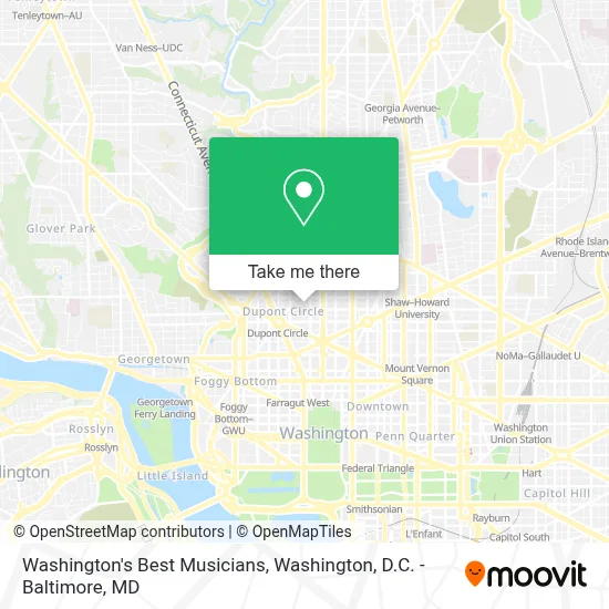
See Washington's Best Musicians on the map
Public Transportation to Washington's Best Musicians
Wondering how to get to Washington's Best Musicians? Moovit helps you find the best way to get to Washington's Best Musicians with step-by-step directions from the nearest public transit station.
Moovit provides free maps and live directions to help you navigate through your city. View schedules, routes, timetables, and find out how long does it take to get to Washington's Best Musicians in real time.
Looking for the nearest stop or station to Washington's Best Musicians? Check out this list of stops closest to your destination: P St Nw+16 St NW; 16 St Nw+P St NW; 16th St & P St NW; New Hampshire & Dupont Cir NW Sb; Massachusetts Av Nw+18 St NW; Mcpherson Sq Metro Station; Farragut North - NE Corner Connecticut Ave. &Amp; K St.; U Street.
Bus: 305, A58, D32, D50, D60, D74, C91, D6X, 315, 325.Metro: RED, BLUE, ORANGE, SILVER, GREEN, YELLOW.
Want to see if there’s another route that gets you there at an earlier time? Moovit helps you find alternative routes or times. Get directions from and directions to Washington's Best Musicians easily from the Moovit App or Website.
We make riding to Washington's Best Musicians easy, which is why over 1.7 million users, including users in Washington, trust Moovit as the best app for public transit. You don’t need to download an individual bus app or train app, Moovit is your all-in-one transit app that helps you find the best bus time or train time available.
For information on prices of bus and metro, costs and ride fares to Washington's Best Musicians, please check the Moovit app.
Use the app to navigate to popular places including to the airport, hospital, stadium, grocery store, mall, coffee shop, school, college, and university.
Washington's Best Musicians Address: 1724 Corcoran St NW street in Washington
- Dc Digs Guest Apartments,
- Sterling.Ai,
- Au Lait,
- Short Walk Home,
- Tipsy Nails And Spa,
- Floriana,
- The Commodore Dc,
- Redbox,
- Michael Andrews Bespoke, Washington, D.C.,
- Debby Harper Salon & Spa,
- The German Marshall Fund Of the United States,
- Consulate General Of Nicaragua,
- Embassy Of Nicaragua,
- Dupont Optical,
- Dupont Executive,
- Gcaar,
- Steam Cafe & Lounge,
- Dc Association Of Realtors,
- American Library Association,
- Medics Usa - Primary And Walk-In Care
Places Near Washington's Best Musicians
- National Theatre, Washington,
- M&T Bank Stadium, Baltimore,
- Westfield Montgomery Mall, Montgomery County,
- Amazon Hq2, Arlington County,
- National Zoo, Washington,
- Pennsylvania Ave NW (3rd st and pennsylvania), Washington,
- Georgetown, Washington,
- Sibley Memorial Hospital, Washington,
- Washington National Cathedral, Washington,
- Washington DC VA Medical Center, Washington,
- Basilica of the National Shrine, Washington,
- Capital One Arena, Washington,
- PG Mall, Prince George's County,
- The Anthem, Washington,
- Warner Theatre, Washington,
- National Museum of African American History and Culture, Washington,
- Museum Of The Bible, Washington,
- Marriott Marquis Washington, DC, Washington,
- Rock Creek Tennis Center, Washington,
- Camden Yards, Baltimore
How to get to popular places in Washington, D.C. - Baltimore, MD with public transit
Get around Washington by public transit!
Traveling around Washington has never been so easy. See step by step directions as you travel to any attraction, street or major public transit station. View bus and train schedules, arrival times, service alerts and detailed routes on a map, so you know exactly how to get to anywhere in Washington.
When traveling to any destination around Washington use Moovit's Live Directions with Get Off Notifications to know exactly where and how far to walk, how long to wait for your line, and how many stops are left. Moovit will alert you when it's time to get off — no need to constantly re-check whether yours is the next stop.
Wondering how to use public transit in Washington or how to pay for public transit in Washington? Moovit public transit app can help you navigate your way with public transit easily, and at minimum cost. It includes public transit fees, ticket prices, and costs. Looking for a map of Washington public transit lines? Moovit public transit app shows all public transit maps in Washington with all Bus, Train, Metro, Light Rail and Ferry routes and stops on an interactive map.
Washington, D.C. - Baltimore, MD has 5 transit type(s), including: Bus, Train, Metro, Light Rail and Ferry, operated by several transit agencies, including WMATA, Montgomery County Ride On, Fairfax Connector, TheBus, PRTC, DASH - Alexandria, Arlington Transit (ART), RTA of Central Maryland, MDOT MTA, MDOT MTA Light RailLink, MDOT MTA Commuter Bus, MDOT MTA Local Bus, FXBGO!, Virginia Railway Express (VRE) and MARC