Directions to Watermark Design (Charlottesville) with public transportation
The following transit lines have routes that pass near Watermark Design
 Bus: AFTON EXPRESS, GREYHOUND US0600, T, 6, 8.
- Train: NORTHEAST REGIONAL, CARDINAL, CRESCENT, FOOTHILLS EXPRESS.
How to get to Watermark Design by bus?
Click on the bus route to see step by step directions with maps, line arrival times and updated time schedules.
How to get to Watermark Design by train?
Click on the train route to see step by step directions with maps, line arrival times and updated time schedules.
Bus stops near Watermark Design in Charlottesville
Train station near Watermark Design in Charlottesville
- Charlottesville Amtrak Station, 61 min walk,VIEW
Bus lines to Watermark Design in Charlottesville
- T, Inbound,VIEW
- 6, UVA HEALTH/WILLOUGHBY,VIEW
- 8, BRSC/STONEFIELD,VIEW
- 10, PANTOPS/MARTHA JEFF,VIEW
- 11, LOCUST GROVE/FSQ,VIEW
- CROZET, Crozet Connect West,VIEW
- CROZET, Crozet Connect East,VIEW
- CROZET, Crozet Evening Loop,VIEW
- 29, 29 North Connect,VIEW
- AFTON EXPRESS, Afton Express,VIEW
- GREYHOUND US0600, Nashville Bus Station,VIEW
What are the closest stations to Watermark Design?
The closest stations to Watermark Design are:
- The Downtown Mall is 115 yards away, 2 min walk.
- E Market St at 2nd St NE is 215 yards away, 3 min walk.
- Water St @ Omni Hotel is 317 yards away, 4 min walk.
- Ridge Mcintire Rd. at Omni Hotel is 435 yards away, 6 min walk.
- Charlottesville Union Station is 530 yards away, 7 min walk.
- Charlottesville Amtrak Station is 5126 yards away, 61 min walk.
Which bus lines stop near Watermark Design?
These bus lines stop near Watermark Design: AFTON EXPRESS, GREYHOUND US0600.
Which train line stops near Watermark Design?
NORTHEAST REGIONAL (Roanoke)
What’s the nearest bus station to Watermark Design in Charlottesville?
The nearest bus station to Watermark Design in Charlottesville is The Downtown Mall. It’s a 2 min walk away.
What time is the first train to Watermark Design in Charlottesville?
The NORTHEAST REGIONAL is the first train that goes to Watermark Design in Charlottesville. It stops nearby at 10:07 AM.
What time is the last train to Watermark Design in Charlottesville?
The CRESCENT is the last train that goes to Watermark Design in Charlottesville. It stops nearby at 8:52 PM.
What time is the first bus to Watermark Design in Charlottesville?
The CROZET is the first bus that goes to Watermark Design in Charlottesville. It stops nearby at 5:31 AM.
What time is the last bus to Watermark Design in Charlottesville?
The GREYHOUND US0600 is the last bus that goes to Watermark Design in Charlottesville. It stops nearby at 7:15 AM.
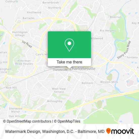
See Watermark Design, Charlottesville, on the map
Public Transit to Watermark Design in Charlottesville
Wondering how to get to Watermark Design in Charlottesville? Moovit helps you find the best way to get to Watermark Design with step-by-step directions from the nearest public transit station.
Moovit provides free maps and live directions to help you navigate through your city. View schedules, routes, timetables, and find out how long does it take to get to Watermark Design in real time.
Looking for the nearest stop or station to Watermark Design? Check out this list of stops closest to your destination: The Downtown Mall; E Market St at 2nd St NE; Water St @ Omni Hotel; Ridge Mcintire Rd. at Omni Hotel; Charlottesville Union Station; Charlottesville Amtrak Station.
Bus: AFTON EXPRESS, GREYHOUND US0600, T, 6, 8, 10, 11, CROZET, CROZET, CROZET, 29.Train: NORTHEAST REGIONAL, CARDINAL, CRESCENT, FOOTHILLS EXPRESS.
Want to see if there’s another route that gets you there at an earlier time? Moovit helps you find alternative routes or times. Get directions from and directions to Watermark Design easily from the Moovit App or Website.
We make riding to Watermark Design easy, which is why over 1.5 million users, including users in Charlottesville, trust Moovit as the best app for public transit. You don’t need to download an individual bus app or train app, Moovit is your all-in-one transit app that helps you find the best bus time or train time available.
For information on prices of bus and train, costs and ride fares to Watermark Design, please check the Moovit app.
Use the app to navigate to popular places including to the airport, hospital, stadium, grocery store, mall, coffee shop, school, college, and university.
Watermark Design Address: 300 W Main St Charlottesville, VA 22903 street in Charlottesville
- Mid Town Music,
- Open Bio Labs,
- Visi-Trak Worldwide,
- Elder Research,
- Next Level Salon,
- Red Star Consulting,
- The Cutting Edge,
- Stoneking von Storch Architects,
- John Milner Associates,
- The Cutting Edge Salon,
- Music Resource Center,
- ATM,
- The Meriwether Lewis And William Clark Sculpture,
- Greyhound Bus Lines,
- Greyhound-Charlottesville,
- Greyhound Bus,
- Free Pregnancy Testing,
- Residence Inn Charlottesville Downtown,
- Grand Market International Foods,
- Midway Manor Apartments
Places Near Watermark Design (Charlottesville)
- Museum Of The Bible, Washington,
- Pennsylvania Ave NW (3rd st and pennsylvania), Washington,
- Rock Creek Tennis Center, Washington,
- Camden Yards, Baltimore,
- Washington National Cathedral, Washington,
- M&T Bank Stadium, Baltimore,
- Basilica of the National Shrine, Washington,
- Amazon Hq2, Arlington County,
- Washington DC VA Medical Center, Washington,
- National Museum of African American History and Culture, Washington,
- PG Mall, Prince George's County,
- Warner Theatre, Washington,
- Georgetown, Washington,
- National Mall, Washington,
- Marriott Marquis Washington, DC, Washington,
- National Zoo, Washington,
- Capital One Arena, Washington,
- Westfield Montgomery Mall, Montgomery County,
- Sibley Memorial Hospital, Washington,
- The Anthem, Washington
How to get to popular places in Washington, D.C. - Baltimore, MD with public transit
Get around Charlottesville by public transit!
Traveling around Charlottesville has never been so easy. See step by step directions as you travel to any attraction, street or major public transit station. View bus and train schedules, arrival times, service alerts and detailed routes on a map, so you know exactly how to get to anywhere in Charlottesville.
When traveling to any destination around Charlottesville use Moovit's Live Directions with Get Off Notifications to know exactly where and how far to walk, how long to wait for your line, and how many stops are left. Moovit will alert you when it's time to get off — no need to constantly re-check whether yours is the next stop.
Wondering how to use public transit in Charlottesville or how to pay for public transit in Charlottesville? Moovit public transit app can help you navigate your way with public transit easily, and at minimum cost. It includes public transit fees, ticket prices, and costs. Looking for a map of Charlottesville public transit lines? Moovit public transit app shows all public transit maps in Charlottesville with all Bus, Train, Metro, Light Rail and Ferry routes and stops on an interactive map.
Washington, D.C. - Baltimore, MD has 5 transit type(s), including: Bus, Train, Metro, Light Rail and Ferry, operated by several transit agencies, including WMATA, Montgomery County Ride On, Fairfax Connector, TheBus, PRTC, DASH - Alexandria, Arlington Transit (ART), RTA of Central Maryland, MDOT MTA, MDOT MTA Light RailLink, MDOT MTA Commuter Bus, MDOT MTA Local Bus, FXBGO!, Virginia Railway Express (VRE) and MARC