How to get to Wayne Locks by bus?
Click on the bus route to see step by step directions with maps, line arrival times and updated time schedules.
Bus stops near Wayne Locks
Bus lines to Wayne Locks
What are the closest stations to Wayne Locks?
The closest stations to Wayne Locks are:
- Preakness Shopping Center is 471 yards away, 6 min walk.
- Paterson Hamburg Tpke at Berdan Ave is 618 yards away, 8 min walk.
Which bus lines stop near Wayne Locks?
These bus lines stop near Wayne Locks: 197, 744.
What’s the nearest bus station to Wayne Locks?
The nearest bus station to Wayne Locks is Preakness Shopping Center. It’s a 6 min walk away.
What time is the first bus to Wayne Locks?
The 197 is the first bus that goes to Wayne Locks. It stops nearby at 5:16 AM.
What time is the last bus to Wayne Locks?
The 197 is the last bus that goes to Wayne Locks. It stops nearby at 1:15 AM.
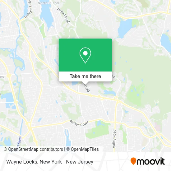
See Wayne Locks on the map
Public Transportation to Wayne Locks
Wondering how to get to Wayne Locks? Moovit helps you find the best way to get to Wayne Locks with step-by-step directions from the nearest public transit station.
Moovit provides free maps and live directions to help you navigate through your city. View schedules, routes, timetables, and find out how long does it take to get to Wayne Locks in real time.
Looking for the nearest stop or station to Wayne Locks? Check out this list of stops closest to your destination: Preakness Shopping Center; Paterson Hamburg Tpke at Berdan Ave.
Bus: 197, 744, 748.
Want to see if there’s another route that gets you there at an earlier time? Moovit helps you find alternative routes or times. Get directions from and directions to Wayne Locks easily from the Moovit App or Website.
We make riding to Wayne Locks easy, which is why over 1.5 million users, including users in Wayne, trust Moovit as the best app for public transit. You don’t need to download an individual bus app or train app, Moovit is your all-in-one transit app that helps you find the best bus time or train time available.
For information on prices of bus, costs and ride fares to Wayne Locks, please check the Moovit app.
Use the app to navigate to popular places including to the airport, hospital, stadium, grocery store, mall, coffee shop, school, college, and university.
Wayne Locks Address: 187 Berdan Ave Wayne, NJ 07470 street in Wayne
- Wayne Chamber Of Commerce - NJ,
- Silvana Adipietro Realtor Century 21 Gemini,
- George Strus - Century 21 Realtor,
- Elizabeth Keossy - Broker Associate,
- Maria Ferrito Century 21 Gemini Llc,
- USPS Collection Box - Po Lobby,
- Wayne Mobile Car Detailing,
- Blockerdns,
- United States Postal Service,
- Preakness,
- North Jersey Homes Claudia Cece,
- Ruzica Rosie Djordjevic Re / Max Country Realty,
- Jay Tatar,
- Bob Lindsay - Re/Max Legend,
- American Air Duct,
- Stop & Shop #888,
- Blue Rhino Propane Exchange,
- Lexi_Stylesz,
- Sunrise Of Wayne,
- Hallmark Licensing
Places Near Wayne Locks
- 1 Police Plaza, Manhattan,
- Pier 83, Manhattan,
- qqqq, Manhattan,
- Rockefeller Center, Manhattan,
- Katz's Deli, Manhattan,
- Queens Center Mall, Queens,
- Chinatown, Manhattan,
- Times Square, Manhattan,
- 3 Stone St, Manhattan,
- San Gennaro Feast, Manhattan,
- 66 John Street, Manhattan,
- Wall Street, Manhattan,
- Bellevue Hospital, Manhattan,
- 911 Memorial, Manhattan,
- SoHo, Manhattan,
- Mountainside Hospital, Glen Ridge,
- Hudson Yards, Manhattan,
- 111 Centre New York City Supreme Court, Manhattan,
- 26 Federal Plaza, Manhattan,
- 376 Hudson Street, Manhattan
How to get to popular places in New York - New Jersey with public transit
Get around Wayne by public transit!
Traveling around Wayne has never been so easy. See step by step directions as you travel to any attraction, street or major public transit station. View bus and train schedules, arrival times, service alerts and detailed routes on a map, so you know exactly how to get to anywhere in Wayne.
When traveling to any destination around Wayne use Moovit's Live Directions with Get Off Notifications to know exactly where and how far to walk, how long to wait for your line, and how many stops are left. Moovit will alert you when it's time to get off — no need to constantly re-check whether yours is the next stop.
Wondering how to use public transit in Wayne or how to pay for public transit in Wayne? Moovit public transit app can help you navigate your way with public transit easily, and at minimum cost. It includes public transit fees, ticket prices, and costs. Looking for a map of Wayne public transit lines? Moovit public transit app shows all public transit maps in Wayne with all Bus, Train, Subway, Light Rail, Ferry and Cable Car routes and stops on an interactive map.
New York - New Jersey has 6 transit type(s), including: Bus, Train, Subway, Light Rail, Ferry and Cable Car, operated by several transit agencies, including MTA Subway, Metro-North Railroad, LIRR, PATH, MTA New York City Transit - Express routes, MTA Bus, NJ Transit, NYC Ferry, NICE bus, Bee-Line Bus, NJ Transit Rail, Norwalk Transit District, Hartford Line, River Valley Transit and HART