How to get to Web Trends Government Solution by bus?
Click on the bus route to see step by step directions with maps, line arrival times and updated time schedules.
From Northern Virginia Community College - Annandale Campus, Fairfax County
81 minFrom Oxon Hill, MD, Prince George's County
93 minFrom Springfield, VA, Fairfax County
36 minFrom Springhill Suites Alexandria Old Town/Southwest, Alexandria
58 minFrom Army-Navy Country Club (ARL), Arlington County
75 minFrom The Capital Wheel at the National Harbor, Prince George's County
89 minFrom Birchmere, Alexandria
74 minFrom Alexandria Station - AMTRAK/VRE (ALX), Alexandria
58 minFrom Sheraton Suites Old Town Alexandria, Alexandria
72 minFrom Alexandria,VA, Alexandria
70 min
How to get to Web Trends Government Solution by train?
Click on the train route to see step by step directions with maps, line arrival times and updated time schedules.
How to get to Web Trends Government Solution by metro?
Click on the metro route to see step by step directions with maps, line arrival times and updated time schedules.
Bus stops near Web Trends Government Solution in Fairfax County
Metro station near Web Trends Government Solution in Fairfax County
- Franconia-Springfield Metro, 46 min walk,VIEW
Train station near Web Trends Government Solution in Fairfax County
- Franconia-Springfield Vre Station, 50 min walk,VIEW
Bus lines to Web Trends Government Solution in Fairfax County
What are the closest stations to Web Trends Government Solution?
The closest stations to Web Trends Government Solution are:
- Summer Ridge Rd @ Edgeware La is 339 yards away, 5 min walk.
- Kingstowne Village Pkwy @ Edgeware is 411 yards away, 5 min walk.
- Kingstowne Village Pkwy @ Joust Ln is 418 yards away, 6 min walk.
- Kingstowne Village Pkwy @ Ians Way is 429 yards away, 6 min walk.
- Telegraph Rd @ Glenwood Mews Ct is 1553 yards away, 19 min walk.
- Franconia-Springfield Metro is 3868 yards away, 46 min walk.
- Franconia-Springfield Vre Station is 4049 yards away, 50 min walk.
Which bus lines stop near Web Trends Government Solution?
These bus lines stop near Web Trends Government Solution: 232, 321.
Which train line stops near Web Trends Government Solution?
FREDERICKSBURG LINE (Spotsylvania)
Which metro line stops near Web Trends Government Solution?
BLUE (Franconia-Springfield)
What’s the nearest bus station to Web Trends Government Solution in Fairfax County?
The nearest bus stations to Web Trends Government Solution in Fairfax County are Summer Ridge Rd @ Edgeware La and Kingstowne Village Pkwy @ Edgeware. The closest one is a 5 min walk away.
What time is the first metro to Web Trends Government Solution in Fairfax County?
The BLUE is the first metro that goes to Web Trends Government Solution in Fairfax County. It stops nearby at 5:00 AM.
What time is the last metro to Web Trends Government Solution in Fairfax County?
The BLUE is the last metro that goes to Web Trends Government Solution in Fairfax County. It stops nearby at 12:44 AM.
What time is the first train to Web Trends Government Solution in Fairfax County?
The FREDERICKSBURG LINE is the first train that goes to Web Trends Government Solution in Fairfax County. It stops nearby at 6:13 AM.
What time is the last train to Web Trends Government Solution in Fairfax County?
The FREDERICKSBURG LINE is the last train that goes to Web Trends Government Solution in Fairfax County. It stops nearby at 7:24 PM.
What time is the first bus to Web Trends Government Solution in Fairfax County?
The 232 is the first bus that goes to Web Trends Government Solution in Fairfax County. It stops nearby at 4:39 AM.
What time is the last bus to Web Trends Government Solution in Fairfax County?
The 321 is the last bus that goes to Web Trends Government Solution in Fairfax County. It stops nearby at 12:58 AM.
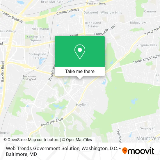
See Web Trends Government Solution, Fairfax County, on the map
Public Transit to Web Trends Government Solution in Fairfax County
Wondering how to get to Web Trends Government Solution in Fairfax County? Moovit helps you find the best way to get to Web Trends Government Solution with step-by-step directions from the nearest public transit station.
Moovit provides free maps and live directions to help you navigate through your city. View schedules, routes, timetables, and find out how long does it take to get to Web Trends Government Solution in real time.
Looking for the nearest stop or station to Web Trends Government Solution? Check out this list of stops closest to your destination: Summer Ridge Rd @ Edgeware La; Kingstowne Village Pkwy @ Edgeware; Kingstowne Village Pkwy @ Joust Ln; Kingstowne Village Pkwy @ Ians Way; Telegraph Rd @ Glenwood Mews Ct; Franconia-Springfield Metro; Franconia-Springfield Vre Station.
Bus: 232, 321, 322, 231.Train: FREDERICKSBURG LINE.Metro: BLUE.
Want to see if there’s another route that gets you there at an earlier time? Moovit helps you find alternative routes or times. Get directions from and directions to Web Trends Government Solution easily from the Moovit App or Website.
We make riding to Web Trends Government Solution easy, which is why over 1.5 million users, including users in Fairfax County, trust Moovit as the best app for public transit. You don’t need to download an individual bus app or train app, Moovit is your all-in-one transit app that helps you find the best bus time or train time available.
For information on prices of bus, metro and train, costs and ride fares to Web Trends Government Solution, please check the Moovit app.
Use the app to navigate to popular places including to the airport, hospital, stadium, grocery store, mall, coffee shop, school, college, and university.
Web Trends Government Solution Address: 6024 Stoddard Ct Alexandria, VA 22315 street in Fairfax County
- Apartment Gym,
- Findlay Plumbing,
- Servicios A Domicilio,
- Officely,
- Viceroy Moving Alexandria,
- Quality Roof,
- Total Lash DC,
- Elite Notary,
- Pixie Dust Cleaners,
- Dan and Associates Home Solutions,
- Blossom Marketing,
- Sanas Glam Room,
- 6120,
- Dogs & CATS,
- Kingstowne, VA,
- General Dynamics Corporation,
- Spirit Halloween,
- Ashley,
- Ashley Homestore,
- USCG TISCOM ( Coast Guard Ceremonial Honor Guard)
Places Near Web Trends Government Solution (Fairfax County)
- Warner Theatre, Washington,
- Pennsylvania Ave NW (3rd st and pennsylvania), Washington,
- The Anthem, Washington,
- National Museum of African American History and Culture, Washington,
- Basilica of the National Shrine, Washington,
- National Zoo, Washington,
- Georgetown, Washington,
- Washington National Cathedral, Washington,
- Amazon Hq2, Arlington County,
- Sibley Memorial Hospital, Washington,
- Rock Creek Tennis Center, Washington,
- M&T Bank Stadium, Baltimore,
- Marriott Marquis Washington, DC, Washington,
- Capital One Arena, Washington,
- Westfield Montgomery Mall, Montgomery County,
- Washington DC VA Medical Center, Washington,
- National Mall, Washington,
- Camden Yards, Baltimore,
- Museum Of The Bible, Washington,
- PG Mall, Prince George's County
How to get to popular places in Washington, D.C. - Baltimore, MD with public transit
Get around Fairfax County by public transit!
Traveling around Fairfax County has never been so easy. See step by step directions as you travel to any attraction, street or major public transit station. View bus and train schedules, arrival times, service alerts and detailed routes on a map, so you know exactly how to get to anywhere in Fairfax County.
When traveling to any destination around Fairfax County use Moovit's Live Directions with Get Off Notifications to know exactly where and how far to walk, how long to wait for your line, and how many stops are left. Moovit will alert you when it's time to get off — no need to constantly re-check whether yours is the next stop.
Wondering how to use public transit in Fairfax County or how to pay for public transit in Fairfax County? Moovit public transit app can help you navigate your way with public transit easily, and at minimum cost. It includes public transit fees, ticket prices, and costs. Looking for a map of Fairfax County public transit lines? Moovit public transit app shows all public transit maps in Fairfax County with all Bus, Train, Metro, Light Rail and Ferry routes and stops on an interactive map.
Washington, D.C. - Baltimore, MD has 5 transit type(s), including: Bus, Train, Metro, Light Rail and Ferry, operated by several transit agencies, including WMATA, Montgomery County Ride On, Fairfax Connector, TheBus, PRTC, DASH - Alexandria, Arlington Transit (ART), RTA of Central Maryland, MDOT MTA, MDOT MTA Light RailLink, MDOT MTA Commuter Bus, MDOT MTA Local Bus, FXBGO!, Virginia Railway Express (VRE) and MARC