Directions to Wedowebapps (Hallandale Beach) with public transportation
The following transit lines have routes that pass near Wedowebapps
 Bus: 04, 28, BLUE EXPRESS ROUTE, AVTPUR.
How to get to Wedowebapps by bus?
Click on the bus route to see step by step directions with maps, line arrival times and updated time schedules.
From Haulover Nude Beach, Miami Beach
60 minFrom Walmart, Miami
71 minFrom North Miami, Miami
69 minFrom Fort Lauderdale International Airport Terminal 3, Hollywood
67 minFrom Interstate 95 & FL Turnpike/US 441/Palmetto Expy/FL 826, Miami
103 minFrom Hollywood Blvd & 441, Hollywood
73 minFrom Us07, Miami Beach
67 minFrom Sawgrass Mills Mall, Miami
89 minFrom Miramar, FL, Miramar-Pembroke Pines
67 minFrom Fort Lauderdale-Hollywood International Airport (FLL) (Fort Lauderdale-Hollywood International Airpo, Hollywood
67 min
Bus stops near Wedowebapps in Hallandale Beach
Bus lines to Wedowebapps in Hallandale Beach
What are the closest stations to Wedowebapps?
The closest stations to Wedowebapps are:
- Hallandale Beach Boulevard/Layne Boulevard is 926 yards away, 12 min walk.
- The Point is 4745 yards away, 56 min walk.
- Portsview is 4903 yards away, 58 min walk.
Which bus lines stop near Wedowebapps?
These bus lines stop near Wedowebapps: 04, 28.
What’s the nearest bus station to Wedowebapps in Hallandale Beach?
The nearest bus station to Wedowebapps in Hallandale Beach is Hallandale Beach Boulevard/Layne Boulevard. It’s a 12 min walk away.
What time is the first bus to Wedowebapps in Hallandale Beach?
The 28 is the first bus that goes to Wedowebapps in Hallandale Beach. It stops nearby at 5:30 AM.
What time is the last bus to Wedowebapps in Hallandale Beach?
The 28 is the last bus that goes to Wedowebapps in Hallandale Beach. It stops nearby at 1:03 AM.
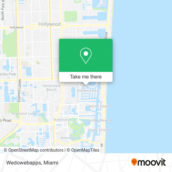
See Wedowebapps, Hallandale Beach, on the map
Public Transit to Wedowebapps in Hallandale Beach
Wondering how to get to Wedowebapps in Hallandale Beach? Moovit helps you find the best way to get to Wedowebapps with step-by-step directions from the nearest public transit station.
Moovit provides free maps and live directions to help you navigate through your city. View schedules, routes, timetables, and find out how long does it take to get to Wedowebapps in real time.
Looking for the nearest stop or station to Wedowebapps? Check out this list of stops closest to your destination: Hallandale Beach Boulevard/Layne Boulevard; The Point; Portsview.
Bus: 04, 28, BLUE EXPRESS ROUTE, AVTPUR.
Want to see if there’s another route that gets you there at an earlier time? Moovit helps you find alternative routes or times. Get directions from and directions to Wedowebapps easily from the Moovit App or Website.
We make riding to Wedowebapps easy, which is why over 1.5 million users, including users in Hallandale Beach, trust Moovit as the best app for public transit. You don’t need to download an individual bus app or train app, Moovit is your all-in-one transit app that helps you find the best bus time or train time available.
For information on prices of bus, costs and ride fares to Wedowebapps, please check the Moovit app.
Use the app to navigate to popular places including to the airport, hospital, stadium, grocery store, mall, coffee shop, school, college, and university.
Wedowebapps Address: 450 Paradise Isle Blvd Hallandale, FL 33009 street in Hallandale Beach
- Golden Horn Condominiums,
- Crystal Cove,
- Positron Project,
- Nata Beauty Spa,
- Park Layne Tower Owners Association,
- Celltronics,
- Octavix Studio,
- Law Offices of Mitchell J Cohen,
- My Medical Outlet,
- Elite Designs,
- Golden Isles, Florida,
- Golden Coiffures,
- Popshelf,
- Sara's Cafe,
- Estrella Insurance,
- Ims Electrolysis,
- Dr. Marcos Akerman MD,
- Mira Zeitlin Aesthetics,
- Yb Career Services,
- Anti Social Drive Miami
Places Near Wedowebapps (Hallandale Beach)
- Bayside Marketplace, Miami,
- Richard E. Gerstein Justice Building, Miami,
- Miami Design District, Miami,
- Keiser University Flagship Campus, West Palm Beach,
- Miami VA Hospital, Miami,
- Marlins Park, Miami,
- Miami Freedom Park, Miami,
- Sawgrass Mall, Miami,
- Little Havana, Miami,
- Zoo Miami, Miami,
- Dolphin Mall Bus, Miami,
- Hard Rock Stadium, Miami Gardens,
- Brickell City Centre, Miami,
- Dolphin Mall, Miami,
- Sawgrass mall ( FL ), Miami Beach,
- Port of Miami Cruise Terminal, Miami,
- Aventura Mall, Miami,
- Aventura Mall, Miami Beach,
- Wynwood, Miami,
- Miami-Dade County Courthouse, Miami
How to get to popular places in Miami with public transit
Get around Hallandale Beach by public transit!
Traveling around Hallandale Beach has never been so easy. See step by step directions as you travel to any attraction, street or major public transit station. View bus and train schedules, arrival times, service alerts and detailed routes on a map, so you know exactly how to get to anywhere in Hallandale Beach.
When traveling to any destination around Hallandale Beach use Moovit's Live Directions with Get Off Notifications to know exactly where and how far to walk, how long to wait for your line, and how many stops are left. Moovit will alert you when it's time to get off — no need to constantly re-check whether yours is the next stop.
Wondering how to use public transit in Hallandale Beach or how to pay for public transit in Hallandale Beach? Moovit public transit app can help you navigate your way with public transit easily, and at minimum cost. It includes public transit fees, ticket prices, and costs. Looking for a map of Hallandale Beach public transit lines? Moovit public transit app shows all public transit maps in Hallandale Beach with all Bus, Train, Light Rail and Ferry routes and stops on an interactive map.
Miami has 4 transit type(s), including: Bus, Train, Light Rail and Ferry, operated by several transit agencies, including Broward County Transit, Miami-Dade Transit, Metrorail, Palm Tran, Tri-Rail, Brightline, MARTY, City of Homestead Trolley, Key West Transit, Treasure Coast Connector, GoLine IRT, Amtrak, Greyhound-us, FlixBus-us and Aventura Express Shuttle Bus