How to get to Welcome To Cape May Sign by bus?
Click on the bus route to see step by step directions with maps, line arrival times and updated time schedules.
From Wildwood, NJ, Wildwood, Nj
46 minFrom Borgata Jitney, Atlantic City, Nj
134 minFrom Atlantic City, NJ, Atlantic City, Nj
115 minFrom Vineland New Jersey, Vineland, Nj
205 minFrom Monster Truck Ice Cream Truck, Pacific Ave, Wildwood Crest, Nj
70 minFrom Toms River, NJ, Toms River, Nj
249 minFrom Toms River Bus Terminal, Toms River, Nj
193 minFrom Avalon, NJ, Avalon, Nj
111 minFrom Jackson Township, Jackson, Nj
369 min
Bus stops near Welcome To Cape May Sign in Cape May, Nj
Bus lines to Welcome To Cape May Sign in Cape May, Nj
What are the closest stations to Welcome To Cape May Sign?
The closest stations to Welcome To Cape May Sign are:
- Perry St at Park Blvd# is 305 yards away, 4 min walk.
- Cape May Welcome Ctr - Lafayette Street is 416 yards away, 5 min walk.
Which bus lines stop near Welcome To Cape May Sign?
These bus lines stop near Welcome To Cape May Sign: 313, 552.
What’s the nearest bus station to Welcome To Cape May Sign in Cape May, Nj?
The nearest bus station to Welcome To Cape May Sign in Cape May, Nj is Perry St at Park Blvd#. It’s a 4 min walk away.
What time is the first bus to Welcome To Cape May Sign in Cape May, Nj?
The 552 is the first bus that goes to Welcome To Cape May Sign in Cape May, Nj. It stops nearby at 4:10 AM.
What time is the last bus to Welcome To Cape May Sign in Cape May, Nj?
The 552 is the last bus that goes to Welcome To Cape May Sign in Cape May, Nj. It stops nearby at 4:13 AM.
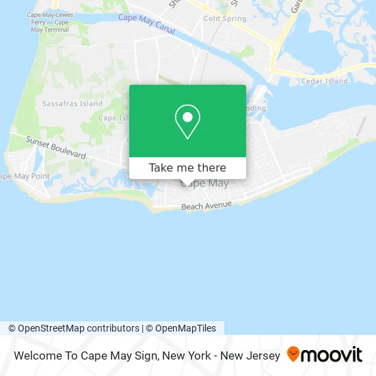
See Welcome To Cape May Sign, Cape May, Nj, on the map
Public Transit to Welcome To Cape May Sign in Cape May, Nj
Wondering how to get to Welcome To Cape May Sign in Cape May, Nj? Moovit helps you find the best way to get to Welcome To Cape May Sign with step-by-step directions from the nearest public transit station.
Moovit provides free maps and live directions to help you navigate through your city. View schedules, routes, timetables, and find out how long does it take to get to Welcome To Cape May Sign in real time.
Looking for the nearest stop or station to Welcome To Cape May Sign? Check out this list of stops closest to your destination: Perry St at Park Blvd#; Cape May Welcome Ctr - Lafayette Street.
Bus: 313, 552, 315.
Want to see if there’s another route that gets you there at an earlier time? Moovit helps you find alternative routes or times. Get directions from and directions to Welcome To Cape May Sign easily from the Moovit App or Website.
We make riding to Welcome To Cape May Sign easy, which is why over 1.5 million users, including users in Cape May, Nj, trust Moovit as the best app for public transit. You don’t need to download an individual bus app or train app, Moovit is your all-in-one transit app that helps you find the best bus time or train time available.
For information on prices of bus, costs and ride fares to Welcome To Cape May Sign, please check the Moovit app.
Use the app to navigate to popular places including to the airport, hospital, stadium, grocery store, mall, coffee shop, school, college, and university.
Location: Cape May, Nj, New York - New Jersey
- Tolley William & Jo Revs,
- Jackson St Parking Lot,
- Seaside Glassworks,
- Coinstar,
- Mutual Title Agency,
- By the Sea Realty, Lee Marcotte,
- Maison Bleue,
- King's Ice Cream,
- The Clinton Hotel,
- Gallery D'May,
- 311 Washington Mall Group,
- Morrow's Nut House,
- Cape May City,
- Clark E Degroff III,
- Rowan Viviane Design,
- Elaine's Boutique,
- D'May Home Gallery,
- Spring Step,
- Tesla,
- Comfort Station
Places Near Welcome To Cape May Sign (Cape May, Nj)
- Chinatown, Manhattan,
- 111 Centre New York City Supreme Court, Manhattan,
- Queens Center Mall, Queens,
- Katz's Deli, Manhattan,
- 911 Memorial, Manhattan,
- SoHo, Manhattan,
- Pier 83, Manhattan,
- Rockefeller Center, Manhattan,
- Mountainside Hospital, Glen Ridge,
- 3 Stone St, Manhattan,
- San Gennaro Feast, Manhattan,
- Wall Street, Manhattan,
- 66 John Street, Manhattan,
- Hudson Yards, Manhattan,
- Times Square, Manhattan,
- 26 Federal Plaza, Manhattan,
- qqqq, Manhattan,
- 376 Hudson Street, Manhattan,
- Bellevue Hospital, Manhattan,
- 1 Police Plaza, Manhattan
How to get to popular places in New York - New Jersey with public transit
Get around Cape May, Nj by public transit!
Traveling around Cape May, Nj has never been so easy. See step by step directions as you travel to any attraction, street or major public transit station. View bus and train schedules, arrival times, service alerts and detailed routes on a map, so you know exactly how to get to anywhere in Cape May, Nj.
When traveling to any destination around Cape May, Nj use Moovit's Live Directions with Get Off Notifications to know exactly where and how far to walk, how long to wait for your line, and how many stops are left. Moovit will alert you when it's time to get off — no need to constantly re-check whether yours is the next stop.
Wondering how to use public transit in Cape May, Nj or how to pay for public transit in Cape May, Nj? Moovit public transit app can help you navigate your way with public transit easily, and at minimum cost. It includes public transit fees, ticket prices, and costs. Looking for a map of Cape May, Nj public transit lines? Moovit public transit app shows all public transit maps in Cape May, Nj with all Bus, Train, Subway, Light Rail, Ferry and Cable Car routes and stops on an interactive map.
New York - New Jersey has 6 transit type(s), including: Bus, Train, Subway, Light Rail, Ferry and Cable Car, operated by several transit agencies, including MTA Subway, Metro-North Railroad, LIRR, PATH, MTA New York City Transit - Express routes, MTA Bus, NJ Transit, NYC Ferry, NICE bus, Bee-Line Bus, NJ Transit Rail, Norwalk Transit District, Hartford Line, River Valley Transit and HART