Directions to Wellspan Health (Baltimore County) with public transportation
The following transit lines have routes that pass near Wellspan Health
 Bus: 51, 93, CITYLINK GREEN, CITYLINK RED, TOWSON ORANGE.
How to get to Wellspan Health by bus?
Click on the bus route to see step by step directions with maps, line arrival times and updated time schedules.
From Mondawmin Mall, Baltimore
52 minFrom Reisterstown Road Plaza, Baltimore
58 minFrom Sinai Hospital, Baltimore
42 minFrom Mva, Baltimore
50 minFrom Walters Art Museum, Baltimore
49 minFrom Druid Hill Park, Baltimore
65 minFrom Light Rail-Timonium Fairgrounds, Baltimore County
24 minFrom Johns Hopkins Medicine at Green Spring Station, Baltimore County
47 minFrom Medstar Union Memorial Hospital, Baltimore
34 minFrom I-83 Exit 5 (Maryland Ave/Charles St), Baltimore
49 min
Bus stops near Wellspan Health in Baltimore County
- Fairmount Ave & Bosley Rd Sb, 1 min walk,VIEW
- Fairmount Avenue at Bosley Avenue Wb 0038 (West), 2 min walk,VIEW
- Dulaney Valley Rd & Southerly Rd, 7 min walk,VIEW
- Pennsylvania Ave & Washington Ave, 7 min walk,VIEW
- Dulaney Valley Rd @ Southerly Rd Nb 0001 (North), 7 min walk,VIEW
- Dulaney Valley Rd & Macy's Nb, 8 min walk,VIEW
Light Rail stations near Wellspan Health in Baltimore County
- Lutherville, 57 min walk,VIEW
Bus lines to Wellspan Health in Baltimore County
What are the closest stations to Wellspan Health?
The closest stations to Wellspan Health are:
- Fairmount Ave & Bosley Rd Sb is 1 yards away, 1 min walk.
- Fairmount Avenue at Bosley Avenue Wb 0038 (West) is 95 yards away, 2 min walk.
- Dulaney Valley Rd & Southerly Rd is 506 yards away, 7 min walk.
- Pennsylvania Ave & Washington Ave is 566 yards away, 7 min walk.
- Dulaney Valley Rd @ Southerly Rd Nb 0001 (North) is 576 yards away, 7 min walk.
- Dulaney Valley Rd & Macy's Nb is 608 yards away, 8 min walk.
- Lutherville is 4833 yards away, 57 min walk.
Which bus lines stop near Wellspan Health?
These bus lines stop near Wellspan Health: 51, 93, CITYLINK GREEN, CITYLINK RED.
What’s the nearest bus station to Wellspan Health in Baltimore County?
The nearest bus station to Wellspan Health in Baltimore County is Fairmount Ave & Bosley Rd Sb. It’s a 1 min walk away.
What time is the first light rail to Wellspan Health in Baltimore County?
The LIGHT RAILLINK is the first light rail that goes to Wellspan Health in Baltimore County. It stops nearby at 4:40 AM.
What time is the last light rail to Wellspan Health in Baltimore County?
The LIGHT RAILLINK is the last light rail that goes to Wellspan Health in Baltimore County. It stops nearby at 1:02 AM.
What time is the first bus to Wellspan Health in Baltimore County?
The 93 is the first bus that goes to Wellspan Health in Baltimore County. It stops nearby at 4:06 AM.
What time is the last bus to Wellspan Health in Baltimore County?
The CITYLINK GREEN is the last bus that goes to Wellspan Health in Baltimore County. It stops nearby at 3:17 AM.
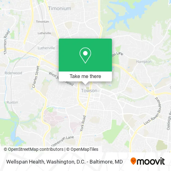
See Wellspan Health, Baltimore County, on the map
Public Transit to Wellspan Health in Baltimore County
Wondering how to get to Wellspan Health in Baltimore County? Moovit helps you find the best way to get to Wellspan Health with step-by-step directions from the nearest public transit station.
Moovit provides free maps and live directions to help you navigate through your city. View schedules, routes, timetables, and find out how long does it take to get to Wellspan Health in real time.
Looking for the nearest stop or station to Wellspan Health? Check out this list of stops closest to your destination: Fairmount Ave & Bosley Rd Sb; Fairmount Avenue at Bosley Avenue Wb 0038 (West); Dulaney Valley Rd & Southerly Rd; Pennsylvania Ave & Washington Ave; Dulaney Valley Rd @ Southerly Rd Nb 0001 (North); Dulaney Valley Rd & Macy's Nb; Lutherville.
Bus: 51, 93, CITYLINK GREEN, CITYLINK RED, TOWSON ORANGE, 52, TOWSON PURPLE, 36.
Want to see if there’s another route that gets you there at an earlier time? Moovit helps you find alternative routes or times. Get directions from and directions to Wellspan Health easily from the Moovit App or Website.
We make riding to Wellspan Health easy, which is why over 1.5 million users, including users in Baltimore County, trust Moovit as the best app for public transit. You don’t need to download an individual bus app or train app, Moovit is your all-in-one transit app that helps you find the best bus time or train time available.
For information on prices of bus, costs and ride fares to Wellspan Health, please check the Moovit app.
Use the app to navigate to popular places including to the airport, hospital, stadium, grocery store, mall, coffee shop, school, college, and university.
Wellspan Health Address: 707 York Rd Towson, MD 21204 street in Baltimore County
- Cops with Mops,
- Hearts of Ireland Referral Agency of MD,
- Farsidirectory,
- Smoking Clouds,
- Waxing Aesthetics by Brittany,
- Jeffrey Pollack Chartered,
- Bruce Ferguson LCPC,
- Koa Lash & Brow,
- Ocb Spa,
- My Crossing Paths Counseling Center, LLC,
- Excel Automotives,
- Shop with US,
- Taken,
- Trek Bicycle Towson,
- Patrick Barta MD,
- Mavis Discount Tire,
- Interstate Batteries,
- Mission BBQ,
- Lopresti's Haircutting & Styling,
- ATHLETA
Places Near Wellspan Health (Baltimore County)
- Rock Creek Tennis Center, Washington,
- PG Mall, Prince George's County,
- Marriott Marquis Washington, DC, Washington,
- Basilica of the National Shrine, Washington,
- Amazon Hq2, Arlington County,
- Westfield Montgomery Mall, Montgomery County,
- M&T Bank Stadium, Baltimore,
- Warner Theatre, Washington,
- Georgetown, Washington,
- National Museum of African American History and Culture, Washington,
- National Zoo, Washington,
- Washington DC VA Medical Center, Washington,
- Capital One Arena, Washington,
- Camden Yards, Baltimore,
- Pennsylvania Ave NW (3rd st and pennsylvania), Washington,
- Sibley Memorial Hospital, Washington,
- The Anthem, Washington,
- National Theatre, Washington,
- Washington National Cathedral, Washington,
- Museum Of The Bible, Washington
How to get to popular places in Washington, D.C. - Baltimore, MD with public transit
Get around Baltimore County by public transit!
Traveling around Baltimore County has never been so easy. See step by step directions as you travel to any attraction, street or major public transit station. View bus and train schedules, arrival times, service alerts and detailed routes on a map, so you know exactly how to get to anywhere in Baltimore County.
When traveling to any destination around Baltimore County use Moovit's Live Directions with Get Off Notifications to know exactly where and how far to walk, how long to wait for your line, and how many stops are left. Moovit will alert you when it's time to get off — no need to constantly re-check whether yours is the next stop.
Wondering how to use public transit in Baltimore County or how to pay for public transit in Baltimore County? Moovit public transit app can help you navigate your way with public transit easily, and at minimum cost. It includes public transit fees, ticket prices, and costs. Looking for a map of Baltimore County public transit lines? Moovit public transit app shows all public transit maps in Baltimore County with all Bus, Train, Metro, Light Rail and Ferry routes and stops on an interactive map.
Washington, D.C. - Baltimore, MD has 5 transit type(s), including: Bus, Train, Metro, Light Rail and Ferry, operated by several transit agencies, including WMATA, Montgomery County Ride On, Fairfax Connector, TheBus, PRTC, DASH - Alexandria, Arlington Transit (ART), RTA of Central Maryland, MDOT MTA, MDOT MTA Light RailLink, MDOT MTA Commuter Bus, MDOT MTA Local Bus, FXBGO!, Virginia Railway Express (VRE) and MARC