West Brighton Av/W 5 St stop - Sunday schedule
| Line | Direction | Time |
|---|---|---|
| B68 | Windsor Terr Pritchard Sq Via C I Av | 6:22 AM |
| B68 | Windsor Terr Pritchard Sq Via C I Av | 6:45 AM |
| B68 | Windsor Terr Pritchard Sq Via C I Av | 7:00 AM |
| B68 | Windsor Terr Pritchard Sq Via C I Av | 7:15 AM |
| B68 | Windsor Terr Pritchard Sq Via C I Av | 7:30 AM |
| B68 | Windsor Terr Pritchard Sq Via C I Av | 7:45 AM |
| B68 | Windsor Terr Pritchard Sq Via C I Av | 7:57 AM |
| B68 | Windsor Terr Pritchard Sq Via C I Av | 8:10 AM |
| B68 | Windsor Terr Pritchard Sq Via C I Av | 8:22 AM |
| B68 | Windsor Terr Pritchard Sq Via C I Av | 8:34 AM |
| B68 | Windsor Terr Pritchard Sq Via C I Av | 8:46 AM |
| B68 | Windsor Terr Pritchard Sq Via C I Av | 8:58 AM |
| B68 | Windsor Terr Pritchard Sq Via C I Av | 9:10 AM |
| B68 | Windsor Terr Pritchard Sq Via C I Av | 9:22 AM |
| B68 | Windsor Terr Pritchard Sq Via C I Av | 9:34 AM |
| B68 | Windsor Terr Pritchard Sq Via C I Av | 9:46 AM |
| B68 | Windsor Terr Pritchard Sq Via C I Av | 9:58 AM |
| B68 | Windsor Terr Pritchard Sq Via C I Av | 10:10 AM |
| B68 | Windsor Terr Pritchard Sq Via C I Av | 10:22 AM |
| B68 | Windsor Terr Pritchard Sq Via C I Av | 10:34 AM |
| B68 | Windsor Terr Pritchard Sq Via C I Av | 10:47 AM |
| B68 | Windsor Terr Pritchard Sq Via C I Av | 10:58 AM |
| B68 | Windsor Terr Pritchard Sq Via C I Av | 11:08 AM |
| B68 | Windsor Terr Pritchard Sq Via C I Av | 11:18 AM |
| B68 | Windsor Terr Pritchard Sq Via C I Av | 11:28 AM |
Directions to West Brighton Av/W 5 St stop (Brooklyn) with public transit
The following transit lines have routes that pass near West Brighton Av/W 5 St
 Bus: B1, B36, B68.
- Subway: F, Q, FX, D, N.
How to get to West Brighton Av/W 5 St stop by bus?
Click on the bus route to see step by step directions with maps, line arrival times and updated time schedules.
How to get to West Brighton Av/W 5 St stop by subway?
Click on the subway route to see step by step directions with maps, line arrival times and updated time schedules.
Bus stops near West Brighton Av/W 5 St stop in Brooklyn
- W 5 St/West Brighton Av, 2 min walk,
- Brighton Beach Av/Ocean Pkwy, 6 min walk,
Subway stations near West Brighton Av/W 5 St station in Brooklyn
- Ocean Pkwy, 4 min walk,
- W 8 St-Ny Aquarium, 4 min walk,
- Coney Island-Stillwell Av, 12 min walk,
- Brighton Beach, 12 min walk,
Bus lines to West Brighton Av/W 5 St stop in Brooklyn
- B36, Sheepshead Bay Avenue U,
- B68, Windsor Terr Pritchard Sq Via C I Av,
- B1, Stillwell Av 86 St,
What are the closest stations to West Brighton Av/W 5 St?
The closest stations to West Brighton Av/W 5 St are:
- W 5 St/West Brighton Av is 103 yards away, 2 min walk.
- Ocean Pkwy is 281 yards away, 4 min walk.
- W 8 St-Ny Aquarium is 288 yards away, 4 min walk.
- Brighton Beach Av/Ocean Pkwy is 433 yards away, 6 min walk.
- Coney Island-Stillwell Av is 951 yards away, 12 min walk.
- Brighton Beach is 979 yards away, 12 min walk.
Which bus lines stop near West Brighton Av/W 5 St?
These bus lines stop near West Brighton Av/W 5 St: B1, B36, B68.
Which subway lines stop near West Brighton Av/W 5 St?
These subway lines stop near West Brighton Av/W 5 St: F, Q.
What’s the nearest subway station to West Brighton Av/W 5 St in Brooklyn?
The nearest subway stations to West Brighton Av/W 5 St in Brooklyn are Ocean Pkwy and W 8 St-Ny Aquarium. The closest one is a 4 min walk away.
What’s the nearest bus station to West Brighton Av/W 5 St in Brooklyn?
The nearest bus station to West Brighton Av/W 5 St in Brooklyn is W 5 St/West Brighton Av. It’s a 2 min walk away.
What time is the first subway to West Brighton Av/W 5 St in Brooklyn?
The F is the first subway that goes to West Brighton Av/W 5 St in Brooklyn. It stops nearby at 3:00 AM.
What time is the last subway to West Brighton Av/W 5 St in Brooklyn?
The F is the last subway that goes to West Brighton Av/W 5 St in Brooklyn. It stops nearby at 4:51 AM.
What time is the first bus to West Brighton Av/W 5 St in Brooklyn?
The B36 is the first bus that goes to West Brighton Av/W 5 St in Brooklyn. It stops nearby at 3:06 AM.
What time is the last bus to West Brighton Av/W 5 St in Brooklyn?
The B1 is the last bus that goes to West Brighton Av/W 5 St in Brooklyn. It stops nearby at 3:28 AM.
West Brighton Av/W 5 St station
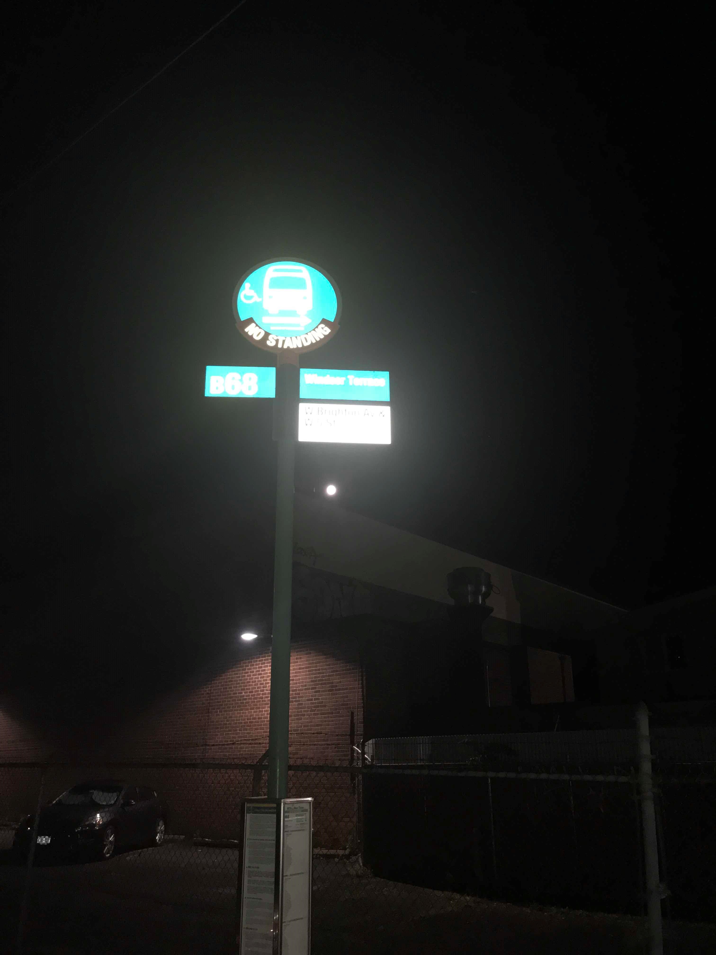 Taken by Бахтиер Б.
See West Brighton Av/W 5 St stop, Brooklyn, on the map
Public transit to West Brighton Av/W 5 St stop in Brooklyn
Looking for directions to West Brighton Av/W 5 St in Brooklyn, United States?
Download the Moovit App to find the current schedule and step-by-step directions for Subway or Bus routes that pass through West Brighton Av/W 5 St.
Looking for the nearest stops closest to West Brighton Av/W 5 St ? Check out this list of closest stops to your destination: W 5 St/West Brighton Av; Ocean Pkwy; W 8 St-Ny Aquarium; Brighton Beach Av/Ocean Pkwy; Coney Island-Stillwell Av; Brighton Beach.
Bus: B1, B36, B68.Subway: F, Q, FX, D, N, B.
We make riding on public transit to West Brighton Av/W 5 St easy, which is why over 1.5 million users, including users in Brooklyn trust Moovit as the best app for public transit.
Use the app to navigate to popular places including to the airport, hospital, stadium, grocery store, mall, coffee shop, school, college, and university.
The first line to this stop is B68, at 6:22 AM, and the last line is B68 at 5:45 AM.
311 Sea Breeze Avenue, Brooklyn, New York, NY, USA
This stop serves MTA Bus’s lines
- W 5 St/West Brighton Av,
- Brighton Beach Av/Ocean Pkwy
Bus stops near West Brighton Av/W 5 St stop
- Ocean Pkwy,
- W 8 St-Ny Aquarium,
- Coney Island-Stillwell Av,
- Brighton Beach
Subway stations near West Brighton Av/W 5 St station
- Ashburton Ave @ Yonkers Ave,
- Elizabeth,
- Grand Ave + Baldwin Ave,
- Maplewood,
- Avenue U,
- Flatbush Av/Lincoln Rd,
- Erskine St /Gateway Pl,
- E 149 St/Grand Concourse,
- Grand St,
- Stadium Lot G-17,
- New Rochelle,
- Branchville Station,
- Chambers St,
- Livingston St/Smith St,
- Livingston St/Smith St,
- 116 St,
- Madison Av/E 72 St,
- High St,
- 111 St/Jamaica Av,
- Asbury Park
Popular public transit stations in Brooklyn
Get around Brooklyn by public transit!
Traveling around Brooklyn has never been so easy. See step by step directions as you travel to any attraction, street or major public transit station. View bus and train schedules, arrival times, service alerts and detailed routes on a map, so you know exactly how to get to anywhere in Brooklyn.
When traveling to any destination around Brooklyn use Moovit's Live Directions with Get Off Notifications to know exactly where and how far to walk, how long to wait for your line, and how many stops are left. Moovit will alert you when it's time to get off — no need to constantly re-check whether yours is the next stop.
Wondering how to use public transit in Brooklyn or how to pay for public transit in Brooklyn? Moovit public transit app can help you navigate your way with public transit easily, and at minimum cost. It includes public transit fees, ticket prices, and costs. Looking for a map of Brooklyn public transit lines? Moovit public transit app shows all public transit maps in Brooklyn with all Bus, Train, Subway, Light Rail, Ferry and Cable Car routes and stops on an interactive map.
New York - New Jersey has 6 transit type(s), including: Bus, Train, Subway, Light Rail, Ferry and Cable Car, operated by several transit agencies, including MTA Subway, Metro-North Railroad, LIRR, PATH, MTA New York City Transit - Express routes, MTA Bus, NJ Transit, NYC Ferry, NICE bus, Bee-Line Bus, NJ Transit Rail, Norwalk Transit District, CTTransit - Waterbury, Hartford Line and River Valley Transit