How to get to Western Union by bus?
Click on the bus route to see step by step directions with maps, line arrival times and updated time schedules.
From U. P. N., Los Olivos
30 minFrom Municipalidad de Carabayllo, Carabayllo
69 minFrom Penal De Ancón (Piedras Gordas), Ancon
56 minFrom AV EL MURO CUADRA 5 MARISCAL CACERES, San Juan D
102 minFrom Universidad Tecnológica del Perú - UTP, Los Olivos
29 minFrom Institución Educativa 117 Signos De Fe, San Juan D
101 minFrom Primera de Pro, Los Olivos
31 minFrom SUNARP, Los Olivos
36 minFrom Universidad Continental, Los Olivos
33 minFrom Parque Zonal Lloque Yupanqui, Los Olivos
40 min
Bus stop near Western Union in Puente Pie
- Famesa, 7 min walk,VIEW
Bus lines to Western Union in Puente Pie
- 1016, La Florida (Ancon) - Aviación (La Victoria),VIEW
- 1017, Ancón - La Victoria,VIEW
- 1131, Gamarra (La Victoria),VIEW
- 1160, Pachacútec (Ventanilla) - Gamarra (La Victoria),VIEW
- 1168, Ventanilla - Panam. Norte - Alfonso Ugarte - Salaverry - Panamericana Norte - Ancón,VIEW
- 1179, Miramar (Ancón) - Upc (Santiago De Surco),VIEW
- 1184, Las Palmas (Pachacamac) - Profam (Santa Rosa),VIEW
- 1238, El Sol (Villa El Salvador) - Lomas (Carabayllo),VIEW
- 1239, Av. Lima (Villa El Salvador) - Zapallal (Puente Piedra),VIEW
- 1240, Las Palmas (Pachacamac) - Ciudad Industrial (Ancón),VIEW
- 1241, Puente Piedra - Lurin,VIEW
- 1242, Santa Rosa (Ancón) - Quebrada Verde (Pachacamac),VIEW
- 1246, Chepen (Villa El Salvador),VIEW
- 1260, Huaycán (Ate) - Pachacútec (Ventanilla),VIEW
- 1262, Pastor Sevilla (Villa El Salvador) - Pachacútec (Ventanilla),VIEW
- 1287, Jicamarca (S.J.L) - Profam (Santa Rosa),VIEW
- 1338, La Playa (Ventanilla) - La Paz (La Perla),VIEW
- 1448, Pachacútec (Ventanilla) - Av. Venezuela (San Miguel),VIEW
- 1468, Miramar (Ancón) - Atocongo (San Juan de Miraflores),VIEW
- AN12, Terminal Naranjal (Independencia) - Tottus (Puente Piedra),VIEW
What are the closest stations to Western Union?
The closest stations to Western Union are:
- Famesa is 464 meters away, 7 min walk.
Which bus lines stop near Western Union?
These bus lines stop near Western Union: 1168, 1184, 1239, 1240, 1260, 1448.
What’s the nearest bus station to Western Union in Puente Pie?
The nearest bus station to Western Union in Puente Pie is Famesa. It’s a 7 min walk away.
What time is the first bus to Western Union in Puente Pie?
The 1240 is the first bus that goes to Western Union in Puente Pie. It stops nearby at 4:06 AM.
What time is the last bus to Western Union in Puente Pie?
The 1168 is the last bus that goes to Western Union in Puente Pie. It stops nearby at 1:05 AM.
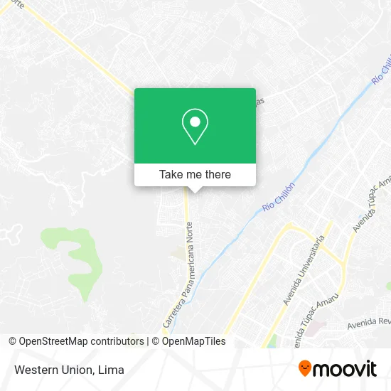
See Western Union, Puente Pie, on the map
Public Transit to Western Union in Puente Pie
Wondering how to get to Western Union in Puente Pie? Moovit helps you find the best way to get to Western Union with step-by-step directions from the nearest public transit station.
Moovit provides free maps and live directions to help you navigate through your city. View schedules, routes, timetables, and find out how long does it take to get to Western Union in real time.
Looking for the nearest stop or station to Western Union? Check out this list of stops closest to your destination: Famesa.
Bus: 1168, 1184, 1239, 1240, 1260, 1448, 1016, 1017, 1131, 1160.
Want to see if there’s another route that gets you there at an earlier time? Moovit helps you find alternative routes or times. Get directions from and directions to Western Union easily from the Moovit App or Website.
We make riding to Western Union easy, which is why over 1.5 million users, including users in Puente Pie, trust Moovit as the best app for public transit. You don’t need to download an individual bus app or train app, Moovit is your all-in-one transit app that helps you find the best bus time or train time available.
For information on prices of bus, costs and ride fares to Western Union, please check the Moovit app.
Use the app to navigate to popular places including to the airport, hospital, stadium, grocery store, mall, coffee shop, school, college, and university.
Western Union Address: Avenida Las Magnolias Lechucero Bajo, 15121 Puente Piedra street in Puente Pie
- Lechucero Bajo,
- La Florida del Norte,
- Cevicheria La Caleta del Paisa,
- Asociación de Propietarios Las Fresas,
- Colegio Honores Hélice,
- Estación El Polo,
- Asoc. de Prop. Tambo Inga,
- "Estacion El Polo" (Grifo y Autoservicio),
- Inversiones Lacoste,
- Chifa Hai-Ge,
- Los Embajadores,
- Lomas de Los Olivos,
- Las Viñas de Carabayllo Carabayllo,
- AVENIDA PANAMERICANA NORTE KILOMETRO 28 5 PUENTE PIEDRA,
- Pollería Gudy,
- Celima-Trébol,
- Casalinda,
- Clínica Veterinaria Aristocat,
- Paradero Establo,
- Paradero Famesa
Places Near Western Union (Puente Pie)
- Mall Del Sur,
- Pontificia Universidad Católica del Perú - PUCP, San Miguel,
- Real Plaza Puruchuco, Ate,
- Larcomar, Miraflores,
- Av. La Marina, San Miguel,
- Gamarra,
- av arequipa, Lima,
- Barranco, Barranco,
- Parque de las Leyendas, San Miguel,
- Av. Abancay, Lima,
- Hospital Edgardo Rebagliati Martins, Jesus Mari,
- Aeropuerto Internacional Jorge Chávez, Ventanilla,
- Av. Salaverry, Jesus Mari,
- Parque Kennedy, Miraflores,
- Paradero Av.Brasil,
- Circuito Mágico Del Agua, Lima,
- Centro Comercial Plaza Norte, Independen,
- Miraflores, Miraflores,
- Plaza San Miguel, San Miguel,
- Jockey Plaza, Santiago D
How to get to popular places in Lima with public transit
Get around Puente Pie by public transit!
Traveling around Puente Pie has never been so easy. See step by step directions as you travel to any attraction, street or major public transit station. View bus and train schedules, arrival times, service alerts and detailed routes on a map, so you know exactly how to get to anywhere in Puente Pie.
When traveling to any destination around Puente Pie use Moovit's Live Directions with Get Off Notifications to know exactly where and how far to walk, how long to wait for your line, and how many stops are left. Moovit will alert you when it's time to get off — no need to constantly re-check whether yours is the next stop.
Wondering how to use public transit in Puente Pie or how to pay for public transit in Puente Pie? Moovit public transit app can help you navigate your way with public transit easily, and at minimum cost. It includes public transit fees, ticket prices, and costs. Looking for a map of Puente Pie public transit lines? Moovit public transit app shows all public transit maps in Puente Pie with all Bus, Metro and Ferry routes and stops on an interactive map.
Lima has 3 transit type(s), including: Bus, Metro and Ferry, operated by several transit agencies, including Metro de Lima Línea 2 , Metro de Lima, Corredor Rojo, Metropolitano, Metropolitano - Alimentadores, Corredor Morado, Corredor Azul, Rutas Tradicionales, Transportes y Servicios La Esperanza S.A., Las Flores S.A., Virgen de la Asunción S.A., Consorcio HAM, Transportes y Service Canadá S.A., ETUL4SA and ETUCHISA