Directions to Westgate Kenya (Parklands/Westlands) with public transportation
The following transit lines have routes that pass near Westgate Kenya
 Bus: 119A, 23W, 48C, 48K, 11B.
How to get to Westgate Kenya by bus?
Click on the bus route to see step by step directions with maps, line arrival times and updated time schedules.
Bus stops near Westgate Kenya in Parklands/Westlands
- General Mathenge Junction, 7 min walk,
- Westlands, 8 min walk,
- Westlands Terminal, 8 min walk,
Bus lines to Westgate Kenya in Parklands/Westlands
- 119A, Gathiga,
- 11B, Westlands,
- 118, Wangige,
- 119, Wangige,
- 23W, Westlands,
What are the closest stations to Westgate Kenya?
The closest stations to Westgate Kenya are:
- General Mathenge Junction is 497 meters away, 7 min walk.
- Westlands is 563 meters away, 8 min walk.
- Westlands Terminal is 572 meters away, 8 min walk.
Which bus lines stop near Westgate Kenya?
These bus lines stop near Westgate Kenya: 119A, 23W, 48C, 48K.
What’s the nearest bus station to Westgate Kenya in Parklands/Westlands?
The nearest bus station to Westgate Kenya in Parklands/Westlands is General Mathenge Junction. It’s a 7 min walk away.
What time is the first bus to Westgate Kenya in Parklands/Westlands?
The 11B is the first bus that goes to Westgate Kenya in Parklands/Westlands. It stops nearby at 6:00 AM.
What time is the last bus to Westgate Kenya in Parklands/Westlands?
The 119 is the last bus that goes to Westgate Kenya in Parklands/Westlands. It stops nearby at 9:53 PM.
See Westgate Kenya, Parklands/Westlands, on the map
Public Transit to Westgate Kenya in Parklands/Westlands
Wondering how to get to Westgate Kenya in Parklands/Westlands? Moovit helps you find the best way to get to Westgate Kenya with step-by-step directions from the nearest public transit station.
Moovit provides free maps and live directions to help you navigate through your city. View schedules, routes, timetables, and find out how long does it take to get to Westgate Kenya in real time.
Looking for the nearest stop or station to Westgate Kenya? Check out this list of stops closest to your destination: General Mathenge Junction; Westlands; Westlands Terminal.
Bus: 119A, 23W, 48C, 48K, 11B, 118, 119.
Want to see if there’s another route that gets you there at an earlier time? Moovit helps you find alternative routes or times. Get directions from and directions to Westgate Kenya easily from the Moovit App or Website.
We make riding to Westgate Kenya easy, which is why over 1.5 million users, including users in Parklands/Westlands, trust Moovit as the best app for public transit. You don’t need to download an individual bus app or train app, Moovit is your all-in-one transit app that helps you find the best bus time or train time available.
For information on prices of bus, costs and ride fares to Westgate Kenya, please check the Moovit app.
Use the app to navigate to popular places including to the airport, hospital, stadium, grocery store, mall, coffee shop, school, college, and university.
Location: Parklands/Westlands, Nairobi
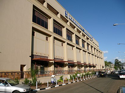
Westgate Shopping Mall (also known as Westgate) is an upscale shopping mall located in the Westlands division of Nairobi, Kenya. It was first opened in 2007.Wiki
- Westgate,
- FedEx,
- Westgate Mall Car Park,
- Westgate Shopping Mall,
- Pizza Inn (Westgate),
- 15 Mwanzi Road,
- Westgate Cinema,
- Giz Office 2,
- Millionaires Casino,
- Haandis, The Mall, Westlands,
- Kodak Express,
- Salute Iworld,
- Ignite Gym,
- Lintons Place LTD,
- Innscor Kenya LTD-Westgate,
- Planet Yoghurt-Westgate,
- Aquapet LTD-Westlands,
- Puma,
- Airtel-Westgate Shopping Centre,
- Standard Chartered
Places Near Westgate Kenya (Parklands/Westlands)
- Kenya Army Headquarters, DOD, Hurlingham, Parklands/Westlands,
- Jamhuri Show Ground, Kibera,
- Nyayo House, Central,
- Kawangware, P.O. Box 21103 Kawangware, Dagoretti,
- Veteran House, Moi avenue, Nairobi,Kenya, Central,
- Naivasha NNUS Stage, Central,
- PCEA KIKUYU HOSPITAL, Kikuyu,
- Magereza House Prison Headquarters, Central,
- Athi River/Kitengela Bus Stage, Central,
- Nyamakima Bus Stage, Central,
- NRB Imenti House Moi Avenue City Square, Central,
- kasarani Mwiki stage, Central,
- TAHMEED BOOKING OFFICE, Central,
- Kiriri Womens university of science and technology, Thika,
- Jamhuri Park Showground, Kibera,
- Lucky Summer Estate, Kasarani,
- Hass Plaza, Makadara,
- Mtihani House, South C., Makadara,
- Vision Plaza, Mombasa Road., Embakasi,
- Two Rivers Mall, Parklands/Westlands
How to get to popular places in Nairobi with public transit
Get around Parklands/Westlands by public transit!
Traveling around Parklands/Westlands has never been so easy. See step by step directions as you travel to any attraction, street or major public transit station. View bus and train schedules, arrival times, service alerts and detailed routes on a map, so you know exactly how to get to anywhere in Parklands/Westlands.
When traveling to any destination around Parklands/Westlands use Moovit's Live Directions with Get Off Notifications to know exactly where and how far to walk, how long to wait for your line, and how many stops are left. Moovit will alert you when it's time to get off — no need to constantly re-check whether yours is the next stop.
Wondering how to use public transit in Parklands/Westlands or how to pay for public transit in Parklands/Westlands? Moovit public transit app can help you navigate your way with public transit easily, and at minimum cost. It includes public transit fees, ticket prices, and costs. Looking for a map of Parklands/Westlands public transit lines? Moovit public transit app shows all public transit maps in Parklands/Westlands with all bus routes and stops on an interactive map.
Nairobi has 1 transit type(s), including: Bus, operated by several transit agencies, including KBS