How to get to Wf-Idf by bus?
Click on the bus route to see step by step directions with maps, line arrival times and updated time schedules.
From Brie-Comte-Robert, Brie-Comte-Robert
41 minFrom Centre Commercial Pontault-Combault, Pontault-Combault
158 minFrom 94410, Saint-Maurice
80 minFrom Tigery, Tigery
192 minFrom CENTRE COMMERCIAL CRETEIL SOLEIL, Creteil
40 minFrom IKEA, Villiers-Sur-Marne
120 minFrom Choisy-Le-Roi, Arrondissement de L'Haÿ-Les-Roses
64 minFrom Hôpital Henri Mondor, Creteil
70 minFrom Ormesson-Sur-Marne, Ormesson-Sur-Marne
80 minFrom Consulat D'Algérie, Créteil
49 min
Bus stops near Wf-Idf in Marolles-En-Brie
Bus lines to Wf-Idf in Marolles-En-Brie
What are the closest stations to Wf-Idf?
The closest stations to Wf-Idf are:
- Rue Des Orfèvres is 821 meters away, 11 min walk.
- Avenue du Parc is 1067 meters away, 14 min walk.
Which bus lines stop near Wf-Idf?
These bus lines stop near Wf-Idf: 4110, 423, 451, N137.
What’s the nearest bus station to Wf-Idf in Marolles-En-Brie?
The nearest bus station to Wf-Idf in Marolles-En-Brie is Rue Des Orfèvres. It’s a 11 min walk away.
What time is the first bus to Wf-Idf in Marolles-En-Brie?
The 451 is the first bus that goes to Wf-Idf in Marolles-En-Brie. It stops nearby at 9:17 AM.
What time is the last bus to Wf-Idf in Marolles-En-Brie?
The 451 is the last bus that goes to Wf-Idf in Marolles-En-Brie. It stops nearby at 8:22 PM.
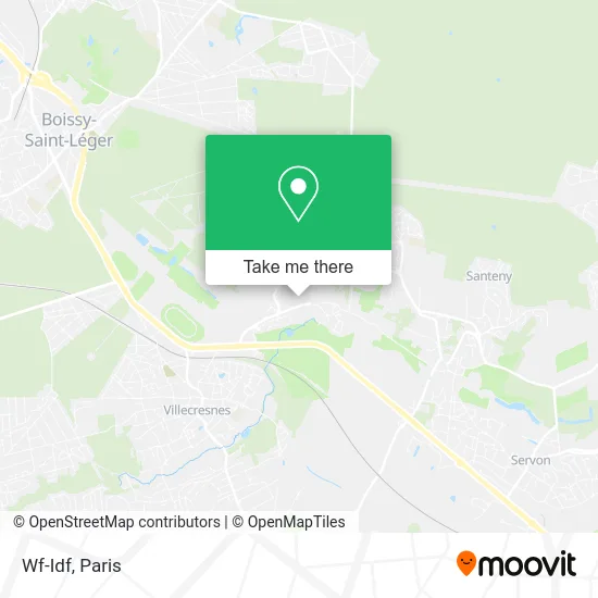
See Wf-Idf, Marolles-En-Brie, on the map
Public Transit to Wf-Idf in Marolles-En-Brie
Wondering how to get to Wf-Idf in Marolles-En-Brie? Moovit helps you find the best way to get to Wf-Idf with step-by-step directions from the nearest public transit station.
Moovit provides free maps and live directions to help you navigate through your city. View schedules, routes, timetables, and find out how long does it take to get to Wf-Idf in real time.
Looking for the nearest stop or station to Wf-Idf? Check out this list of stops closest to your destination: Rue Des Orfèvres; Avenue du Parc.
Bus: 4110, 423, 451, N137, 431.
Want to see if there’s another route that gets you there at an earlier time? Moovit helps you find alternative routes or times. Get directions from and directions to Wf-Idf easily from the Moovit App or Website.
We make riding to Wf-Idf easy, which is why over 1.5 million users, including users in Marolles-En-Brie, trust Moovit as the best app for public transit. You don’t need to download an individual bus app or train app, Moovit is your all-in-one transit app that helps you find the best bus time or train time available.
For information on prices of bus, metro and RER, costs and ride fares to Wf-Idf, please check the Moovit app.
Use the app to navigate to popular places including to the airport, hospital, stadium, grocery store, mall, coffee shop, school, college, and university.
Wf-Idf Address: 5 Rue Pierre Bezançon 94440 Marolles-en-Brie street in Marolles-En-Brie
- Amandine Perino,
- Gamat,
- Grillades & Sushis,
- Mairie de Marolles-en-Brie,
- Coralie - Esthéticienne à Domicile - Wecasa Beauté,
- Marolles-en-Brie,
- Permanence Départementale,
- Escape,
- Akaneko,
- SOS Plombier,
- Conservatoire de Marolles,
- Domaine de Grosbois,
- Association in,
- Dubost Bernard,
- Golf de Marolles,
- Parcours Île de France,
- Le Restaurant du Golf,
- Chateau de GrosBois,
- FedEx,
- Viand Maison Basset
Places Near Wf-Idf (Marolles-En-Brie)
- Créteil Soleil, Creteil,
- Hôpital Necker, Paris,
- Hopital Foch, Suresnes,
- Hôpital Henri Mondor, Creteil,
- Fondation Louis Vuitton, Paris,
- Marché Saint-Pierre, Paris,
- Galeries Lafayette Haussmann, Paris,
- Gare Routière Flixbus, Paris,
- Théâtre Mogador, Paris,
- Hôpital Beaujon, Clichy,
- Hôpital de la Pitié-Salpêtrière, Paris,
- Galeries Lafayette, Paris,
- 29 Rue Manin, Paris,
- Hôpital Saint-Joseph, Paris,
- Atelier Des Lumieres, Paris,
- Centre Hospitalier des 15/20, Paris,
- Hôpital Cochin, Paris,
- Hopital Lariboisière, Paris,
- Hôpital Pitié Salpêtrière, Paris,
- Institut Curie, Paris
How to get to popular places in Paris with public transit
Get around Marolles-En-Brie by public transit!
Traveling around Marolles-En-Brie has never been so easy. See step by step directions as you travel to any attraction, street or major public transit station. View bus and train schedules, arrival times, service alerts and detailed routes on a map, so you know exactly how to get to anywhere in Marolles-En-Brie.
When traveling to any destination around Marolles-En-Brie use Moovit's Live Directions with Get Off Notifications to know exactly where and how far to walk, how long to wait for your line, and how many stops are left. Moovit will alert you when it's time to get off — no need to constantly re-check whether yours is the next stop.
Wondering how to use public transit in Marolles-En-Brie or how to pay for public transit in Marolles-En-Brie? Moovit public transit app can help you navigate your way with public transit easily, and at minimum cost. It includes public transit fees, ticket prices, and costs. Looking for a map of Marolles-En-Brie public transit lines? Moovit public transit app shows all public transit maps in Marolles-En-Brie with all Bus, Train, Metro, Light Rail, RER, Funicular and Gondola routes and stops on an interactive map.
Paris has 7 transit type(s), including: Bus, Train, Metro, Light Rail, RER, Funicular and Gondola, operated by several transit agencies, including RATP, RER, RER Bus de remplacement, Train, Train Bus de remplacement, Tramway Bus de remplacement, TER, ADP, Magical Shuttle, Argenteuil - Boucles de Seine, Autocars Dominique, Bièvre, Brie et 2 Morin, Le Bus - C.C. du Clermontois and Cœur d’Essonne