How to get to White Wave Graphics by bus?
Click on the bus route to see step by step directions with maps, line arrival times and updated time schedules.
From Linden, NJ, Linden
73 minFrom Walmart, Linden
105 minFrom South Ave, Staten Island
179 minFrom Elizabeth, NJ, Elizabeth
63 minFrom Plainfield, NJ, Plainfield
59 minFrom Jersery Gardens Mall, Elizabeth
70 minFrom IKEA Elizabeth Shuttle Bus To Manhattan, Elizabeth
68 minFrom HUUHHHH??, Woodbridge
100 minFrom Hillside, NJ, Hillside
62 min
How to get to White Wave Graphics by train?
Click on the train route to see step by step directions with maps, line arrival times and updated time schedules.
Train station near White Wave Graphics in Westfield
- Garwood, 5 min walk,VIEW
What are the closest stations to White Wave Graphics?
The closest stations to White Wave Graphics are:
- Garwood is 346 yards away, 5 min walk.
Which bus lines stop near White Wave Graphics?
These bus lines stop near White Wave Graphics: 112, 113, 59.
Which train line stops near White Wave Graphics?
RVL (Raritan / High Bridge)
What’s the nearest train station to White Wave Graphics in Westfield?
The nearest train station to White Wave Graphics in Westfield is Garwood. It’s a 5 min walk away.
What time is the first train to White Wave Graphics in Westfield?
The RVL is the first train that goes to White Wave Graphics in Westfield. It stops nearby at 4:57 AM.
What time is the last train to White Wave Graphics in Westfield?
The RVL is the last train that goes to White Wave Graphics in Westfield. It stops nearby at 1:54 AM.
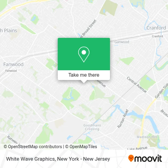
See White Wave Graphics, Westfield, on the map
Public Transit to White Wave Graphics in Westfield
Wondering how to get to White Wave Graphics in Westfield? Moovit helps you find the best way to get to White Wave Graphics with step-by-step directions from the nearest public transit station.
Moovit provides free maps and live directions to help you navigate through your city. View schedules, routes, timetables, and find out how long does it take to get to White Wave Graphics in real time.
Looking for the nearest stop or station to White Wave Graphics? Check out this list of stops closest to your destination: Garwood.
Bus: 112, 113, 59.Train: RVL.
Want to see if there’s another route that gets you there at an earlier time? Moovit helps you find alternative routes or times. Get directions from and directions to White Wave Graphics easily from the Moovit App or Website.
We make riding to White Wave Graphics easy, which is why over 1.5 million users, including users in Westfield, trust Moovit as the best app for public transit. You don’t need to download an individual bus app or train app, Moovit is your all-in-one transit app that helps you find the best bus time or train time available.
For information on prices of bus and train, costs and ride fares to White Wave Graphics, please check the Moovit app.
Use the app to navigate to popular places including to the airport, hospital, stadium, grocery store, mall, coffee shop, school, college, and university.
White Wave Graphics Address: 813 Nancy Way street in Westfield
- College Bound Mentor,
- Back Copond,
- S&L,
- Foundation For Sustainable Veteran Housing,
- Vision Adventurers,
- Stepping Stones Healing Arts,
- Keller Field Westfield NJ,
- Gary Kehler Football Stadium,
- William N. Garbarini & Associates,
- Palumbo Fuel,
- Lincoln Early Childhood Center,
- Nina's Pooch and Kitty Pet Care,
- Iris N. Biagioli,
- Suzeebehindthescenes,
- Shaxamaxon Golf Course,
- Liam's Room,
- Flor Corburn,
- Newark To Westfield Train,
- Joseph Gachko,
- Varsity Vantage Westfield NJ
Places Near White Wave Graphics (Westfield)
- San Gennaro Feast, Manhattan,
- Hudson Yards, Manhattan,
- Chinatown, Manhattan,
- Rockefeller Center, Manhattan,
- 66 John Street, Manhattan,
- Queens Center Mall, Queens,
- Bellevue Hospital, Manhattan,
- 911 Memorial, Manhattan,
- Mountainside Hospital, Glen Ridge,
- Wall Street, Manhattan,
- 111 Centre New York City Supreme Court, Manhattan,
- 376 Hudson Street, Manhattan,
- 26 Federal Plaza, Manhattan,
- qqqq, Manhattan,
- 3 Stone St, Manhattan,
- SoHo, Manhattan,
- Katz's Deli, Manhattan,
- 1 Police Plaza, Manhattan,
- Pier 83, Manhattan,
- Times Square, Manhattan
How to get to popular places in New York - New Jersey with public transit
Get around Westfield by public transit!
Traveling around Westfield has never been so easy. See step by step directions as you travel to any attraction, street or major public transit station. View bus and train schedules, arrival times, service alerts and detailed routes on a map, so you know exactly how to get to anywhere in Westfield.
When traveling to any destination around Westfield use Moovit's Live Directions with Get Off Notifications to know exactly where and how far to walk, how long to wait for your line, and how many stops are left. Moovit will alert you when it's time to get off — no need to constantly re-check whether yours is the next stop.
Wondering how to use public transit in Westfield or how to pay for public transit in Westfield? Moovit public transit app can help you navigate your way with public transit easily, and at minimum cost. It includes public transit fees, ticket prices, and costs. Looking for a map of Westfield public transit lines? Moovit public transit app shows all public transit maps in Westfield with all Bus, Train, Subway, Light Rail, Ferry and Cable Car routes and stops on an interactive map.
New York - New Jersey has 6 transit type(s), including: Bus, Train, Subway, Light Rail, Ferry and Cable Car, operated by several transit agencies, including MTA Subway, Metro-North Railroad, LIRR, PATH, MTA New York City Transit - Express routes, MTA Bus, NJ Transit, NYC Ferry, NICE bus, Bee-Line Bus, NJ Transit Rail, Norwalk Transit District, Hartford Line, River Valley Transit and HART