Directions to Whitney Card & Copy (New Haven) with public transportation
The following transit lines have routes that pass near Whitney Card & Copy
 Bus: 228, 255, 271, 272, 278.
- Train: 3, HARTFORD LINE, NORTHEAST REGIONAL, VERMONTER, AMTRAK HARTFORD LINE.
How to get to Whitney Card & Copy by bus?
Click on the bus route to see step by step directions with maps, line arrival times and updated time schedules.
How to get to Whitney Card & Copy by train?
Click on the train route to see step by step directions with maps, line arrival times and updated time schedules.
Bus stops near Whitney Card & Copy in New Haven
Train stations near Whitney Card & Copy in New Haven
Bus lines to Whitney Card & Copy in New Haven
- 228, 228c - Whitney Ave-Centerville-Quinnipiac Univ,VIEW
- 229, 229 - Waterbury-Centerville Via Whitney Ave,VIEW
- 278, 278 - New Haven Connector-Downtown New Haven State St Rr Stn,VIEW
- 212, 212x - New Haven Via I-91,VIEW
- 215, 215 - New Haven Via Universal Dr,VIEW
- 224, 224d - State St-Dmv-Devine St,VIEW
- 950, 950 - Meriden-New Haven Express,VIEW
- 213, 213x - New Haven Via I-91,VIEW
- 234, 234 - Winchester Ave-Mill Rock Rd,VIEW
What are the closest stations to Whitney Card & Copy?
The closest stations to Whitney Card & Copy are:
- Whitney Ave @ Audubon St is 36 yards away, 1 min walk.
- Temple St @ 420 Temple St is 125 yards away, 2 min walk.
- Grove St @ Whitney Ave is 177 yards away, 3 min walk.
- Church St @ Grove St is 199 yards away, 3 min walk.
- Temple St @ Trumbull St is 213 yards away, 3 min walk.
- Grove St @ Temple St is 276 yards away, 4 min walk.
- New Haven State Street is 973 yards away, 12 min walk.
- New Haven is 2042 yards away, 25 min walk.
Which bus lines stop near Whitney Card & Copy?
These bus lines stop near Whitney Card & Copy: 228, 255, 271, 272, 278, GREYHOUND US0240, GREYHOUND US0255S, USS.
Which train lines stop near Whitney Card & Copy?
These train lines stop near Whitney Card & Copy: 3, HARTFORD LINE, NORTHEAST REGIONAL, VERMONTER.
What’s the nearest train station to Whitney Card & Copy in New Haven?
The nearest train station to Whitney Card & Copy in New Haven is New Haven State Street. It’s a 12 min walk away.
What’s the nearest bus station to Whitney Card & Copy in New Haven?
The nearest bus station to Whitney Card & Copy in New Haven is Whitney Ave @ Audubon St. It’s a 1 min walk away.
What time is the first train to Whitney Card & Copy in New Haven?
The 3 is the first train that goes to Whitney Card & Copy in New Haven. It stops nearby at 3:17 AM.
What time is the last train to Whitney Card & Copy in New Haven?
The 3 is the last train that goes to Whitney Card & Copy in New Haven. It stops nearby at 3:56 AM.
What time is the first bus to Whitney Card & Copy in New Haven?
The 224 is the first bus that goes to Whitney Card & Copy in New Haven. It stops nearby at 5:06 AM.
What time is the last bus to Whitney Card & Copy in New Haven?
The 228 is the last bus that goes to Whitney Card & Copy in New Haven. It stops nearby at 1:47 AM.
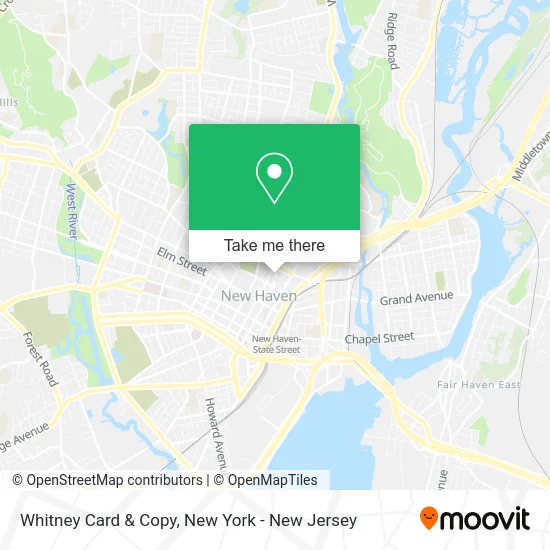
See Whitney Card & Copy, New Haven, on the map
Public Transit to Whitney Card & Copy in New Haven
Wondering how to get to Whitney Card & Copy in New Haven? Moovit helps you find the best way to get to Whitney Card & Copy with step-by-step directions from the nearest public transit station.
Moovit provides free maps and live directions to help you navigate through your city. View schedules, routes, timetables, and find out how long does it take to get to Whitney Card & Copy in real time.
Looking for the nearest stop or station to Whitney Card & Copy? Check out this list of stops closest to your destination: Whitney Ave @ Audubon St; Temple St @ 420 Temple St; Grove St @ Whitney Ave; Church St @ Grove St; Temple St @ Trumbull St; Grove St @ Temple St; New Haven State Street; New Haven.
Bus: 228, 255, 271, 272, 278, GREYHOUND US0240, GREYHOUND US0255S, USS, 229, 212, 215, 224, 950.Train: 3, HARTFORD LINE, NORTHEAST REGIONAL, VERMONTER, AMTRAK HARTFORD LINE, COMMUTER RAIL, VALLEY FLYER, ACELA, COMMUTER RAIL.
Want to see if there’s another route that gets you there at an earlier time? Moovit helps you find alternative routes or times. Get directions from and directions to Whitney Card & Copy easily from the Moovit App or Website.
We make riding to Whitney Card & Copy easy, which is why over 1.5 million users, including users in New Haven, trust Moovit as the best app for public transit. You don’t need to download an individual bus app or train app, Moovit is your all-in-one transit app that helps you find the best bus time or train time available.
For information on prices of bus and train, costs and ride fares to Whitney Card & Copy, please check the Moovit app.
Use the app to navigate to popular places including to the airport, hospital, stadium, grocery store, mall, coffee shop, school, college, and university.
Whitney Card & Copy Address: 48 Whitney Ave New Haven, CT 06510 street in New Haven
- Habesha Ethiopian Restaurant & Bar,
- BB.Q Chicken New Haven,
- Parliament Tutors - New Haven,
- Gourmet Heaven,
- Yale University Naval Reserve Officers Training Corps,
- Yale University - Investment Office,
- Oiss at Yale University,
- Yale Conferences & Events,
- Yale College It / Web Operations Directory,
- The Giggling Pig New Haven Llc,
- Yale College Arts,
- Phone N Computer Repair Center,
- Yale Summer Session,
- The-Nail Spa,
- Buckley Institute,
- Yale University - Office Of Career Strategy,
- Yale Office Of Career Strategy,
- Yale University,
- Yale Sustainability,
- Pearce Real Estate
Places Near Whitney Card & Copy (New Haven)
- 911 Memorial, Manhattan,
- Mountainside Hospital, Glen Ridge,
- Katz's Deli, Manhattan,
- qqqq, Manhattan,
- Pier 83, Manhattan,
- San Gennaro Feast, Manhattan,
- 26 Federal Plaza, Manhattan,
- Chinatown, Manhattan,
- Hudson Yards, Manhattan,
- Queens Center Mall, Queens,
- 3 Stone St, Manhattan,
- SoHo, Manhattan,
- Rockefeller Center, Manhattan,
- Wall Street, Manhattan,
- 66 John Street, Manhattan,
- Bellevue Hospital, Manhattan,
- Times Square, Manhattan,
- 1 Police Plaza, Manhattan,
- 111 Centre New York City Supreme Court, Manhattan,
- 376 Hudson Street, Manhattan
How to get to popular places in New York - New Jersey with public transit
Get around New Haven by public transit!
Traveling around New Haven has never been so easy. See step by step directions as you travel to any attraction, street or major public transit station. View bus and train schedules, arrival times, service alerts and detailed routes on a map, so you know exactly how to get to anywhere in New Haven.
When traveling to any destination around New Haven use Moovit's Live Directions with Get Off Notifications to know exactly where and how far to walk, how long to wait for your line, and how many stops are left. Moovit will alert you when it's time to get off — no need to constantly re-check whether yours is the next stop.
Wondering how to use public transit in New Haven or how to pay for public transit in New Haven? Moovit public transit app can help you navigate your way with public transit easily, and at minimum cost. It includes public transit fees, ticket prices, and costs. Looking for a map of New Haven public transit lines? Moovit public transit app shows all public transit maps in New Haven with all Bus, Train, Subway, Light Rail, Ferry and Cable Car routes and stops on an interactive map.
New York - New Jersey has 6 transit type(s), including: Bus, Train, Subway, Light Rail, Ferry and Cable Car, operated by several transit agencies, including MTA Subway, Metro-North Railroad, LIRR, PATH, MTA New York City Transit - Express routes, MTA Bus, NJ Transit, NYC Ferry, NICE bus, Bee-Line Bus, NJ Transit Rail, Norwalk Transit District, Hartford Line, River Valley Transit and HART