Directions to Whitneyannessentials (Yonkers) with public transportation
The following transit lines have routes that pass near Whitneyannessentials
 Bus: 1, 25, 4, 7, 8.
- Train: 1, ADIRONDACK, BERKSHIRE FLYER, EMPIRE SERVICE, ETHAN ALLEN EXPRESS.
How to get to Whitneyannessentials by bus?
Click on the bus route to see step by step directions with maps, line arrival times and updated time schedules.
From East Tremont Ave, Bronx
68 minFrom Morris Park, Bronx
77 minFrom Met Cloisters, Manhattan
55 minFrom Radio Hotel, Manhattan
63 minFrom Bronx VA Medical Center, Bronx
42 minFrom Lehman College, Bronx
34 minFrom George Washington Bridge, Manhattan
77 minFrom George Washington Bridge Bus Station, Manhattan
69 minFrom 177th Fort Washington Ave, Manhattan
69 minFrom Englewood, NJ, Englewood
94 min
How to get to Whitneyannessentials by train?
Click on the train route to see step by step directions with maps, line arrival times and updated time schedules.
Bus stops near Whitneyannessentials in Yonkers
Train stations near Whitneyannessentials in Yonkers
Bus lines to Whitneyannessentials in Yonkers
- 1, Dobbs Ferry,VIEW
- 3, Centre at Purchase 2,VIEW
- 30, Bronxville,VIEW
- 32, Nepperhan St @ Buena Vista Ave,VIEW
- 9, Westchester Circular,VIEW
- 2, 242nd Street Subway Station,VIEW
- 5, Oakland Ave @ Halstead Ave,VIEW
- 7, Mount Vernon,VIEW
- 8, Central Park Ave & Tuckahoe Rd,VIEW
- 6, White Plains,VIEW
- 25, Yonkers,VIEW
- 4, Bedford Park,VIEW
- 78, Getty Square,VIEW
- BXM3, Yonkers Getty Sq Via Sedgwick Av Via Broadway,VIEW
What are the closest stations to Whitneyannessentials?
The closest stations to Whitneyannessentials are:
- Riverdale Ave @ Main St is 35 yards away, 1 min walk.
- Main St @ Mill St is 117 yards away, 2 min walk.
- Warburton Ave @ Manor House Sq is 143 yards away, 2 min walk.
- Riverdale Ave @ Hudson St is 196 yards away, 3 min walk.
- S Broadway @ New Main St is 236 yards away, 4 min walk.
- S Broadway/New Main St is 245 yards away, 4 min walk.
- Ludlow is 1640 yards away, 20 min walk.
- Yonkers is 2791 yards away, 33 min walk.
Which bus lines stop near Whitneyannessentials?
These bus lines stop near Whitneyannessentials: 1, 25, 4, 7, 8.
Which train line stops near Whitneyannessentials?
1 (713#| Croton-Harmon)
What’s the nearest train station to Whitneyannessentials in Yonkers?
The nearest train station to Whitneyannessentials in Yonkers is Ludlow. It’s a 20 min walk away.
What’s the nearest bus station to Whitneyannessentials in Yonkers?
The nearest bus station to Whitneyannessentials in Yonkers is Riverdale Ave @ Main St. It’s a 1 min walk away.
What time is the first train to Whitneyannessentials in Yonkers?
The 1 is the first train that goes to Whitneyannessentials in Yonkers. It stops nearby at 5:07 AM.
What time is the last train to Whitneyannessentials in Yonkers?
The 1 is the last train that goes to Whitneyannessentials in Yonkers. It stops nearby at 2:30 AM.
What time is the first bus to Whitneyannessentials in Yonkers?
The 4 is the first bus that goes to Whitneyannessentials in Yonkers. It stops nearby at 4:45 AM.
What time is the last bus to Whitneyannessentials in Yonkers?
The BXM3 is the last bus that goes to Whitneyannessentials in Yonkers. It stops nearby at 1:05 AM.
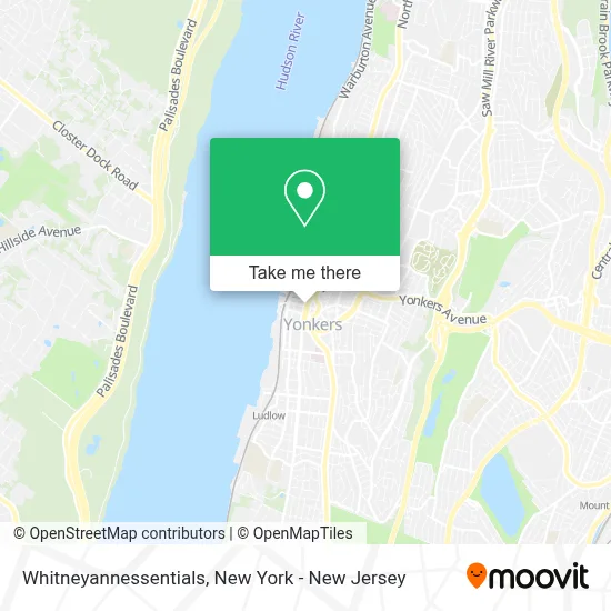
See Whitneyannessentials, Yonkers, on the map
Public Transit to Whitneyannessentials in Yonkers
Wondering how to get to Whitneyannessentials in Yonkers? Moovit helps you find the best way to get to Whitneyannessentials with step-by-step directions from the nearest public transit station.
Moovit provides free maps and live directions to help you navigate through your city. View schedules, routes, timetables, and find out how long does it take to get to Whitneyannessentials in real time.
Looking for the nearest stop or station to Whitneyannessentials? Check out this list of stops closest to your destination: Riverdale Ave @ Main St; Main St @ Mill St; Warburton Ave @ Manor House Sq; Riverdale Ave @ Hudson St; S Broadway @ New Main St; S Broadway/New Main St; Ludlow; Yonkers.
Bus: 1, 25, 4, 7, 8, 3, 30, 32, 9, 2, 5, 6.Train: 1, ADIRONDACK, BERKSHIRE FLYER, EMPIRE SERVICE, ETHAN ALLEN EXPRESS, MAPLE LEAF.
Want to see if there’s another route that gets you there at an earlier time? Moovit helps you find alternative routes or times. Get directions from and directions to Whitneyannessentials easily from the Moovit App or Website.
We make riding to Whitneyannessentials easy, which is why over 1.5 million users, including users in Yonkers, trust Moovit as the best app for public transit. You don’t need to download an individual bus app or train app, Moovit is your all-in-one transit app that helps you find the best bus time or train time available.
For information on prices of bus, subway and train, costs and ride fares to Whitneyannessentials, please check the Moovit app.
Use the app to navigate to popular places including to the airport, hospital, stadium, grocery store, mall, coffee shop, school, college, and university.
Whitneyannessentials Address: 37 Main St street in Yonkers
- Palisade Boat Club,
- Pete Lott Photography,
- Water Front on the Go,
- Main St (riverdale & main street),
- Casa De Cafe,
- La Cantina,
- Limit8 - Nonprofit Web Design Experts,
- Pop Color Beauty Bar & Social House,
- Central International African Market,
- Accentcare Personal Care Services,
- Carnadas & Paellas Restaurant,
- Giovanni's Pizza,
- Center Of Hope Ag,
- Twenty First Century Dental - Yonkers Location,
- Bodega Bites by Haylee,
- Guapo Mexican Cuban Cuisine,
- Total Wireless,
- Law Office Of Andrew M. Romano,
- Warburton Galerie,
- Fitness Factory
Places Near Whitneyannessentials (Yonkers)
- 911 Memorial, Manhattan,
- Katz's Deli, Manhattan,
- 3 Stone St, Manhattan,
- Pier 83, Manhattan,
- Times Square, Manhattan,
- 111 Centre New York City Supreme Court, Manhattan,
- Chinatown, Manhattan,
- qqqq, Manhattan,
- San Gennaro Feast, Manhattan,
- 1 Police Plaza, Manhattan,
- Wall Street, Manhattan,
- 66 John Street, Manhattan,
- Bellevue Hospital, Manhattan,
- Hudson Yards, Manhattan,
- 376 Hudson Street, Manhattan,
- SoHo, Manhattan,
- Rockefeller Center, Manhattan,
- Queens Center Mall, Queens,
- Mountainside Hospital, Glen Ridge,
- 26 Federal Plaza, Manhattan
How to get to popular places in New York - New Jersey with public transit
Get around Yonkers by public transit!
Traveling around Yonkers has never been so easy. See step by step directions as you travel to any attraction, street or major public transit station. View bus and train schedules, arrival times, service alerts and detailed routes on a map, so you know exactly how to get to anywhere in Yonkers.
When traveling to any destination around Yonkers use Moovit's Live Directions with Get Off Notifications to know exactly where and how far to walk, how long to wait for your line, and how many stops are left. Moovit will alert you when it's time to get off — no need to constantly re-check whether yours is the next stop.
Wondering how to use public transit in Yonkers or how to pay for public transit in Yonkers? Moovit public transit app can help you navigate your way with public transit easily, and at minimum cost. It includes public transit fees, ticket prices, and costs. Looking for a map of Yonkers public transit lines? Moovit public transit app shows all public transit maps in Yonkers with all Bus, Train, Subway, Light Rail, Ferry and Cable Car routes and stops on an interactive map.
New York - New Jersey has 6 transit type(s), including: Bus, Train, Subway, Light Rail, Ferry and Cable Car, operated by several transit agencies, including MTA Subway, Metro-North Railroad, LIRR, PATH, MTA New York City Transit - Express routes, MTA Bus, NJ Transit, NYC Ferry, NICE bus, Bee-Line Bus, NJ Transit Rail, Norwalk Transit District, Hartford Line, River Valley Transit and HART