How to get to Why Not by bus?
Click on the bus route to see step by step directions with maps, line arrival times and updated time schedules.
From Tribunal de Paris, Paris
45 minFrom Rue Lepic, Paris
47 minFrom Avenue du Maine, Paris
43 minFrom Hall 1, Paris
43 minFrom Rue de la Roquette, Paris
46 minFrom Rue du Chemin Vert, Paris
47 minFrom BnF, Paris
59 minFrom Rue Traversiere, Paris
49 minFrom Canal Saint-Martin, Paris
61 minFrom Carreau du Temple, Paris
50 min
How to get to Why Not by train?
Click on the train route to see step by step directions with maps, line arrival times and updated time schedules.
How to get to Why Not by metro?
Click on the metro route to see step by step directions with maps, line arrival times and updated time schedules.
From Tribunal de Paris, Paris
43 minFrom Rue Lepic, Paris
53 minFrom Avenue du Maine, Paris
38 minFrom Hall 1, Paris
45 minFrom Rue de la Roquette, Paris
42 minFrom Rue du Chemin Vert, Paris
46 minFrom BnF, Paris
48 minFrom Rue Traversiere, Paris
47 minFrom Canal Saint-Martin, Paris
47 minFrom Carreau du Temple, Paris
45 min
Bus stops near Why Not in Boulogne-Billancourt
Metro stations near Why Not in Boulogne-Billancourt
Bus lines to Why Not in Boulogne-Billancourt
What are the closest stations to Why Not?
The closest stations to Why Not are:
- Ancienne Mairie is 84 meters away, 2 min walk.
- Marcel Sembat is 105 meters away, 2 min walk.
- Route de la Reine - Jean Jaurès is 110 meters away, 2 min walk.
- Silly - Morizet is 136 meters away, 3 min walk.
- Rue de Billancourt is 309 meters away, 5 min walk.
- Boulogne Pont de Saint-Cloud is 365 meters away, 5 min walk.
Which train line stops near Why Not?
L (Paris-Saint-Lazare)
Which metro line stops near Why Not?
10 (Gare D'Austerlitz)
Which bus line stops near Why Not?
72 (Parc de Saint-Cloud)
What’s the nearest metro station to Why Not in Boulogne-Billancourt?
The nearest metro station to Why Not in Boulogne-Billancourt is Marcel Sembat. It’s a 2 min walk away.
What’s the nearest bus station to Why Not in Boulogne-Billancourt?
The nearest bus stations to Why Not in Boulogne-Billancourt are Ancienne Mairie and Route de la Reine - Jean Jaurès. The closest one is a 2 min walk away.
What time is the first light rail to Why Not in Boulogne-Billancourt?
The T2 is the first light rail that goes to Why Not in Boulogne-Billancourt. It stops nearby at 6:13 AM.
What time is the last light rail to Why Not in Boulogne-Billancourt?
The T2 is the last light rail that goes to Why Not in Boulogne-Billancourt. It stops nearby at 12:56 AM.
What time is the first metro to Why Not in Boulogne-Billancourt?
The 9 is the first metro that goes to Why Not in Boulogne-Billancourt. It stops nearby at 5:31 AM.
What time is the last metro to Why Not in Boulogne-Billancourt?
The 9 is the last metro that goes to Why Not in Boulogne-Billancourt. It stops nearby at 1:13 AM.
What time is the first bus to Why Not in Boulogne-Billancourt?
The 123 is the first bus that goes to Why Not in Boulogne-Billancourt. It stops nearby at 6:30 AM.
What time is the last bus to Why Not in Boulogne-Billancourt?
The 72 is the last bus that goes to Why Not in Boulogne-Billancourt. It stops nearby at 1:29 AM.
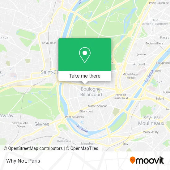
See Why Not, Boulogne-Billancourt, on the map
Public Transit to Why Not in Boulogne-Billancourt
Wondering how to get to Why Not in Boulogne-Billancourt? Moovit helps you find the best way to get to Why Not with step-by-step directions from the nearest public transit station.
Moovit provides free maps and live directions to help you navigate through your city. View schedules, routes, timetables, and find out how long does it take to get to Why Not in real time.
Looking for the nearest stop or station to Why Not? Check out this list of stops closest to your destination: Ancienne Mairie; Marcel Sembat; Route de la Reine - Jean Jaurès; Silly - Morizet; Rue de Billancourt; Boulogne Pont de Saint-Cloud.
Train: L.Metro: 10, 9.Bus: 72, 126, 175, SUBB N, 123.
Want to see if there’s another route that gets you there at an earlier time? Moovit helps you find alternative routes or times. Get directions from and directions to Why Not easily from the Moovit App or Website.
We make riding to Why Not easy, which is why over 1.5 million users, including users in Boulogne-Billancourt, trust Moovit as the best app for public transit. You don’t need to download an individual bus app or train app, Moovit is your all-in-one transit app that helps you find the best bus time or train time available.
For information on prices of metro, bus and train, costs and ride fares to Why Not, please check the Moovit app.
Use the app to navigate to popular places including to the airport, hospital, stadium, grocery store, mall, coffee shop, school, college, and university.
Why Not Address: 104 Route de la Reine 92100 Boulogne-Billancourt street in Boulogne-Billancourt
- 100 Route de la Reine,
- Axa,
- Parqueterie Française,
- FedEx,
- Coffres Forts Solon,
- Les Balcons,
- M.A.I.A,
- Maif,
- Exomind,
- Agir Finance,
- Neos Conseils & Expertises,
- Documentaire/Gerer,
- Thomas Industrial Media,
- Maison de Dermatologie de l'Ouest Parisien,
- Exclusive Networks,
- Cck Architectes,
- Ledet,
- De Beauvoir Murcia Béatrice,
- Les Chapeaux D,
- Maila
Places Near Why Not (Boulogne-Billancourt)
- Galeries Lafayette Haussmann, Paris,
- Hôpital Necker, Paris,
- Beaugrenelle, Paris,
- Hôpital Saint-Joseph, Paris,
- Gare Routière Flixbus, Paris,
- Théâtre Mogador, Paris,
- Hôpital de la Pitié-Salpêtrière, Paris,
- Hôpital Pitié Salpêtrière, Paris,
- Hopital Lariboisière, Paris,
- 29 Rue Manin, Paris,
- Créteil Soleil, Creteil,
- Fondation Louis Vuitton, Paris,
- Atelier Des Lumieres, Paris,
- Marché Saint-Pierre, Paris,
- Hopital Foch, Suresnes,
- Centre Hospitalier des 15/20, Paris,
- Hôpital Cochin, Paris,
- Hôpital Henri Mondor, Creteil,
- Hôpital Beaujon, Clichy,
- Galeries Lafayette, Paris
How to get to popular places in Paris with public transit
Get around Boulogne-Billancourt by public transit!
Traveling around Boulogne-Billancourt has never been so easy. See step by step directions as you travel to any attraction, street or major public transit station. View bus and train schedules, arrival times, service alerts and detailed routes on a map, so you know exactly how to get to anywhere in Boulogne-Billancourt.
When traveling to any destination around Boulogne-Billancourt use Moovit's Live Directions with Get Off Notifications to know exactly where and how far to walk, how long to wait for your line, and how many stops are left. Moovit will alert you when it's time to get off — no need to constantly re-check whether yours is the next stop.
Wondering how to use public transit in Boulogne-Billancourt or how to pay for public transit in Boulogne-Billancourt? Moovit public transit app can help you navigate your way with public transit easily, and at minimum cost. It includes public transit fees, ticket prices, and costs. Looking for a map of Boulogne-Billancourt public transit lines? Moovit public transit app shows all public transit maps in Boulogne-Billancourt with all Bus, Train, Metro, Light Rail, RER, Funicular and Gondola routes and stops on an interactive map.
Paris has 7 transit type(s), including: Bus, Train, Metro, Light Rail, RER, Funicular and Gondola, operated by several transit agencies, including RATP, RER, RER Bus de remplacement, Train, Train Bus de remplacement, Tramway Bus de remplacement, TER, ADP, Magical Shuttle, Argenteuil - Boucles de Seine, Autocars Dominique, Bièvre, Brie et 2 Morin, Le Bus - C.C. du Clermontois and Cœur d’Essonne