Directions to Wichita Area Roman Catholic Churches with public transportation
The following transit lines have routes that pass near Wichita Area Roman Catholic Churches
How to get to Wichita Area Roman Catholic Churches by bus?
Click on the bus route to see step by step directions with maps, line arrival times and updated time schedules.
Bus stops near Wichita Area Roman Catholic Churches
Bus lines to Wichita Area Roman Catholic Churches
What are the closest stations to Wichita Area Roman Catholic Churches?
The closest stations to Wichita Area Roman Catholic Churches are:
- Washington And 2nd St Ob is 328 yards away, 4 min walk.
- Douglas And Washington Ib is 537 yards away, 7 min walk.
- Central And Ohio Ob is 576 yards away, 7 min walk.
Which bus lines stop near Wichita Area Roman Catholic Churches?
These bus lines stop near Wichita Area Roman Catholic Churches: Q-LINE CLIFTON T, ROUTE21: DOUGLAS, ROUTE28: KU MED-.
What’s the nearest bus station to Wichita Area Roman Catholic Churches?
The nearest bus station to Wichita Area Roman Catholic Churches is Washington And 2nd St Ob. It’s a 4 min walk away.
What time is the first bus to Wichita Area Roman Catholic Churches?
The ROUTE21: DOUGLAS is the first bus that goes to Wichita Area Roman Catholic Churches. It stops nearby at 4:42 AM.
What time is the last bus to Wichita Area Roman Catholic Churches?
The ROUTE21: DOUGLAS is the last bus that goes to Wichita Area Roman Catholic Churches. It stops nearby at 10:28 PM.
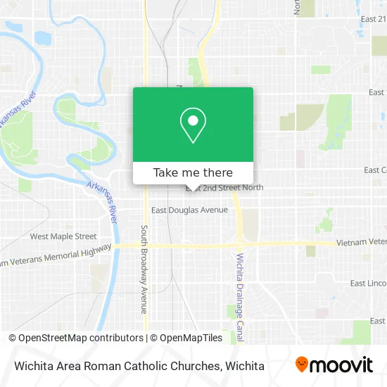
See Wichita Area Roman Catholic Churches on the map
Public Transportation to Wichita Area Roman Catholic Churches
Wondering how to get to Wichita Area Roman Catholic Churches? Moovit helps you find the best way to get to Wichita Area Roman Catholic Churches with step-by-step directions from the nearest public transit station.
Moovit provides free maps and live directions to help you navigate through your city. View schedules, routes, timetables, and find out how long does it take to get to Wichita Area Roman Catholic Churches in real time.
Looking for the nearest stop or station to Wichita Area Roman Catholic Churches? Check out this list of stops closest to your destination: Washington And 2nd St Ob; Douglas And Washington Ib; Central And Ohio Ob.
Bus: Q-LINE CLIFTON T, ROUTE21: DOUGLAS, ROUTE28: KU MED-, NORTH HIGH SCHOO, EAST HIGH SCHOOL, ROUTE25: E CENTR.
Want to see if there’s another route that gets you there at an earlier time? Moovit helps you find alternative routes or times. Get directions from and directions to Wichita Area Roman Catholic Churches easily from the Moovit App or Website.
We make riding to Wichita Area Roman Catholic Churches easy, which is why over 1.5 million users, including users in Wichita, trust Moovit as the best app for public transit. You don’t need to download an individual bus app or train app, Moovit is your all-in-one transit app that helps you find the best bus time or train time available.
For information on prices of bus, costs and ride fares to Wichita Area Roman Catholic Churches, please check the Moovit app.
Use the app to navigate to popular places including to the airport, hospital, stadium, grocery store, mall, coffee shop, school, college, and university.
Wichita Area Roman Catholic Churches Address: 258 N Ohio St Wichita, KS 67214 street in Wichita
- Aegis Group LLC - Angel Olsen,
- Canvas Wealth Advisors,
- QuikTrip,
- Black Building Management R E,
- Simply Sangria,
- McClelland Inc.,
- Straight Printing,
- E Z Choice Meats,
- Carstar Ict,
- Club Boomerang,
- Sidelines Sports Bar & Grill (Sidelines Sport Bar),
- R&R Public House,
- Fredo's,
- Adecco,
- ATM,
- Walker's Jazz Lounge,
- Auto Craft Collision Repair,
- Snap Restyling,
- Salon Q,
- Superior Image
Places Near Wichita Area Roman Catholic Churches
- Wichita Dwight D. Eisenhower National Airport (ICT) (Wichita Eisenhower National Airport), Wichita,
- Westside Athletic Field (Friends University Baseball Field), Wichita,
- Towne East Mall, Wichita,
- Sena African Hair Braiding LLC, Wichita,
- Paige Place Apartments, Wichita,
- Spirit AeroSystems, Bldg 2-280J (Section 9),
- Hubb's glory hole, Wichita,
- East 21st Street North and Webb Road, Wichita,
- Lopez Services, Wichita,
- Ratcliff Auto and Truck Repair, Wichita,
- Total Card Solutions, Wichita,
- Spirit Aerosystems Inc, Building 1-198D,
- Bmer Tech Automotive, Wichita,
- Four Corners Cafe @ Wesley Medical Center, Wichita,
- Spirit Aerosystems,
- Afghan Halal Market, Wichita,
- McConnell Air Force Base, Mcconnell Afb,
- North High School, Wichita,
- 21st & Maize, Wichita,
- Ascencion Via Christi Hospital St Francis, Wichita
How to get to popular places in Wichita with public transit
Get around Wichita by public transit!
Traveling around Wichita has never been so easy. See step by step directions as you travel to any attraction, street or major public transit station. View bus and train schedules, arrival times, service alerts and detailed routes on a map, so you know exactly how to get to anywhere in Wichita.
When traveling to any destination around Wichita use Moovit's Live Directions with Get Off Notifications to know exactly where and how far to walk, how long to wait for your line, and how many stops are left. Moovit will alert you when it's time to get off — no need to constantly re-check whether yours is the next stop.
Wondering how to use public transit in Wichita or how to pay for public transit in Wichita? Moovit public transit app can help you navigate your way with public transit easily, and at minimum cost. It includes public transit fees, ticket prices, and costs. Looking for a map of Wichita public transit lines? Moovit public transit app shows all public transit maps in Wichita with all bus routes and stops on an interactive map.
Wichita has 1 transit type(s), including: bus, operated by several transit agencies, including Wichita Transit, Greyhound-us and FlixBus-us