Directions to Wichita Area Roman Catholic Churches with public transportation
The following transit lines have routes that pass near Wichita Area Roman Catholic Churches
How to get to Wichita Area Roman Catholic Churches by bus?
Click on the bus route to see step by step directions with maps, line arrival times and updated time schedules.
From TACO BELL
64 minFrom Biryani Express
56 minFrom Payday Loans
64 minFrom United States Government Senators
47 minFrom Acceptance Now
53 minFrom Automotive Electrical Specialist
49 minFrom Utility Helpnet
67 minFrom N Woodland St
66 minFrom Restoration Family Services Inc.
47 minFrom 21st St and Amidon
66 min
Bus stops near Wichita Area Roman Catholic Churches
Bus lines to Wichita Area Roman Catholic Churches
What are the closest stations to Wichita Area Roman Catholic Churches?
The closest stations to Wichita Area Roman Catholic Churches are:
- Harry And Hillside Ib is 491 yards away, 6 min walk.
- Lincoln And Hillside Ob is 834 yards away, 10 min walk.
- Wsu South Campus is 950 yards away, 12 min walk.
Which bus line stops near Wichita Area Roman Catholic Churches?
ROUTE22: S BDWY- (Route 22 Inbound)
What’s the nearest bus station to Wichita Area Roman Catholic Churches?
The nearest bus station to Wichita Area Roman Catholic Churches is Harry And Hillside Ib. It’s a 6 min walk away.
What time is the first bus to Wichita Area Roman Catholic Churches?
The ROUTE29: HYDRAUL is the first bus that goes to Wichita Area Roman Catholic Churches. It stops nearby at 5:04 AM.
What time is the last bus to Wichita Area Roman Catholic Churches?
The ROUTE22: S BDWY- is the last bus that goes to Wichita Area Roman Catholic Churches. It stops nearby at 10:12 PM.
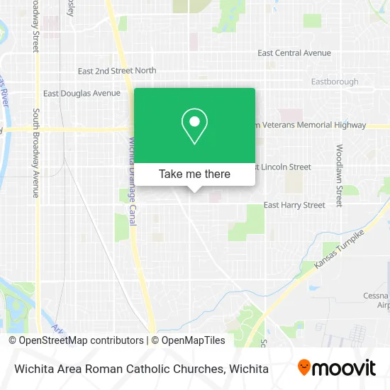
See Wichita Area Roman Catholic Churches on the map
Public Transportation to Wichita Area Roman Catholic Churches
Wondering how to get to Wichita Area Roman Catholic Churches? Moovit helps you find the best way to get to Wichita Area Roman Catholic Churches with step-by-step directions from the nearest public transit station.
Moovit provides free maps and live directions to help you navigate through your city. View schedules, routes, timetables, and find out how long does it take to get to Wichita Area Roman Catholic Churches in real time.
Looking for the nearest stop or station to Wichita Area Roman Catholic Churches? Check out this list of stops closest to your destination: Harry And Hillside Ib; Lincoln And Hillside Ob; Wsu South Campus.
Bus: ROUTE22: S BDWY-, ROUTE29: HYDRAUL, 202: OLIVE.
Want to see if there’s another route that gets you there at an earlier time? Moovit helps you find alternative routes or times. Get directions from and directions to Wichita Area Roman Catholic Churches easily from the Moovit App or Website.
We make riding to Wichita Area Roman Catholic Churches easy, which is why over 1.5 million users, including users in Wichita, trust Moovit as the best app for public transit. You don’t need to download an individual bus app or train app, Moovit is your all-in-one transit app that helps you find the best bus time or train time available.
For information on prices of bus, costs and ride fares to Wichita Area Roman Catholic Churches, please check the Moovit app.
Use the app to navigate to popular places including to the airport, hospital, stadium, grocery store, mall, coffee shop, school, college, and university.
Wichita Area Roman Catholic Churches Address: 3313 Grand St Wichita, KS 67218 street in Wichita
- Gerard House,
- All Saints Catholic School,
- Winged Electrical Repair,
- Clair Dwight St do,
- All Saints Knights of Columbus Council,
- Crispy Donuts,
- Level X Beauty Salon,
- Digi Computer & Network,
- D & T Smoke Shop & Liq,
- Ams Reference Lab,
- Lasermed,
- Central Kansas Podiatry Associates,
- Jackson Hewitt Tax Service,
- Swift Electrical Repair,
- Harris Tires,
- Ernie J Chaney MD,
- CVS/pharmacy,
- Nuway Burgers,
- Only Angels Home Healthcare,
- Scuree
Places Near Wichita Area Roman Catholic Churches
- Towne East Mall, Wichita,
- McConnell Air Force Base, Mcconnell Afb,
- 21st & Maize, Wichita,
- Four Corners Cafe @ Wesley Medical Center, Wichita,
- Spirit Aerosystems,
- Total Card Solutions, Wichita,
- Westside Athletic Field (Friends University Baseball Field), Wichita,
- Paige Place Apartments, Wichita,
- East 21st Street North and Webb Road, Wichita,
- North High School, Wichita,
- Wichita Dwight D. Eisenhower National Airport (ICT) (Wichita Eisenhower National Airport), Wichita,
- Bmer Tech Automotive, Wichita,
- Hubb's glory hole, Wichita,
- Spirit AeroSystems, Bldg 2-280J (Section 9),
- Sena African Hair Braiding LLC, Wichita,
- Ascencion Via Christi Hospital St Francis, Wichita,
- Spirit Aerosystems Inc, Building 1-198D,
- Ratcliff Auto and Truck Repair, Wichita,
- Lopez Services, Wichita,
- Afghan Halal Market, Wichita
How to get to popular places in Wichita with public transit
Get around Wichita by public transit!
Traveling around Wichita has never been so easy. See step by step directions as you travel to any attraction, street or major public transit station. View bus and train schedules, arrival times, service alerts and detailed routes on a map, so you know exactly how to get to anywhere in Wichita.
When traveling to any destination around Wichita use Moovit's Live Directions with Get Off Notifications to know exactly where and how far to walk, how long to wait for your line, and how many stops are left. Moovit will alert you when it's time to get off — no need to constantly re-check whether yours is the next stop.
Wondering how to use public transit in Wichita or how to pay for public transit in Wichita? Moovit public transit app can help you navigate your way with public transit easily, and at minimum cost. It includes public transit fees, ticket prices, and costs. Looking for a map of Wichita public transit lines? Moovit public transit app shows all public transit maps in Wichita with all bus routes and stops on an interactive map.
Wichita has 1 transit type(s), including: bus, operated by several transit agencies, including Wichita Transit, Greyhound-us and FlixBus-us