How to get to Wilkins Center by bus?
Click on the bus route to see step by step directions with maps, line arrival times and updated time schedules.
From New Rochelle, NY, New Rochelle
98 minFrom Ridge Hill Mall, Yonkers
145 minFrom Mamaroneck NY, Mamaroneck
107 minFrom White Plains, NY, White Plains
71 minFrom Westchester Mall, White Plains
72 minFrom Regeneron Pharmaceuticals Inc, Tarrytown
143 minFrom NBC Sports Shuttle, Stamford
125 minFrom GFFF, Stamford
119 minFrom the bee-line system Bus Stop - Rye Playland (13, 75, 91), Rye
102 minFrom Rye Playland, Rye
104 min
Train stations near Wilkins Center in Greenwich
What are the closest stations to Wilkins Center?
The closest stations to Wilkins Center are:
- Port Chester is 568 yards away, 8 min walk.
- Greenwich is 5442 yards away, 65 min walk.
Which bus lines stop near Wilkins Center?
These bus lines stop near Wilkins Center: 12, 311.
What’s the nearest train station to Wilkins Center in Greenwich?
The nearest train station to Wilkins Center in Greenwich is Port Chester. It’s a 8 min walk away.
What time is the first train to Wilkins Center in Greenwich?
The 3 is the first train that goes to Wilkins Center in Greenwich. It stops nearby at 4:49 AM.
What time is the last train to Wilkins Center in Greenwich?
The 3 is the last train that goes to Wilkins Center in Greenwich. It stops nearby at 2:46 AM.
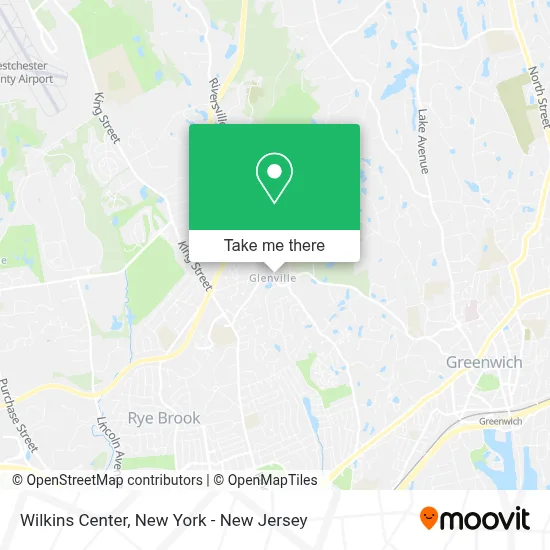
See Wilkins Center, Greenwich, on the map
Public Transit to Wilkins Center in Greenwich
Wondering how to get to Wilkins Center in Greenwich? Moovit helps you find the best way to get to Wilkins Center with step-by-step directions from the nearest public transit station.
Moovit provides free maps and live directions to help you navigate through your city. View schedules, routes, timetables, and find out how long does it take to get to Wilkins Center in real time.
Looking for the nearest stop or station to Wilkins Center? Check out this list of stops closest to your destination: Port Chester; Greenwich.
Bus: 12, 311.Train: 3, 4, 5.
Want to see if there’s another route that gets you there at an earlier time? Moovit helps you find alternative routes or times. Get directions from and directions to Wilkins Center easily from the Moovit App or Website.
We make riding to Wilkins Center easy, which is why over 1.5 million users, including users in Greenwich, trust Moovit as the best app for public transit. You don’t need to download an individual bus app or train app, Moovit is your all-in-one transit app that helps you find the best bus time or train time available.
For information on prices of bus and train, costs and ride fares to Wilkins Center, please check the Moovit app.
Use the app to navigate to popular places including to the airport, hospital, stadium, grocery store, mall, coffee shop, school, college, and university.
Wilkins Center Address: 7 Riversville Rd street in Greenwich
- Center For Discovery,
- 7 Riversville,
- Glenville Medical Concierge Care,
- Glenville Medical Concierge Care (Glenville Medical Associates),
- Popup Bagels,
- Logos Greenwich,
- Ivy Infusions,
- Infusions & Med Spa,
- Code 20,
- Sunoco Gas Station,
- Epv Balloons,
- 9th District Vets Club,
- Jordan Christiansen, Llc: Jordan Christiansen, Esq.,
- Ups Access Point Location,
- The Country Table,
- Town & Country Landscape Management,
- Belpointe Prep,
- Glenville Fire Dept,
- Greenwich American Legion Post 29,
- Glenville Volunteer Fire Company, Inc.
Places Near Wilkins Center (Greenwich)
- 376 Hudson Street, Manhattan,
- Bellevue Hospital, Manhattan,
- 3 Stone St, Manhattan,
- Wall Street, Manhattan,
- 66 John Street, Manhattan,
- 1 Police Plaza, Manhattan,
- San Gennaro Feast, Manhattan,
- Hudson Yards, Manhattan,
- 911 Memorial, Manhattan,
- Chinatown, Manhattan,
- qqqq, Manhattan,
- 26 Federal Plaza, Manhattan,
- Mountainside Hospital, Glen Ridge,
- Pier 83, Manhattan,
- Queens Center Mall, Queens,
- Times Square, Manhattan,
- 111 Centre New York City Supreme Court, Manhattan,
- SoHo, Manhattan,
- Katz's Deli, Manhattan,
- Rockefeller Center, Manhattan
How to get to popular places in New York - New Jersey with public transit
Get around Greenwich by public transit!
Traveling around Greenwich has never been so easy. See step by step directions as you travel to any attraction, street or major public transit station. View bus and train schedules, arrival times, service alerts and detailed routes on a map, so you know exactly how to get to anywhere in Greenwich.
When traveling to any destination around Greenwich use Moovit's Live Directions with Get Off Notifications to know exactly where and how far to walk, how long to wait for your line, and how many stops are left. Moovit will alert you when it's time to get off — no need to constantly re-check whether yours is the next stop.
Wondering how to use public transit in Greenwich or how to pay for public transit in Greenwich? Moovit public transit app can help you navigate your way with public transit easily, and at minimum cost. It includes public transit fees, ticket prices, and costs. Looking for a map of Greenwich public transit lines? Moovit public transit app shows all public transit maps in Greenwich with all Bus, Train, Subway, Light Rail, Ferry and Cable Car routes and stops on an interactive map.
New York - New Jersey has 6 transit type(s), including: Bus, Train, Subway, Light Rail, Ferry and Cable Car, operated by several transit agencies, including MTA Subway, Metro-North Railroad, LIRR, PATH, MTA New York City Transit - Express routes, MTA Bus, NJ Transit, NYC Ferry, NICE bus, Bee-Line Bus, NJ Transit Rail, Norwalk Transit District, Hartford Line, River Valley Transit and HART