Directions to Williams Distributing (Kentwood) with public transportation
The following transit lines have routes that pass near Williams Distributing
 Bus: 27.
How to get to Williams Distributing by bus?
Click on the bus route to see step by step directions with maps, line arrival times and updated time schedules.
From Mi Tierra El Salvador Cafe Y Pupuseria, Wyoming
90 minFrom ABC Technologies, Wyoming
96 minFrom GBL Sales, Grand Rapids
115 minFrom Dickinson Park, Grand Rapids
69 minFrom Land N Sea Distributing, Wyoming
107 minFrom White Knight Roadside & Towing, Grand Rapids
67 minFrom Advanced Laser Cutting Technologies, Cutlerville
105 minFrom EvGateway, Wyoming
105 minFrom Spectrum Health-Blodgett Hospital, East Grand Rapids
71 minFrom Mega-Bev, Grand Rapids
67 min
Bus stop near Williams Distributing in Kentwood
- 44th/Brockton (Wb), 7 min walk,VIEW
Bus lines to Williams Distributing in Kentwood
- 27, Airport Ind,VIEW
What are the closest stations to Williams Distributing?
The closest stations to Williams Distributing are:
- 44th/Brockton (Wb) is 513 yards away, 7 min walk.
Which bus line stops near Williams Distributing?
27 (Airport Ind)
What’s the nearest bus station to Williams Distributing in Kentwood?
The nearest bus station to Williams Distributing in Kentwood is 44th/Brockton (Wb). It’s a 7 min walk away.
What time is the first bus to Williams Distributing in Kentwood?
The 27 is the first bus that goes to Williams Distributing in Kentwood. It stops nearby at 6:16 AM.
What time is the last bus to Williams Distributing in Kentwood?
The 27 is the last bus that goes to Williams Distributing in Kentwood. It stops nearby at 10:53 PM.
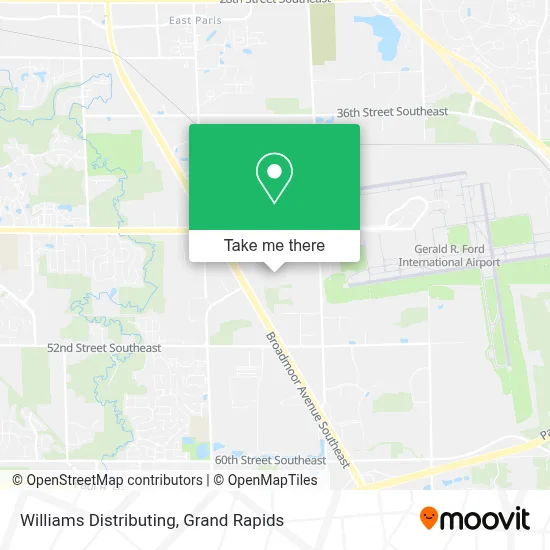
See Williams Distributing, Kentwood, on the map
Public Transit to Williams Distributing in Kentwood
Wondering how to get to Williams Distributing in Kentwood? Moovit helps you find the best way to get to Williams Distributing with step-by-step directions from the nearest public transit station.
Moovit provides free maps and live directions to help you navigate through your city. View schedules, routes, timetables, and find out how long does it take to get to Williams Distributing in real time.
Looking for the nearest stop or station to Williams Distributing? Check out this list of stops closest to your destination: 44th/Brockton (Wb).
Bus: 27.
Want to see if there’s another route that gets you there at an earlier time? Moovit helps you find alternative routes or times. Get directions from and directions to Williams Distributing easily from the Moovit App or Website.
We make riding to Williams Distributing easy, which is why over 1.5 million users, including users in Kentwood, trust Moovit as the best app for public transit. You don’t need to download an individual bus app or train app, Moovit is your all-in-one transit app that helps you find the best bus time or train time available.
For information on prices of bus, costs and ride fares to Williams Distributing, please check the Moovit app.
Use the app to navigate to popular places including to the airport, hospital, stadium, grocery store, mall, coffee shop, school, college, and university.
Williams Distributing Address: 4480 44th St SE street in Kentwood
- Amway Hangar,
- Steelcase Corporate Hangar,
- GRR Employee Parking,
- Gerald R Ford Int'l Airport (GRR),
- Cascade Engineering,
- 44th & Patterson,
- Eaton Corporation,
- Gerald R. Ford International Airport (GRR) (Gerald R. Ford International Airport),
- Patterson Ave and 36th St,
- Cascade Engineering, South Plant,
- Xpedx Paper & Graphics,
- 62-B District Court,
- Sky Zone Grand Rapids,
- BURGER KING,
- 28th Street Southeast & Patterson Avenue Southeast,
- Wingate Apartments,
- 28th St SE (M-11) & Patterson Ave SE,
- Amazon Locker-Blasi,
- Hearthside Food Solutions H1,
- E Paris Ave SE / 28th St SE
Places Near Williams Distributing (Kentwood)
- Frederik Meijer Gardens, Grand Rapids,
- Metro Cascade,
- Union High School, Grand Rapids,
- Butterworth Hospital Internal Radiology, Grand Rapids,
- Woodland Mall, Kentwood,
- Grand Rapids Community College, Grand Rapids,
- Spectrum Health-Blodgett Hospital, East Grand Rapids,
- Hudsonville,
- Helel DeVos Children's Hospital Food Court, Grand Rapids,
- Spectrum Health Butterworth Hospital, Grand Rapids,
- John Ball Zoo, Grand Rapids,
- YMCA - David D. Hunting, Grand Rapids,
- Van Andel Arena, Grand Rapids,
- Grandville, MI, Grandville,
- Kent County Courthouse, Grand Rapids,
- Lemmen-Holton Cancer Pavilion, Grand Rapids,
- Pine Rest Mental Health, Grand Rapids,
- University of Michigan Health Metro Health Hospital, Wyoming,
- Byron Center,
- Blodgett Hospital, East Grand Rapids
How to get to popular places in Grand Rapids with public transit
Get around Kentwood by public transit!
Traveling around Kentwood has never been so easy. See step by step directions as you travel to any attraction, street or major public transit station. View bus and train schedules, arrival times, service alerts and detailed routes on a map, so you know exactly how to get to anywhere in Kentwood.
When traveling to any destination around Kentwood use Moovit's Live Directions with Get Off Notifications to know exactly where and how far to walk, how long to wait for your line, and how many stops are left. Moovit will alert you when it's time to get off — no need to constantly re-check whether yours is the next stop.
Wondering how to use public transit in Kentwood or how to pay for public transit in Kentwood? Moovit public transit app can help you navigate your way with public transit easily, and at minimum cost. It includes public transit fees, ticket prices, and costs. Looking for a map of Kentwood public transit lines? Moovit public transit app shows all public transit maps in Kentwood with all Bus and Train routes and stops on an interactive map.
Grand Rapids has 2 transit type(s), including: Bus and Train, operated by several transit agencies, including The Rapid, Amtrak and FlixBus-us