How to get to Williams Wing Chun Kung Fu, Jkd by bus?
Click on the bus route to see step by step directions with maps, line arrival times and updated time schedules.
From Museo Americano de Historia Natural, Manhattan
68 minFrom Roosevelt Ave / 74th St, Queens
71 minFrom Intrepid Museum, Manhattan
50 minFrom 55th and Broadway, Manhattan
49 minFrom 125, Manhattan
72 minFrom Maspeth, Queens
73 minFrom W 120th St / Broadway, Manhattan
94 minFrom 125th St & Park Ave, Manhattan
74 minFrom MTA X80 - Manhattan to Randall's Island, Manhattan
73 minFrom 23rd Street & 6th Ave., Manhattan
73 min
How to get to Williams Wing Chun Kung Fu, Jkd by train?
Click on the train route to see step by step directions with maps, line arrival times and updated time schedules.
How to get to Williams Wing Chun Kung Fu, Jkd by subway?
Click on the subway route to see step by step directions with maps, line arrival times and updated time schedules.
From Museo Americano de Historia Natural, Manhattan
28 minFrom Roosevelt Ave / 74th St, Queens
33 minFrom Intrepid Museum, Manhattan
40 minFrom 55th and Broadway, Manhattan
22 minFrom 125, Manhattan
43 minFrom W 120th St / Broadway, Manhattan
46 minFrom 125th St & Park Ave, Manhattan
45 minFrom MTA X80 - Manhattan to Randall's Island, Manhattan
44 minFrom 23rd Street & 6th Ave., Manhattan
48 min
Bus stops near Williams Wing Chun Kung Fu, Jkd in Manhattan
Subway stations near Williams Wing Chun Kung Fu, Jkd in Manhattan
Bus lines to Williams Wing Chun Kung Fu, Jkd in Manhattan
What are the closest stations to Williams Wing Chun Kung Fu, Jkd?
The closest stations to Williams Wing Chun Kung Fu, Jkd are:
- Grand St/Clinton St is 282 yards away, 4 min walk.
- Grand St is 285 yards away, 4 min walk.
- Essex St/Delancey St is 307 yards away, 4 min walk.
- Delancey St/Essex St is 330 yards away, 5 min walk.
- East Houston St/Av B is 412 yards away, 6 min walk.
- Bowery is 430 yards away, 6 min walk.
- Allen St/Delancey St is 518 yards away, 7 min walk.
- East Broadway is 732 yards away, 9 min walk.
Which bus lines stop near Williams Wing Chun Kung Fu, Jkd?
These bus lines stop near Williams Wing Chun Kung Fu, Jkd: B39, M14A-SBS, M15, M15-SBS, M21.
Which train lines stop near Williams Wing Chun Kung Fu, Jkd?
These train lines stop near Williams Wing Chun Kung Fu, Jkd: BLU, YEL.
Which subway lines stop near Williams Wing Chun Kung Fu, Jkd?
These subway lines stop near Williams Wing Chun Kung Fu, Jkd: F, J, M.
What’s the nearest subway station to Williams Wing Chun Kung Fu, Jkd in Manhattan?
The nearest subway station to Williams Wing Chun Kung Fu, Jkd in Manhattan is Grand St. It’s a 4 min walk away.
What’s the nearest bus station to Williams Wing Chun Kung Fu, Jkd in Manhattan?
The nearest bus stations to Williams Wing Chun Kung Fu, Jkd in Manhattan are Grand St/Clinton St and Essex St/Delancey St. The closest one is a 4 min walk away.
What time is the first subway to Williams Wing Chun Kung Fu, Jkd in Manhattan?
The F is the first subway that goes to Williams Wing Chun Kung Fu, Jkd in Manhattan. It stops nearby at 3:01 AM.
What time is the last subway to Williams Wing Chun Kung Fu, Jkd in Manhattan?
The F is the last subway that goes to Williams Wing Chun Kung Fu, Jkd in Manhattan. It stops nearby at 3:59 AM.
What time is the first bus to Williams Wing Chun Kung Fu, Jkd in Manhattan?
The M15 is the first bus that goes to Williams Wing Chun Kung Fu, Jkd in Manhattan. It stops nearby at 3:12 AM.
What time is the last bus to Williams Wing Chun Kung Fu, Jkd in Manhattan?
The M15 is the last bus that goes to Williams Wing Chun Kung Fu, Jkd in Manhattan. It stops nearby at 2:42 AM.
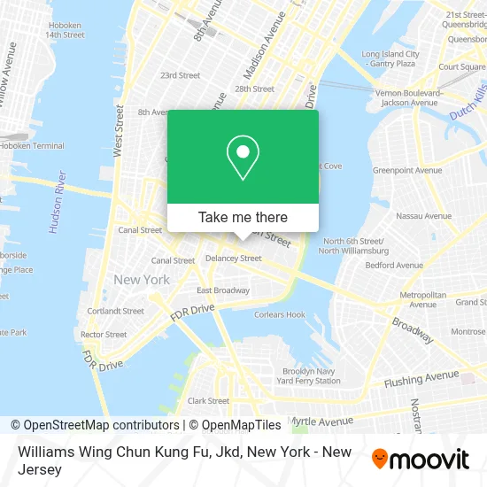
See Williams Wing Chun Kung Fu, Jkd, Manhattan, on the map
Public Transit to Williams Wing Chun Kung Fu, Jkd in Manhattan
Wondering how to get to Williams Wing Chun Kung Fu, Jkd in Manhattan? Moovit helps you find the best way to get to Williams Wing Chun Kung Fu, Jkd with step-by-step directions from the nearest public transit station.
Moovit provides free maps and live directions to help you navigate through your city. View schedules, routes, timetables, and find out how long does it take to get to Williams Wing Chun Kung Fu, Jkd in real time.
Looking for the nearest stop or station to Williams Wing Chun Kung Fu, Jkd? Check out this list of stops closest to your destination: Grand St/Clinton St; Grand St; Essex St/Delancey St; Delancey St/Essex St; East Houston St/Av B; Bowery; Allen St/Delancey St; East Broadway.
Bus: B39, M14A-SBS, M15, M15-SBS, M21, M9.Train: BLU, YEL.Subway: F, J, M, B, D, Z, FX.
Want to see if there’s another route that gets you there at an earlier time? Moovit helps you find alternative routes or times. Get directions from and directions to Williams Wing Chun Kung Fu, Jkd easily from the Moovit App or Website.
We make riding to Williams Wing Chun Kung Fu, Jkd easy, which is why over 1.5 million users, including users in Manhattan, trust Moovit as the best app for public transit. You don’t need to download an individual bus app or train app, Moovit is your all-in-one transit app that helps you find the best bus time or train time available.
For information on prices of subway, bus and train, costs and ride fares to Williams Wing Chun Kung Fu, Jkd, please check the Moovit app.
Use the app to navigate to popular places including to the airport, hospital, stadium, grocery store, mall, coffee shop, school, college, and university.
Williams Wing Chun Kung Fu, Jkd Address: 107 Suffolk St street in Manhattan
- Custom Bookcases, Build Ins Wall Units,
- Nightmare Dollhouse,
- Teatro Latea,
- Fantini Studio,
- La Plaza,
- Fragmental Museum,
- Nightmare Haunted House,
- Aba Mindful Capoeira Center,
- More Gardens Fund,
- Full Bunny Contact,
- Nyc Dance Arts,
- The Clemente Soto Velez Cultural and Educational Center,
- The Self-Portrait Project,
- Blonding Nyc,
- Hk Deutsch Akademie,
- Akiko Nails & Hair Salon,
- Pilates Coven,
- The Hair Painter,
- Hubneo Vr Lab - Virtual Reality Simulation Center,
- Shake Shack Lower East Side
Places Near Williams Wing Chun Kung Fu, Jkd (Manhattan)
- Times Square, Manhattan,
- San Gennaro Feast, Manhattan,
- Bellevue Hospital, Manhattan,
- 3 Stone St, Manhattan,
- 111 Centre New York City Supreme Court, Manhattan,
- Katz's Deli, Manhattan,
- 1 Police Plaza, Manhattan,
- Chinatown, Manhattan,
- 911 Memorial, Manhattan,
- 376 Hudson Street, Manhattan,
- qqqq, Manhattan,
- SoHo, Manhattan,
- 26 Federal Plaza, Manhattan,
- Rockefeller Center, Manhattan,
- Hudson Yards, Manhattan,
- Wall Street, Manhattan,
- 66 John Street, Manhattan,
- Mountainside Hospital, Glen Ridge,
- Pier 83, Manhattan,
- Queens Center Mall, Queens
How to get to popular places in New York - New Jersey with public transit
Get around Manhattan by public transit!
Traveling around Manhattan has never been so easy. See step by step directions as you travel to any attraction, street or major public transit station. View bus and train schedules, arrival times, service alerts and detailed routes on a map, so you know exactly how to get to anywhere in Manhattan.
When traveling to any destination around Manhattan use Moovit's Live Directions with Get Off Notifications to know exactly where and how far to walk, how long to wait for your line, and how many stops are left. Moovit will alert you when it's time to get off — no need to constantly re-check whether yours is the next stop.
Wondering how to use public transit in Manhattan or how to pay for public transit in Manhattan? Moovit public transit app can help you navigate your way with public transit easily, and at minimum cost. It includes public transit fees, ticket prices, and costs. Looking for a map of Manhattan public transit lines? Moovit public transit app shows all public transit maps in Manhattan with all Bus, Train, Subway, Light Rail, Ferry and Cable Car routes and stops on an interactive map.
New York - New Jersey has 6 transit type(s), including: Bus, Train, Subway, Light Rail, Ferry and Cable Car, operated by several transit agencies, including MTA Subway, Metro-North Railroad, LIRR, PATH, MTA New York City Transit - Express routes, MTA Bus, NJ Transit, NYC Ferry, NICE bus, Bee-Line Bus, NJ Transit Rail, Norwalk Transit District, Hartford Line, River Valley Transit and HART