How to get to Wing Chun Kung Fu by bus?
Click on the bus route to see step by step directions with maps, line arrival times and updated time schedules.
From Dean Martin @ Blue Diamond (N), Enterprise
45 minFrom Desert Pines High School, Las Vegas
82 minFrom Rampart Casino, Las Vegas
61 minFrom Roadguard Ignition Interlock, Paradise
48 minFrom El Cortez Hotel & Casino, Las Vegas
60 minFrom Walmart, Las Vegas
66 minFrom Post Road & Decatur, Las Vegas, Paradise
44 minFrom Las Vegas Immigration Court, Paradise
66 minFrom T-Mobile, Las Vegas
54 minFrom Circus Circus, Las Vegas
43 min
Bus stops near Wing Chun Kung Fu in Las Vegas
Monorail station near Wing Chun Kung Fu in Las Vegas
- Bally'S/Paris Station, 11 min walk,VIEW
Bus lines to Wing Chun Kung Fu in Las Vegas
What are the closest stations to Wing Chun Kung Fu?
The closest stations to Wing Chun Kung Fu are:
- Nb Valley View Before San Joaquin is 155 yards away, 2 min walk.
- Eb Spring Mtn After Valley View is 866 yards away, 11 min walk.
- Bally'S/Paris Station is 889 yards away, 11 min walk.
Which bus lines stop near Wing Chun Kung Fu?
These bus lines stop near Wing Chun Kung Fu: 104, 203.
What’s the nearest bus station to Wing Chun Kung Fu in Las Vegas?
The nearest bus station to Wing Chun Kung Fu in Las Vegas is Nb Valley View Before San Joaquin. It’s a 2 min walk away.
What’s the nearest Monorail station to Wing Chun Kung Fu in Las Vegas?
The nearest Monorail station to Wing Chun Kung Fu in Las Vegas is Bally'S/Paris Station. It’s a 11 min walk away.
What time is the first bus to Wing Chun Kung Fu in Las Vegas?
The 203 is the first bus that goes to Wing Chun Kung Fu in Las Vegas. It stops nearby at 4:10 AM.
What time is the last bus to Wing Chun Kung Fu in Las Vegas?
The 203 is the last bus that goes to Wing Chun Kung Fu in Las Vegas. It stops nearby at 1:45 AM.
What time is the first Monorail to Wing Chun Kung Fu in Las Vegas?
The LVM is the first Monorail that goes to Wing Chun Kung Fu in Las Vegas. It stops nearby at 7:00 AM.
What time is the last Monorail to Wing Chun Kung Fu in Las Vegas?
The LVM is the last Monorail that goes to Wing Chun Kung Fu in Las Vegas. It stops nearby at 12:02 AM.
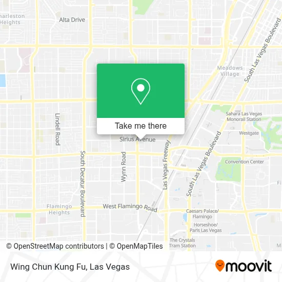
See Wing Chun Kung Fu, Las Vegas, on the map
Public Transit to Wing Chun Kung Fu in Las Vegas
Wondering how to get to Wing Chun Kung Fu in Las Vegas? Moovit helps you find the best way to get to Wing Chun Kung Fu with step-by-step directions from the nearest public transit station.
Moovit provides free maps and live directions to help you navigate through your city. View schedules, routes, timetables, and find out how long does it take to get to Wing Chun Kung Fu in real time.
Looking for the nearest stop or station to Wing Chun Kung Fu? Check out this list of stops closest to your destination: Nb Valley View Before San Joaquin; Eb Spring Mtn After Valley View; Bally'S/Paris Station.
Bus: 104, 203.Monorail: LVM.
Want to see if there’s another route that gets you there at an earlier time? Moovit helps you find alternative routes or times. Get directions from and directions to Wing Chun Kung Fu easily from the Moovit App or Website.
We make riding to Wing Chun Kung Fu easy, which is why over 1.7 million users, including users in Las Vegas, trust Moovit as the best app for public transit. You don’t need to download an individual bus app or train app, Moovit is your all-in-one transit app that helps you find the best bus time or train time available.
For information on prices of bus, costs and ride fares to Wing Chun Kung Fu, please check the Moovit app.
Use the app to navigate to popular places including to the airport, hospital, stadium, grocery store, mall, coffee shop, school, college, and university.
Wing Chun Kung Fu Address: 3120 S Valley View Blvd street in Las Vegas
- Sirius Ave / S Valley View Blvd,
- Wildfire Casino,
- Desert Inn & Valley View,
- Adult World,
- Amazon Locker-Digby,
- Glamour Boutique Two (Just You Home of Glamour Boutique 2),
- Omega Mart,
- Meow Wolf Las Vegas,
- Omega Mart - Meow Wolf,
- Area15,
- Meow Wolf - Las Vegas (Meow Wolf's Omega Mart),
- Operating Engineers Local 12 Trust Fund,
- Ed W. Clark High School,
- Polish on Point by Danielle Davis LLC,
- Spring Mountain Rd / S Valley View Blvd,
- Rtc Bus Stop - Las Vegas Blvd. at Spring Mountain,
- Huli Huli 'n Dakine Grill BBQ,
- Golden Tiki,
- Chinatown Vegas,
- Arville Street & Pennwood Avenue
Places Near Wing Chun Kung Fu (Las Vegas)
- Las Vegas North Premium Outlets, Las Vegas,
- Omega Mart, Las Vegas,
- Koolsville Tattoos, Las Vegas,
- Arte Museum Las Vegas, Paradise,
- Lee Canyon, Las Vegas,
- Trump International Hotel Las Vegas, Paradise,
- Walmart Supercenter, Las Vegas,
- Gold & Silver Pawn Shop, Las Vegas,
- Walmart, Las Vegas,
- Allegiant Stadium, Paradise,
- Area15, Las Vegas,
- Las Vegas South Premium Outlets, Enterprise,
- Las Vegas Premium Outlets-North, Enterprise,
- Town Square, Enterprise,
- The Deuce Bus Stop at Fremont St, Las Vegas,
- The Palms Casino Resort, Paradise,
- The Neon Museum, Las Vegas,
- Zak Bagans Haunted Museum, Las Vegas,
- Welcome To Fabulous Las Vegas Sign, Paradise,
- Meow Wolf - Las Vegas (Meow Wolf's Omega Mart), Las Vegas
How to get to popular places in Las Vegas with public transit
Get around Las Vegas by public transit!
Traveling around Las Vegas has never been so easy. See step by step directions as you travel to any attraction, street or major public transit station. View bus and train schedules, arrival times, service alerts and detailed routes on a map, so you know exactly how to get to anywhere in Las Vegas.
When traveling to any destination around Las Vegas use Moovit's Live Directions with Get Off Notifications to know exactly where and how far to walk, how long to wait for your line, and how many stops are left. Moovit will alert you when it's time to get off — no need to constantly re-check whether yours is the next stop.
Wondering how to use public transit in Las Vegas or how to pay for public transit in Las Vegas? Moovit public transit app can help you navigate your way with public transit easily, and at minimum cost. It includes public transit fees, ticket prices, and costs. Looking for a map of Las Vegas public transit lines? Moovit public transit app shows all public transit maps in Las Vegas with all Bus and Monorail routes and stops on an interactive map.
Las Vegas has 2 transit type(s), including: Bus and Monorail, operated by several transit agencies, including RTCSNV, City of Las Vegas, Alvand Transportation, Vegas Airporter, Las Vegas Monorail, FlixBus-us and Greyhound-us