Directions to Winstead Management Group (Richmond) with public transportation
The following transit lines have routes that pass near Winstead Management Group
 Bus: 14, 3B, FLIXBUS N2601, 1, 2A.
- Train: NORTHEAST REGIONAL.
How to get to Winstead Management Group by bus?
Click on the bus route to see step by step directions with maps, line arrival times and updated time schedules.
From Lorton, VA, Fairfax County
204 minFrom Rose Gaming Resort, Prince William County
220 minFrom Lorton, VA - Amtrak Auto Train Station (LOR), Fairfax County
210 minFrom Hampton University, Hampton
293 minFrom Potomac Mills Mall, Prince William County
195 minFrom Busch Gardens Williamsburg (Employee Parking Lot), James City County
136 minFrom UVA Hospital Medical Center, Charlottesville
284 minFrom Amazon Fulfillment Center-Ric3, Richmond
58 minFrom Woodbridge, VA, Prince William County
139 min
How to get to Winstead Management Group by train?
Click on the train route to see step by step directions with maps, line arrival times and updated time schedules.
Bus stops near Winstead Management Group in Richmond
Train station near Winstead Management Group in Richmond
- Pathrichmond Main Street Amtrak Station, 34 min walk,VIEW
Bus lines to Winstead Management Group in Richmond
- 1, Chamberlayne/Azalea,VIEW
- 2A, Forest Hill/North Ave,VIEW
- 2B, Jahnke/Forest Hill/North Ave,VIEW
- 2C, Semmes/Midlothian/Belt Blvd,VIEW
- 3C, U.S. 1/Harwood,VIEW
- 14, Hermitage/Azalea,VIEW
- 50, Broad/Willow Lawn,VIEW
- 78, Cary/Colorado/Downtown,VIEW
- 5, Cary/Main/Whitcomb,VIEW
- 29, 29x Gaskins Express(Hrc),VIEW
- 95, 95x Richmond-Petersburg Express (Pbg),VIEW
- 87, Bellemeade/Hopkins/Ss Plaza,VIEW
- BRT, Broad/Main/Rocketts,VIEW
What are the closest stations to Winstead Management Group?
The closest stations to Winstead Management Group are:
- Broad & 7th is 115 yards away, 2 min walk.
- Main & 5th is 133 yards away, 2 min walk.
- 7th Street And Franklin Street is 175 yards away, 3 min walk.
- 8th + Main is 178 yards away, 3 min walk.
- Convention Center Eastbound Station is 352 yards away, 5 min walk.
- Pathrichmond Main Street Amtrak Station is 2839 yards away, 34 min walk.
Which bus lines stop near Winstead Management Group?
These bus lines stop near Winstead Management Group: 14, 3B, FLIXBUS N2601.
Which train line stops near Winstead Management Group?
NORTHEAST REGIONAL (Newport News)
What’s the nearest bus station to Winstead Management Group in Richmond?
The nearest bus stations to Winstead Management Group in Richmond are Broad & 7th and Main & 5th. The closest one is a 2 min walk away.
What time is the first train to Winstead Management Group in Richmond?
The NORTHEAST REGIONAL is the first train that goes to Winstead Management Group in Richmond. It stops nearby at 5:19 AM.
What time is the last train to Winstead Management Group in Richmond?
The NORTHEAST REGIONAL is the last train that goes to Winstead Management Group in Richmond. It stops nearby at 6:52 PM.
What time is the first bus to Winstead Management Group in Richmond?
The 1 is the first bus that goes to Winstead Management Group in Richmond. It stops nearby at 5:05 AM.
What time is the last bus to Winstead Management Group in Richmond?
The 2C is the last bus that goes to Winstead Management Group in Richmond. It stops nearby at 1:34 AM.
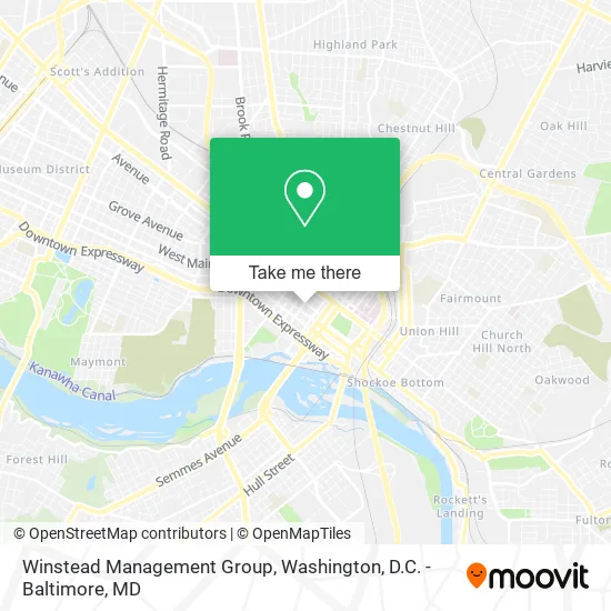
See Winstead Management Group, Richmond, on the map
Public Transit to Winstead Management Group in Richmond
Wondering how to get to Winstead Management Group in Richmond? Moovit helps you find the best way to get to Winstead Management Group with step-by-step directions from the nearest public transit station.
Moovit provides free maps and live directions to help you navigate through your city. View schedules, routes, timetables, and find out how long does it take to get to Winstead Management Group in real time.
Looking for the nearest stop or station to Winstead Management Group? Check out this list of stops closest to your destination: Broad & 7th; Main & 5th; 7th Street And Franklin Street; 8th + Main; Convention Center Eastbound Station; Pathrichmond Main Street Amtrak Station.
Bus: 14, 3B, FLIXBUS N2601, 1, 2A, 2B, 2C, 3C, 5, 87, 29, 95, BRT.Train: NORTHEAST REGIONAL.
Want to see if there’s another route that gets you there at an earlier time? Moovit helps you find alternative routes or times. Get directions from and directions to Winstead Management Group easily from the Moovit App or Website.
We make riding to Winstead Management Group easy, which is why over 1.5 million users, including users in Richmond, trust Moovit as the best app for public transit. You don’t need to download an individual bus app or train app, Moovit is your all-in-one transit app that helps you find the best bus time or train time available.
For information on prices of bus and train, costs and ride fares to Winstead Management Group, please check the Moovit app.
Use the app to navigate to popular places including to the airport, hospital, stadium, grocery store, mall, coffee shop, school, college, and university.
Winstead Management Group Address: 501 E Franklin St Richmond, VA 23219 street in Richmond
- Moxy Hotels,
- Swanson Sec Guard Patrol Services,
- Gangaenviro Systems Inc.,
- Mycomputerworks,
- Government Offices City Economic Development,
- Baymountain,
- 501 East Franklin,
- Aardvark Driving School Downtown,
- US Department of Agriculture,
- Minimoves,
- Monument City Parking,
- Edible Arrangements,
- Just Flowers,
- John Marshall Barber Shop,
- Franklin Express,
- Pump & Tank Co.,
- Felicia's Fabulous Nails,
- Penny Lane Pub Restaurant,
- Penny Lane Pub,
- Recurve Services
Places Near Winstead Management Group (Richmond)
- Westfield Montgomery Mall, Montgomery County,
- Sibley Memorial Hospital, Washington,
- Marriott Marquis Washington, DC, Washington,
- Museum Of The Bible, Washington,
- Amazon Hq2, Arlington County,
- Pennsylvania Ave NW (3rd st and pennsylvania), Washington,
- National Zoo, Washington,
- Georgetown, Washington,
- Washington National Cathedral, Washington,
- Washington DC VA Medical Center, Washington,
- Warner Theatre, Washington,
- PG Mall, Prince George's County,
- Camden Yards, Baltimore,
- National Museum of African American History and Culture, Washington,
- National Mall, Washington,
- M&T Bank Stadium, Baltimore,
- Basilica of the National Shrine, Washington,
- The Anthem, Washington,
- Rock Creek Tennis Center, Washington,
- Capital One Arena, Washington
How to get to popular places in Washington, D.C. - Baltimore, MD with public transit
Get around Richmond by public transit!
Traveling around Richmond has never been so easy. See step by step directions as you travel to any attraction, street or major public transit station. View bus and train schedules, arrival times, service alerts and detailed routes on a map, so you know exactly how to get to anywhere in Richmond.
When traveling to any destination around Richmond use Moovit's Live Directions with Get Off Notifications to know exactly where and how far to walk, how long to wait for your line, and how many stops are left. Moovit will alert you when it's time to get off — no need to constantly re-check whether yours is the next stop.
Wondering how to use public transit in Richmond or how to pay for public transit in Richmond? Moovit public transit app can help you navigate your way with public transit easily, and at minimum cost. It includes public transit fees, ticket prices, and costs. Looking for a map of Richmond public transit lines? Moovit public transit app shows all public transit maps in Richmond with all Bus, Train, Metro, Light Rail and Ferry routes and stops on an interactive map.
Washington, D.C. - Baltimore, MD has 5 transit type(s), including: Bus, Train, Metro, Light Rail and Ferry, operated by several transit agencies, including WMATA, Montgomery County Ride On, Fairfax Connector, TheBus, PRTC, DASH - Alexandria, Arlington Transit (ART), RTA of Central Maryland, MDOT MTA, MDOT MTA Light RailLink, MDOT MTA Commuter Bus, MDOT MTA Local Bus, FXBGO!, Virginia Railway Express (VRE) and MARC