Directions to Wireless World (Fort Lauderdale) with public transportation
The following transit lines have routes that pass near Wireless World
 Bus: 10, 36, 40, BEACH LINK.
- Train: BLFM.
- Ferry: WATER TROLLEY.
How to get to Wireless World by bus?
Click on the bus route to see step by step directions with maps, line arrival times and updated time schedules.
From Bass Pro Shops Indoor Shooting Range, Hollywood
89 minFrom Lauderhill Mall, Plantation
39 minFrom Walmart Supercenter, Fort Lauderdale
55 minFrom Florida Turnpike Sunrise Blvd. Toll Plaza, Plantation
56 minFrom DRV PNK Stadium, Fort Lauderdale
61 minFrom Dania Beach, Hollywood
58 minFrom Chase, Fort Lauderdale
55 minFrom Dania Pointe, Hollywood
101 minFrom Bass Pro Shops Outdoor World, Hollywood
89 minFrom Harrah's Pompano Beach, Pompano Beach
91 min
Bus stops near Wireless World in Fort Lauderdale
Train station near Wireless World in Fort Lauderdale
- Fort Lauderdale, 5 min walk,VIEW
Ferry station near Wireless World in Fort Lauderdale
- Huizenga Plaza, 8 min walk,VIEW
Bus lines to Wireless World in Fort Lauderdale
What are the closest stations to Wireless World?
The closest stations to Wireless World are:
- Sunrise Boulevard/Middle River Drive is 136 yards away, 3 min walk.
- Sunrise Boulevard & Bayview Drive is 143 yards away, 3 min walk.
- Fort Lauderdale is 343 yards away, 5 min walk.
- Huizenga Plaza is 662 yards away, 8 min walk.
- US 1/Sunrise Boulevard - (IHOP) is 817 yards away, 11 min walk.
Which bus lines stop near Wireless World?
These bus lines stop near Wireless World: 10, 36, 40.
What’s the nearest train station to Wireless World in Fort Lauderdale?
The nearest train station to Wireless World in Fort Lauderdale is Fort Lauderdale. It’s a 5 min walk away.
What’s the nearest bus station to Wireless World in Fort Lauderdale?
The nearest bus stations to Wireless World in Fort Lauderdale are Sunrise Boulevard/Middle River Drive and Sunrise Boulevard & Bayview Drive. The closest one is a 3 min walk away.
What’s the nearest ferry station to Wireless World in Fort Lauderdale?
The nearest ferry station to Wireless World in Fort Lauderdale is Huizenga Plaza. It’s a 8 min walk away.
What time is the first train to Wireless World in Fort Lauderdale?
The BLFM is the first train that goes to Wireless World in Fort Lauderdale. It stops nearby at 6:25 AM.
What time is the last train to Wireless World in Fort Lauderdale?
The BLFM is the last train that goes to Wireless World in Fort Lauderdale. It stops nearby at 11:51 PM.
What time is the first bus to Wireless World in Fort Lauderdale?
The 36 is the first bus that goes to Wireless World in Fort Lauderdale. It stops nearby at 5:19 AM.
What time is the last bus to Wireless World in Fort Lauderdale?
The 36 is the last bus that goes to Wireless World in Fort Lauderdale. It stops nearby at 12:26 AM.
What time is the first ferry to Wireless World in Fort Lauderdale?
The WATER TROLLEY is the first ferry that goes to Wireless World in Fort Lauderdale. It stops nearby at 10:00 AM.
What time is the last ferry to Wireless World in Fort Lauderdale?
The WATER TROLLEY is the last ferry that goes to Wireless World in Fort Lauderdale. It stops nearby at 10:20 PM.
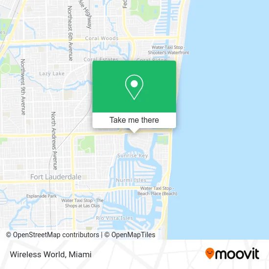
See Wireless World, Fort Lauderdale, on the map
Public Transit to Wireless World in Fort Lauderdale
Wondering how to get to Wireless World in Fort Lauderdale? Moovit helps you find the best way to get to Wireless World with step-by-step directions from the nearest public transit station.
Moovit provides free maps and live directions to help you navigate through your city. View schedules, routes, timetables, and find out how long does it take to get to Wireless World in real time.
Looking for the nearest stop or station to Wireless World? Check out this list of stops closest to your destination: Sunrise Boulevard/Middle River Drive; Sunrise Boulevard & Bayview Drive; Fort Lauderdale; Huizenga Plaza; US 1/Sunrise Boulevard - (IHOP).
Bus: 10, 36, 40, BEACH LINK.Train: BLFM.Ferry: WATER TROLLEY.
Want to see if there’s another route that gets you there at an earlier time? Moovit helps you find alternative routes or times. Get directions from and directions to Wireless World easily from the Moovit App or Website.
We make riding to Wireless World easy, which is why over 1.5 million users, including users in Fort Lauderdale, trust Moovit as the best app for public transit. You don’t need to download an individual bus app or train app, Moovit is your all-in-one transit app that helps you find the best bus time or train time available.
For information on prices of bus, costs and ride fares to Wireless World, please check the Moovit app.
Use the app to navigate to popular places including to the airport, hospital, stadium, grocery store, mall, coffee shop, school, college, and university.
Wireless World Address: 2414 E Sunrise Blvd Fort Lauderdale, FL 33304 street in Fort Lauderdale
- Yuly 360,
- Bonita's Boutique,
- Crazy Comics,
- Unelma,
- The Galleria Mall Food Court,
- Inspire Me Bracelets,
- Brush Strokes,
- Lifestones,
- Piercing Pagoda,
- Rafael Rojo International Beauty Salon,
- Red Mango,
- Hollister,
- New York & Company,
- Tesla,
- Wireless Gear,
- Libertyx Bitcoin Cashier,
- Palm Court Market,
- STARBUCKS,
- Shop Express,
- Key West Day Tours
Places Near Wireless World (Fort Lauderdale)
- Miami-Dade County Courthouse, Miami,
- Miami Freedom Park, Miami,
- Bayside Marketplace, Miami,
- Dolphin Mall Bus, Miami,
- Richard E. Gerstein Justice Building, Miami,
- Zoo Miami, Miami,
- Dolphin Mall, Miami,
- Brickell City Centre, Miami,
- 1351 NW 12th St, Miami,
- Marlins Park, Miami,
- Miami Design District, Miami,
- Sawgrass Mall, Miami,
- Little Havana, Miami,
- Port of Miami Cruise Terminal, Miami,
- Hard Rock Stadium, Miami Gardens,
- Aventura Mall, Miami,
- Wynwood, Miami,
- Keiser University Flagship Campus, West Palm Beach,
- Sawgrass mall ( FL ), Miami Beach,
- Aventura Mall, Miami Beach
How to get to popular places in Miami with public transit
Get around Fort Lauderdale by public transit!
Traveling around Fort Lauderdale has never been so easy. See step by step directions as you travel to any attraction, street or major public transit station. View bus and train schedules, arrival times, service alerts and detailed routes on a map, so you know exactly how to get to anywhere in Fort Lauderdale.
When traveling to any destination around Fort Lauderdale use Moovit's Live Directions with Get Off Notifications to know exactly where and how far to walk, how long to wait for your line, and how many stops are left. Moovit will alert you when it's time to get off — no need to constantly re-check whether yours is the next stop.
Wondering how to use public transit in Fort Lauderdale or how to pay for public transit in Fort Lauderdale? Moovit public transit app can help you navigate your way with public transit easily, and at minimum cost. It includes public transit fees, ticket prices, and costs. Looking for a map of Fort Lauderdale public transit lines? Moovit public transit app shows all public transit maps in Fort Lauderdale with all Bus, Train, Light Rail and Ferry routes and stops on an interactive map.
Miami has 4 transit type(s), including: Bus, Train, Light Rail and Ferry, operated by several transit agencies, including Broward County Transit, Miami-Dade Transit, Metrorail, Palm Tran, Tri-Rail, Brightline, MARTY, City of Homestead Trolley, Key West Transit, Treasure Coast Connector, GoLine IRT, Amtrak, Greyhound-us, FlixBus-us and Aventura Express Shuttle Bus