Directions to Work (Fairfax County) with public transportation
The following transit lines have routes that pass near Work
 Bus: 371, 305.
- Train: FREDERICKSBURG LINE.
How to get to Work by bus?
Click on the bus route to see step by step directions with maps, line arrival times and updated time schedules.
From Springfield Mall, Fairfax County
54 minFrom Burke, VA, Fairfax County
79 minFrom Potomac Mills Mall, Prince William County
81 minFrom Transportation Security Administration - TSA Headquarters, Fairfax County
48 minFrom Springfield, VA, Fairfax County
61 minFrom Springfield Mall (franconia / Springfield Mall), Fairfax County
54 minFrom [I-495] Exit 54 - Braddock Road, Fairfax County
107 minFrom Kingstowne, VA, Fairfax County
64 minFrom Balian Springs, Fairfax County
96 min
How to get to Work by train?
Click on the train route to see step by step directions with maps, line arrival times and updated time schedules.
Bus stops near Work in Fairfax County
Train station near Work in Fairfax County
- Lorton Station, 50 min walk,VIEW
Bus lines to Work in Fairfax County
What are the closest stations to Work?
The closest stations to Work are:
- Lorton Park And Ride is 226 yards away, 3 min walk.
- Lorton Rd @ Sanger St is 845 yards away, 10 min walk.
- Lorton Station is 4307 yards away, 50 min walk.
Which bus line stops near Work?
371 (371 Lorton)
Which train line stops near Work?
FREDERICKSBURG LINE (Spotsylvania)
What’s the nearest bus station to Work in Fairfax County?
The nearest bus station to Work in Fairfax County is Lorton Park And Ride. It’s a 3 min walk away.
What time is the first train to Work in Fairfax County?
The FREDERICKSBURG LINE is the first train that goes to Work in Fairfax County. It stops nearby at 6:05 AM.
What time is the last train to Work in Fairfax County?
The FREDERICKSBURG LINE is the last train that goes to Work in Fairfax County. It stops nearby at 7:31 PM.
What time is the first bus to Work in Fairfax County?
The 371 is the first bus that goes to Work in Fairfax County. It stops nearby at 4:10 AM.
What time is the last bus to Work in Fairfax County?
The 371 is the last bus that goes to Work in Fairfax County. It stops nearby at 1:13 AM.
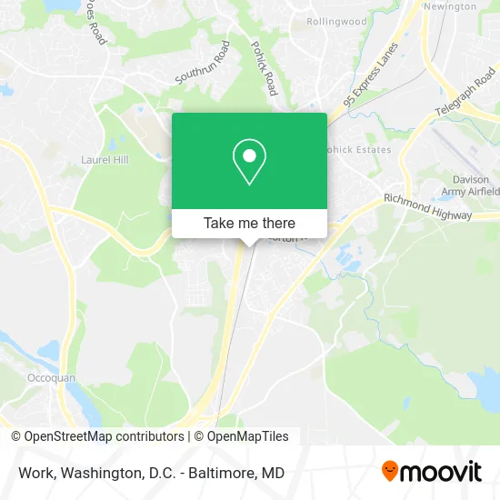
See Work, Fairfax County, on the map
Public Transit to Work in Fairfax County
Wondering how to get to Work in Fairfax County? Moovit helps you find the best way to get to Work with step-by-step directions from the nearest public transit station.
Moovit provides free maps and live directions to help you navigate through your city. View schedules, routes, timetables, and find out how long does it take to get to Work in real time.
Looking for the nearest stop or station to Work? Check out this list of stops closest to your destination: Lorton Park And Ride; Lorton Rd @ Sanger St; Lorton Station.
Bus: 371, 305.Train: FREDERICKSBURG LINE.
Want to see if there’s another route that gets you there at an earlier time? Moovit helps you find alternative routes or times. Get directions from and directions to Work easily from the Moovit App or Website.
We make riding to Work easy, which is why over 1.5 million users, including users in Fairfax County, trust Moovit as the best app for public transit. You don’t need to download an individual bus app or train app, Moovit is your all-in-one transit app that helps you find the best bus time or train time available.
For information on prices of bus, train and metro, costs and ride fares to Work, please check the Moovit app.
Use the app to navigate to popular places including to the airport, hospital, stadium, grocery store, mall, coffee shop, school, college, and university.
Work Address: Gunston Cove Rd Lorton, VA 22079 street in Fairfax County
- Inova-Gohealth Urgent Care,
- Tigerden Martial Arts,
- Elite Action Lorton,
- Lorton Marketplace,
- Panera Bread,
- WING STOP,
- aroma,
- Poke Bros.,
- Dunya Kabob,
- Paisanos,
- Alcoholic Beverage Control Dept Lorton,
- Cynamed,
- Binary Ideas,
- Shred Nations,
- Dee Luxe Nails,
- Capital Metro Homes,
- Sharon Carlisle Photography,
- Everclear Window Cleaning,
- Binary Ideas Local Marketing,
- DUNKIN'
Places Near Work (Fairfax County)
- National Museum of African American History and Culture, Washington,
- Westfield Montgomery Mall, Montgomery County,
- Washington National Cathedral, Washington,
- Rock Creek Tennis Center, Washington,
- Washington DC VA Medical Center, Washington,
- Marriott Marquis Washington, DC, Washington,
- Pennsylvania Ave NW (3rd st and pennsylvania), Washington,
- PG Mall, Prince George's County,
- Basilica of the National Shrine, Washington,
- Georgetown, Washington,
- National Mall, Washington,
- M&T Bank Stadium, Baltimore,
- Museum Of The Bible, Washington,
- Amazon Hq2, Arlington County,
- Camden Yards, Baltimore,
- Capital One Arena, Washington,
- Warner Theatre, Washington,
- Sibley Memorial Hospital, Washington,
- The Anthem, Washington,
- National Zoo, Washington
How to get to popular places in Washington, D.C. - Baltimore, MD with public transit
Get around Fairfax County by public transit!
Traveling around Fairfax County has never been so easy. See step by step directions as you travel to any attraction, street or major public transit station. View bus and train schedules, arrival times, service alerts and detailed routes on a map, so you know exactly how to get to anywhere in Fairfax County.
When traveling to any destination around Fairfax County use Moovit's Live Directions with Get Off Notifications to know exactly where and how far to walk, how long to wait for your line, and how many stops are left. Moovit will alert you when it's time to get off — no need to constantly re-check whether yours is the next stop.
Wondering how to use public transit in Fairfax County or how to pay for public transit in Fairfax County? Moovit public transit app can help you navigate your way with public transit easily, and at minimum cost. It includes public transit fees, ticket prices, and costs. Looking for a map of Fairfax County public transit lines? Moovit public transit app shows all public transit maps in Fairfax County with all Bus, Train, Metro, Light Rail and Ferry routes and stops on an interactive map.
Washington, D.C. - Baltimore, MD has 5 transit type(s), including: Bus, Train, Metro, Light Rail and Ferry, operated by several transit agencies, including WMATA, Montgomery County Ride On, Fairfax Connector, TheBus, PRTC, DASH - Alexandria, Arlington Transit (ART), RTA of Central Maryland, MDOT MTA, MDOT MTA Light RailLink, MDOT MTA Commuter Bus, MDOT MTA Local Bus, FXBGO!, Virginia Railway Express (VRE) and MARC