How to get to World Changers Church - DC by bus?
Click on the bus route to see step by step directions with maps, line arrival times and updated time schedules.
From Residence Inn by Marriott Arlington Capital View, Arlington County
82 minFrom Arlington Central Library, Arlington County
77 minFrom Consulado General de El Salvador en El Dmv, Montgomery County
70 minFrom Silver Spring, Maryland, Montgomery County
68 minFrom Tony & Joe's Seafood Place, Washington
48 minFrom Clyde's of Chevy Chase, Montgomery County
76 minFrom Embassy of Japan, Washington
40 minFrom Fannie Mae, Washington
51 minFrom Marymount University Campus, Arlington County
80 minFrom Foreign Service Institute, Arlington County
91 min
How to get to World Changers Church - DC by train?
Click on the train route to see step by step directions with maps, line arrival times and updated time schedules.
How to get to World Changers Church - DC by metro?
Click on the metro route to see step by step directions with maps, line arrival times and updated time schedules.
From Residence Inn by Marriott Arlington Capital View, Arlington County
52 minFrom Arlington Central Library, Arlington County
46 minFrom Consulado General de El Salvador en El Dmv, Montgomery County
37 minFrom Silver Spring, Maryland, Montgomery County
30 minFrom Tony & Joe's Seafood Place, Washington
41 minFrom Clyde's of Chevy Chase, Montgomery County
35 minFrom Embassy of Japan, Washington
39 minFrom Fannie Mae, Washington
44 minFrom Marymount University Campus, Arlington County
44 min
Bus stops near World Changers Church - DC in Washington
Metro station near World Changers Church - DC in Washington
- Noma-Gallaudet U, 11 min walk,VIEW
Train stations near World Changers Church - DC in Washington
Bus lines to World Changers Church - DC in Washington
What are the closest stations to World Changers Church - DC?
The closest stations to World Changers Church - DC are:
- Florida Av Ne+7 St NE is 112 yards away, 2 min walk.
- K St Ne+8 St NE is 304 yards away, 4 min walk.
- H St Ne+8 St NE is 603 yards away, 8 min walk.
- Noma-Gallaudet U is 909 yards away, 11 min walk.
- Union Station is 1643 yards away, 20 min walk.
- Union Station Marc Washington is 1733 yards away, 21 min walk.
Which bus lines stop near World Changers Church - DC?
These bus lines stop near World Changers Church - DC: C53, D20, D36.
Which train lines stop near World Changers Church - DC?
These train lines stop near World Changers Church - DC: MARC, NORTHEAST REGIONAL.
Which metro line stops near World Changers Church - DC?
RED (Shady Grove)
What’s the nearest metro station to World Changers Church - DC in Washington?
The nearest metro station to World Changers Church - DC in Washington is Noma-Gallaudet U. It’s a 11 min walk away.
What’s the nearest train station to World Changers Church - DC in Washington?
The nearest train station to World Changers Church - DC in Washington is Union Station. It’s a 20 min walk away.
What’s the nearest bus station to World Changers Church - DC in Washington?
The nearest bus station to World Changers Church - DC in Washington is Florida Av Ne+7 St NE. It’s a 2 min walk away.
What time is the first metro to World Changers Church - DC in Washington?
The RED is the first metro that goes to World Changers Church - DC in Washington. It stops nearby at 5:19 AM.
What time is the last metro to World Changers Church - DC in Washington?
The RED is the last metro that goes to World Changers Church - DC in Washington. It stops nearby at 12:17 AM.
What time is the first train to World Changers Church - DC in Washington?
The ACELA is the first train that goes to World Changers Church - DC in Washington. It stops nearby at 5:00 AM.
What time is the last train to World Changers Church - DC in Washington?
The SILVER METEOR is the last train that goes to World Changers Church - DC in Washington. It stops nearby at 7:10 AM.
What time is the first bus to World Changers Church - DC in Washington?
The C53 is the first bus that goes to World Changers Church - DC in Washington. It stops nearby at 3:02 AM.
What time is the last bus to World Changers Church - DC in Washington?
The C53 is the last bus that goes to World Changers Church - DC in Washington. It stops nearby at 3:12 AM.
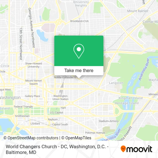
See World Changers Church - DC, Washington, on the map
Public Transit to World Changers Church - DC in Washington
Wondering how to get to World Changers Church - DC in Washington? Moovit helps you find the best way to get to World Changers Church - DC with step-by-step directions from the nearest public transit station.
Moovit provides free maps and live directions to help you navigate through your city. View schedules, routes, timetables, and find out how long does it take to get to World Changers Church - DC in real time.
Looking for the nearest stop or station to World Changers Church - DC? Check out this list of stops closest to your destination: Florida Av Ne+7 St NE; K St Ne+8 St NE; H St Ne+8 St NE; Noma-Gallaudet U; Union Station; Union Station Marc Washington.
Bus: C53, D20, D36, C57, C71, D2X.Train: MARC, NORTHEAST REGIONAL, ACELA, CARDINAL, CAROLINIAN, CRESCENT, FLORIDIAN.Metro: RED.
Want to see if there’s another route that gets you there at an earlier time? Moovit helps you find alternative routes or times. Get directions from and directions to World Changers Church - DC easily from the Moovit App or Website.
We make riding to World Changers Church - DC easy, which is why over 1.5 million users, including users in Washington, trust Moovit as the best app for public transit. You don’t need to download an individual bus app or train app, Moovit is your all-in-one transit app that helps you find the best bus time or train time available.
For information on prices of bus, metro and train, costs and ride fares to World Changers Church - DC, please check the Moovit app.
Use the app to navigate to popular places including to the airport, hospital, stadium, grocery store, mall, coffee shop, school, college, and university.
World Changers Church - DC Address: 800 Florida Ave NE street in Washington
- Hotchkiss Field (Hotchkiss Fld at Gallaudet Univ),
- Gallaudet University,
- Kellogg Conference Hotel,
- 1609 8th St NE,
- I. King Jordan Student Academic Center,
- Gallaudet University,
- Washington humane society,
- Jo Wilson Before and After Day Care Center,
- G-Area,
- Gallaudet University Kellogg Conference Center,
- 11th St NE & Florida Ave NE,
- Yellow Yam,
- Auto Clarity Detailing,
- Motjuste Tirade of Vim Andre Juste Home Improvements,
- Four Walls Career Technical & Education Center,
- LLRH 6,
- Florida Market,
- A. Litteri, Inc.,
- Brentwood Hamilton Field,
- 6th Tapscott St
Places Near World Changers Church - DC (Washington)
- Amazon Hq2, Arlington County,
- M&T Bank Stadium, Baltimore,
- Washington DC VA Medical Center, Washington,
- Camden Yards, Baltimore,
- Pennsylvania Ave NW (3rd st and pennsylvania), Washington,
- Sibley Memorial Hospital, Washington,
- Marriott Marquis Washington, DC, Washington,
- Capital One Arena, Washington,
- National Zoo, Washington,
- Washington National Cathedral, Washington,
- The Anthem, Washington,
- PG Mall, Prince George's County,
- Basilica of the National Shrine, Washington,
- Westfield Montgomery Mall, Montgomery County,
- Georgetown, Washington,
- Rock Creek Tennis Center, Washington,
- National Museum of African American History and Culture, Washington,
- National Mall, Washington,
- Museum Of The Bible, Washington,
- Warner Theatre, Washington
How to get to popular places in Washington, D.C. - Baltimore, MD with public transit
Get around Washington by public transit!
Traveling around Washington has never been so easy. See step by step directions as you travel to any attraction, street or major public transit station. View bus and train schedules, arrival times, service alerts and detailed routes on a map, so you know exactly how to get to anywhere in Washington.
When traveling to any destination around Washington use Moovit's Live Directions with Get Off Notifications to know exactly where and how far to walk, how long to wait for your line, and how many stops are left. Moovit will alert you when it's time to get off — no need to constantly re-check whether yours is the next stop.
Wondering how to use public transit in Washington or how to pay for public transit in Washington? Moovit public transit app can help you navigate your way with public transit easily, and at minimum cost. It includes public transit fees, ticket prices, and costs. Looking for a map of Washington public transit lines? Moovit public transit app shows all public transit maps in Washington with all Bus, Train, Metro, Light Rail and Ferry routes and stops on an interactive map.
Washington, D.C. - Baltimore, MD has 5 transit type(s), including: Bus, Train, Metro, Light Rail and Ferry, operated by several transit agencies, including WMATA, Montgomery County Ride On, Fairfax Connector, TheBus, PRTC, DASH - Alexandria, Arlington Transit (ART), RTA of Central Maryland, MDOT MTA, MDOT MTA Light RailLink, MDOT MTA Commuter Bus, MDOT MTA Local Bus, FXBGO!, Virginia Railway Express (VRE) and MARC