Directions to World Service (Paulista) with public transportation
The following transit lines have routes that pass near World Service
How to get to World Service by bus?
Click on the bus route to see step by step directions with maps, line arrival times and updated time schedules.
From Olinda, Olinda
55 minFrom Maternidade brites De Albuquerque, Olinda
38 minFrom Patteo Shopping, Olinda
43 minFrom Alto da Conquista, Olinda
55 minFrom Bairro Novo, Olinda
48 minFrom Laboratório Elo, Olinda
45 minFrom Praia do Quartel, Olinda
40 minFrom Cotel, Abreu E Lima
73 minFrom inss, Olinda
48 minFrom Avenida Doutor José Augusto Moreira, Olinda
35 min
Bus stops near World Service in Paulista
Bus lines to World Service in Paulista
What are the closest stations to World Service?
The closest stations to World Service are:
- 160431 - Rua Estados Unidos S/N is 96 meters away, 2 min walk.
- 160415 - Rua Paranatama S/N is 186 meters away, 3 min walk.
- Rua Grã-Bretanha, 3005 is 473 meters away, 7 min walk.
Which bus lines stop near World Service?
These bus lines stop near World Service: 1958 COSTA AZUL / TI PELÓPIDAS, 1982 CONJUNTO BEIRA MAR / DERBY.
What’s the nearest bus station to World Service in Paulista?
The nearest bus station to World Service in Paulista is 160431 - Rua Estados Unidos S/N. It’s a 2 min walk away.
What time is the first bus to World Service in Paulista?
The 1978 LOTEAMENTO CONCEIÇÃO / TI RIO DOCE (PE-22) is the first bus that goes to World Service in Paulista. It stops nearby at 4:00 AM.
What time is the last bus to World Service in Paulista?
The 1982 CONJUNTO BEIRA MAR / DERBY is the last bus that goes to World Service in Paulista. It stops nearby at 12:55 AM.
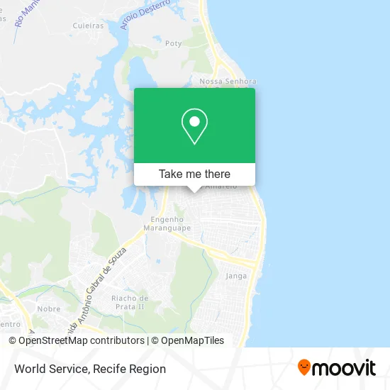
See World Service, Paulista, on the map
Public Transit to World Service in Paulista
Wondering how to get to World Service in Paulista? Moovit helps you find the best way to get to World Service with step-by-step directions from the nearest public transit station.
Moovit provides free maps and live directions to help you navigate through your city. View schedules, routes, timetables, and find out how long does it take to get to World Service in real time.
Looking for the nearest stop or station to World Service? Check out this list of stops closest to your destination: 160431 - Rua Estados Unidos S/N; 160415 - Rua Paranatama S/N; Rua Grã-Bretanha.
Bus: 1958 COSTA AZUL / TI PELÓPIDAS, 1982 CONJUNTO BEIRA MAR / DERBY, 1978 LOTEAMENTO CONCEIÇÃO / TI RIO DOCE (PE-22).
Want to see if there’s another route that gets you there at an earlier time? Moovit helps you find alternative routes or times. Get directions from and directions to World Service easily from the Moovit App or Website.
We make riding to World Service easy, which is why over 1.5 million users, including users in Paulista, trust Moovit as the best app for public transit. You don’t need to download an individual bus app or train app, Moovit is your all-in-one transit app that helps you find the best bus time or train time available.
For information on prices of bus, costs and ride fares to World Service, please check the Moovit app.
Use the app to navigate to popular places including to the airport, hospital, stadium, grocery store, mall, coffee shop, school, college, and university.
World Service Address: Rua Noruega, 214 Pau Amarelo Paulista-PE 53433-190 street in Paulista
- Hort Frutas Sacolão da Promoção,
- Rua Vietnã do Norte,
- Deposito and Horti Fruti Maria Farinha,
- Hostel do Forte,
- Condominio do Residencial Alvorada V,
- Mercadinho e Panificadora Nova Era,
- Varejao Santa Rita,
- Terrakios Ti,
- Mercearia Conceicao,
- Congregação da Igreja Batista do Eng. Maranguape,
- Coturno de Curso,
- Edificio Costa Azul,
- Creche Municipal Maria Anunciada De Arruda (Irmã Linda),
- Planet Plus Internacional,
- Mimor Acessórios,
- Congregação Crista no Brasil,
- Joyce Callas Unhas,
- rua republica arabe unida - pau amarelo pe paulista,
- Marconi Mendes de Brito,
- Marmoraria Santa Cruz
Places Near World Service (Paulista)
- Imbiribeira, Imbiribeira,
- Imip (Instituto Materno-Infantil De Pernambuco), Coelhos,
- Hospital Altino Ventura, Iputinga,
- tuuuuu, Olinda,
- Hospital Geral De Areias, Areias,
- Hospital Universitário Oswaldo Cruz, Santo Amaro,
- llll, Fundão,
- Centro de Convenções de Pernambuco, Olinda,
- Arena de Pernambuco, São Lourenço Da Mata,
- Hospital Agamenon Magalhães, Tamarineira,
- Marco Zero, Bairro Do Recife,
- Shopping Patteo Olinda, Olinda,
- Shopping Recife, Boa Viagem,
- Shopping RioMar Recife, Pina,
- hospital otavio de freitas - UTI, Tejipió,
- Hospital Maria Lucinda, Parnamirim,
- SHOPPING GUARARAPES, Jaboatão Dos Guararapes,
- Hospital Eduardo Campus Da Pessoa Idosa, Areias,
- Parque da Jaqueira, Jaqueira,
- SHOPPING TACARUNA, Santo Amaro
How to get to popular places in Recife Region with public transit
Get around Paulista by public transit!
Traveling around Paulista has never been so easy. See step by step directions as you travel to any attraction, street or major public transit station. View bus and train schedules, arrival times, service alerts and detailed routes on a map, so you know exactly how to get to anywhere in Paulista.
When traveling to any destination around Paulista use Moovit's Live Directions with Get Off Notifications to know exactly where and how far to walk, how long to wait for your line, and how many stops are left. Moovit will alert you when it's time to get off — no need to constantly re-check whether yours is the next stop.
Wondering how to use public transit in Paulista or how to pay for public transit in Paulista? Moovit public transit app can help you navigate your way with public transit easily, and at minimum cost. It includes public transit fees, ticket prices, and costs. Looking for a map of Paulista public transit lines? Moovit public transit app shows all public transit maps in Paulista with all Bus, Train, Subway and Ferry routes and stops on an interactive map.
Recife Region has 4 transit type(s), including: Bus, Train, Subway and Ferry, operated by several transit agencies, including CBTU (Metrorec), BRT (Via Livre), Grande Recife, BORBOREMA IMPERIAL (TIP), BORBOREMA IMPERIAL (B.V), RODOVIÁRIA POTENGY, EMPRESA METROPOLITANA, CONSÓRCIO RECIFE, SÃO JUDAS TADEU, Expresso 1002, Rodotur Turismo, Complementar Recife, Sistema Municipal - Jaboatão, Sistema Municipal - Cabo and Sistema Municipal - Ipojuca