How to get to Wrdmx Comercio by bus?
Click on the bus route to see step by step directions with maps, line arrival times and updated time schedules.
From Feirão Moda Rio, Duque De Caxias
54 minFrom Albert Sabin Centro Oftalmológico, Madureira
42 minFrom BRT - Estação Madureira, Madureira
36 minFrom Del Castilho, Del Castilho
50 minFrom Estrada General Americano Freire, Realengo
28 minFrom Catedral Del Castilho Universal, Del Castilho
59 minFrom Vilar Dos Teles, São João De Meriti
36 minFrom Estrada Adhemar Bebiano, Del Castilho
57 minFrom BRT - Estação Vicente de Carvalho, Vicente De Carvalho
33 minFrom Estádio Nilton Santos - Engenhão, Engenho De Dentro
65 min
How to get to Wrdmx Comercio by train?
Click on the train route to see step by step directions with maps, line arrival times and updated time schedules.
From Albert Sabin Centro Oftalmológico, Madureira
48 minFrom BRT - Estação Madureira, Madureira
41 minFrom Del Castilho, Del Castilho
56 minFrom Estrada General Americano Freire, Realengo
90 minFrom Catedral Del Castilho Universal, Del Castilho
62 minFrom Estrada Adhemar Bebiano, Del Castilho
61 minFrom Estádio Nilton Santos - Engenhão, Engenho De Dentro
67 min
How to get to Wrdmx Comercio by metro?
Click on the metro route to see step by step directions with maps, line arrival times and updated time schedules.
Train station near Wrdmx Comercio in Coelho Neto
- Barros Filho, 4 min walk,VIEW
Bus stops near Wrdmx Comercio in Coelho Neto
Metro station near Wrdmx Comercio in Coelho Neto
- Acari / Fazenda Botafogo, 28 min walk,VIEW
Bus lines to Wrdmx Comercio in Coelho Neto
- 298, Castelo (Desvio Na Pça. Da Cruz Vermelha),VIEW
- SN 298, Castelo,VIEW
- 362, Honório (Área De Lazer),VIEW
- SR 362, Honório,VIEW
- 785, Marechal Hermes,VIEW
- 920, Bonsucesso,VIEW
- 428L, Nova Aurora - Bonsucesso (Via Pavuna),VIEW
- 665, Pavuna - Saens Peña (Via Coelho Neto),VIEW
- SVA 685, Irajá - Méier (Via Rua Embaú),VIEW
- 687, Pavuna - Méier (Via Est. Velha da Pavuna),VIEW
- 688, Pavuna - Méier (Via Álvaro de Miranda),VIEW
- 713L, Cosmorama - Cascadura (Via Pavuna),VIEW
- 715L, Santa Marta - Cascadura (Via Jardim Redentor),VIEW
- 720L, Novo Rio - Cascadura (Via Madureira / Pavuna),VIEW
- 729L, São Vicente - Méier (Via Pavuna),VIEW
- 734L, Vila Norma - Cascadura (Via Vila Tiradentes),VIEW
- 736L, Jardim Botânico - Cascadura (Via Praça da Bandeira),VIEW
- 738L, Jardim Metrópoles - Cascadura (Via Prefeitura),VIEW
- 919, Pavuna - Maré (via Carioca Shopping / Bonsucesso),VIEW
- SN 919, Pavuna - Maré (via Carioca Shopping / Bonsucesso),VIEW
What are the closest stations to Wrdmx Comercio?
The closest stations to Wrdmx Comercio are:
- Barros Filho is 243 meters away, 4 min walk.
- Rua Pedro Jório, 276-300 is 281 meters away, 4 min walk.
- Avenida Prefeito Sá Lessa, 1019 is 292 meters away, 4 min walk.
- Avenida Pastor Martin Luther King Junior, 11311-11411 is 687 meters away, 10 min walk.
- Acari / Fazenda Botafogo is 2161 meters away, 28 min walk.
Which bus lines stop near Wrdmx Comercio?
These bus lines stop near Wrdmx Comercio: 298, 362, 397, 715L, 920.
Which metro line stops near Wrdmx Comercio?
L2 (Pavuna)
Which train line stops near Wrdmx Comercio?
RAMAL BELFORD ROXO (Belford Roxo)
What’s the nearest metro station to Wrdmx Comercio in Coelho Neto?
The nearest metro station to Wrdmx Comercio in Coelho Neto is Acari / Fazenda Botafogo. It’s a 28 min walk away.
What’s the nearest train station to Wrdmx Comercio in Coelho Neto?
The nearest train station to Wrdmx Comercio in Coelho Neto is Barros Filho. It’s a 4 min walk away.
What’s the nearest bus station to Wrdmx Comercio in Coelho Neto?
The nearest bus stations to Wrdmx Comercio in Coelho Neto are Rua Pedro Jório, 276-300 and Avenida Prefeito Sá Lessa, 1019. The closest one is a 4 min walk away.
What time is the first metro to Wrdmx Comercio in Coelho Neto?
The L2 is the first metro that goes to Wrdmx Comercio in Coelho Neto. It stops nearby at 5:01 AM.
What time is the last metro to Wrdmx Comercio in Coelho Neto?
The L2 is the last metro that goes to Wrdmx Comercio in Coelho Neto. It stops nearby at 12:49 AM.
What time is the first train to Wrdmx Comercio in Coelho Neto?
The RAMAL BELFORD ROXO is the first train that goes to Wrdmx Comercio in Coelho Neto. It stops nearby at 4:56 AM.
What time is the last train to Wrdmx Comercio in Coelho Neto?
The RAMAL BELFORD ROXO is the last train that goes to Wrdmx Comercio in Coelho Neto. It stops nearby at 10:12 PM.
What time is the first bus to Wrdmx Comercio in Coelho Neto?
The SN 298 is the first bus that goes to Wrdmx Comercio in Coelho Neto. It stops nearby at 3:00 AM.
What time is the last bus to Wrdmx Comercio in Coelho Neto?
The SN 298 is the last bus that goes to Wrdmx Comercio in Coelho Neto. It stops nearby at 3:10 AM.
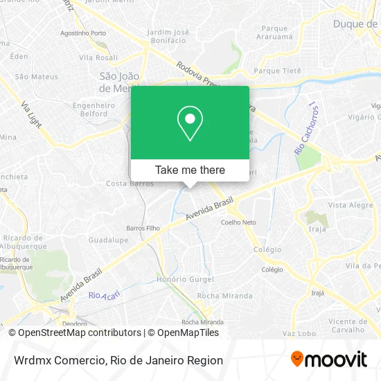
See Wrdmx Comercio, Coelho Neto, on the map
Public Transit to Wrdmx Comercio in Coelho Neto
Wondering how to get to Wrdmx Comercio in Coelho Neto? Moovit helps you find the best way to get to Wrdmx Comercio with step-by-step directions from the nearest public transit station.
Moovit provides free maps and live directions to help you navigate through your city. View schedules, routes, timetables, and find out how long does it take to get to Wrdmx Comercio in real time.
Looking for the nearest stop or station to Wrdmx Comercio? Check out this list of stops closest to your destination: Barros Filho; Rua Pedro Jório; Avenida Prefeito Sá Lessa; Avenida Pastor Martin Luther King Junior; Acari / Fazenda Botafogo.
Bus: 298, 362, 397, 715L, 920, SN 298, SR 362, 785, 428L, 665, SVA 685, 687, 688.Metro: L2.Train: RAMAL BELFORD ROXO.
Want to see if there’s another route that gets you there at an earlier time? Moovit helps you find alternative routes or times. Get directions from and directions to Wrdmx Comercio easily from the Moovit App or Website.
We make riding to Wrdmx Comercio easy, which is why over 1.5 million users, including users in Coelho Neto, trust Moovit as the best app for public transit. You don’t need to download an individual bus app or train app, Moovit is your all-in-one transit app that helps you find the best bus time or train time available.
For information on prices of bus, metro and train, costs and ride fares to Wrdmx Comercio, please check the Moovit app.
Use the app to navigate to popular places including to the airport, hospital, stadium, grocery store, mall, coffee shop, school, college, and university.
Wrdmx Comercio Address: Rua Pedro Jório, 560 Coelho Neto Rio de Janeiro-RJ 21530-030 street in Coelho Neto
- Fazenda botafogo,
- Jevi Assessoria Contábil,
- Vila Olímpica Clara Nunes,
- Psf - Posto de Saúde da Família Fazenda Botafogo,
- Escritório da Brahma,
- Rua Pedro Jório,
- Lima Renan Fotografia,
- Bradesco,
- Ciep Zumbi Dos Palmares,
- Associação de Moradores da Fazenda Botafogo,
- Kiosque - Coelho Neto,
- Vilar dos Teles,
- Psi Erica Meire,
- La Suburbana,
- Avenida Prefeito Sá Lessa,
- Fundação Leão XIII,
- Pastelão da Fazenda,
- Cintia Cristina Sousa de Oliveira,
- Trailer da Vânia,
- Lindacor Distribuidora
Places Near Wrdmx Comercio (Coelho Neto)
- Museu Do Amanhã, Centro,
- Rua Ulysses Guimarães 16, Cidade Nova,
- Hospital Federal Cardoso Fontes, Jacarepaguá,
- Shopping Nova América, Del Castilho,
- Avenida Rio Branco, Centro,
- Rodoviária Novo Rio (Rodoviária do Rio de Janeiro), Santo Cristo,
- Hospital Municipal Ronaldo Gazolla, Acari,
- Shopping Rio Sul, Botafogo,
- Rua Licínio Cardoso, São Francisco Xavier,
- Avenida Venezuela 134, Saúde,
- Shopping RioSul, Botafogo,
- Feirão De Malhas, Duque De Caxias,
- Rio De Janeiro,
- Hospital Federal Do Andaraí, Andaraí,
- Hospital Pedro Ernesto, Vila Isabel,
- Norte Shopping, Cachambi,
- Feira Livre da Gloria, Glória,
- Shopping Downtown, Barra Da Tijuca,
- Niterói, Niterói,
- Praia do Arpoador, Ipanema
How to get to popular places in Rio de Janeiro Region with public transit
Get around Coelho Neto by public transit!
Traveling around Coelho Neto has never been so easy. See step by step directions as you travel to any attraction, street or major public transit station. View bus and train schedules, arrival times, service alerts and detailed routes on a map, so you know exactly how to get to anywhere in Coelho Neto.
When traveling to any destination around Coelho Neto use Moovit's Live Directions with Get Off Notifications to know exactly where and how far to walk, how long to wait for your line, and how many stops are left. Moovit will alert you when it's time to get off — no need to constantly re-check whether yours is the next stop.
Wondering how to use public transit in Coelho Neto or how to pay for public transit in Coelho Neto? Moovit public transit app can help you navigate your way with public transit easily, and at minimum cost. It includes public transit fees, ticket prices, and costs. Looking for a map of Coelho Neto public transit lines? Moovit public transit app shows all public transit maps in Coelho Neto with all Bus, Train, Metro, Light Rail, Ferry, Cable Car, Gondola and Funicular routes and stops on an interactive map.
Rio de Janeiro Region has 8 transit type(s), including: Bus, Train, Metro, Light Rail, Ferry, Cable Car, Gondola and Funicular, operated by several transit agencies, including TrensRJ, Metrô Rio, VLT Carioca, Barcas Rio, BRT MOBI-Rio, Auto Viação Alpha, Auto Viação Tijuca, Gire Transportes, Transurb, Viação Nossa Senhora das Graças, Consórcio INTERSUL, Braso Lisboa (Municipal), Caprichosa Auto Ônibus, Auto Viação Três Amigos and Rodoviária Âncora Matias