Directions to Xboot (Deer Park) with public transportation
The following transit lines have routes that pass near Xboot
 Bus: 4.
- Train: RONKONKOMA BRANCH.
How to get to Xboot by bus?
Click on the bus route to see step by step directions with maps, line arrival times and updated time schedules.
From Plainview, NY, Plainview
129 minFrom East Meadow, NY, East Meadow
96 minFrom Paramount, Huntington
93 minFrom Hauppauge ny, Hauppauge
56 minFrom Crest Hollow Country Club, Woodbury
113 minFrom Woodbury Long Island, Woodbury
117 minFrom Jake's 58 Casino, Islandia
59 minFrom Westbury, NY, Westbury
147 minFrom Brentwood, NY, Brentwood
19 minFrom Baxter Pavillion @ Good Sam, West Islip
59 min
How to get to Xboot by train?
Click on the train route to see step by step directions with maps, line arrival times and updated time schedules.
Bus stop near Xboot in Deer Park
- Grand Blvd/W Jefryn Blvd, 5 min walk,VIEW
Train station near Xboot in Deer Park
- Deer Park, 53 min walk,VIEW
Bus lines to Xboot in Deer Park
- 4, Smith Haven Mall,VIEW
What are the closest stations to Xboot?
The closest stations to Xboot are:
- Grand Blvd/W Jefryn Blvd is 343 yards away, 5 min walk.
- Deer Park is 4601 yards away, 53 min walk.
Which bus line stops near Xboot?
4 (Amityville Rr)
Which train line stops near Xboot?
RONKONKOMA BRANCH (Ronkonkoma)
What’s the nearest bus station to Xboot in Deer Park?
The nearest bus station to Xboot in Deer Park is Grand Blvd/W Jefryn Blvd. It’s a 5 min walk away.
What time is the first train to Xboot in Deer Park?
The RONKONKOMA BRANCH is the first train that goes to Xboot in Deer Park. It stops nearby at 3:19 AM.
What time is the last train to Xboot in Deer Park?
The RONKONKOMA BRANCH is the last train that goes to Xboot in Deer Park. It stops nearby at 3:19 AM.
What time is the first bus to Xboot in Deer Park?
The 4 is the first bus that goes to Xboot in Deer Park. It stops nearby at 5:42 AM.
What time is the last bus to Xboot in Deer Park?
The 4 is the last bus that goes to Xboot in Deer Park. It stops nearby at 10:23 PM.
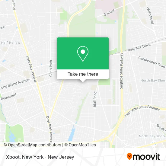
See Xboot, Deer Park, on the map
Public Transit to Xboot in Deer Park
Wondering how to get to Xboot in Deer Park? Moovit helps you find the best way to get to Xboot with step-by-step directions from the nearest public transit station.
Moovit provides free maps and live directions to help you navigate through your city. View schedules, routes, timetables, and find out how long does it take to get to Xboot in real time.
Looking for the nearest stop or station to Xboot? Check out this list of stops closest to your destination: Grand Blvd/W Jefryn Blvd; Deer Park.
Bus: 4.Train: RONKONKOMA BRANCH.
Want to see if there’s another route that gets you there at an earlier time? Moovit helps you find alternative routes or times. Get directions from and directions to Xboot easily from the Moovit App or Website.
We make riding to Xboot easy, which is why over 1.5 million users, including users in Deer Park, trust Moovit as the best app for public transit. You don’t need to download an individual bus app or train app, Moovit is your all-in-one transit app that helps you find the best bus time or train time available.
For information on prices of bus and train, costs and ride fares to Xboot, please check the Moovit app.
Use the app to navigate to popular places including to the airport, hospital, stadium, grocery store, mall, coffee shop, school, college, and university.
Xboot Address: 28 W Jefryn Blvd street in Deer Park
- Nyrc Brace,
- Formats Unlimited,
- Universal Gutters Supplies,
- Integrated Communication Solutions,
- Independence Bunting,
- Alstate Process Service Inc.,
- Brightway Insurance, the Rosemont Agency,
- Optima Foods Inc,
- Ferguson Hvac Supply,
- A-1 Sports Indoor One Wall,
- Plx Inc,
- Jtm Motorsports,
- Bito,
- S.W. Anderson Hvac Supply Training Facility,
- Eorc Eastern Rugs,
- Eastern Foods,
- Guardian Guns and Ammo,
- Quincy Compressor,
- Guardian Security and Investigations,
- Guardian Security Training
Places Near Xboot (Deer Park)
- 3 Stone St, Manhattan,
- San Gennaro Feast, Manhattan,
- 376 Hudson Street, Manhattan,
- Hudson Yards, Manhattan,
- qqqq, Manhattan,
- Bellevue Hospital, Manhattan,
- Rockefeller Center, Manhattan,
- 911 Memorial, Manhattan,
- Chinatown, Manhattan,
- SoHo, Manhattan,
- Wall Street, Manhattan,
- 66 John Street, Manhattan,
- Pier 83, Manhattan,
- Times Square, Manhattan,
- Queens Center Mall, Queens,
- 1 Police Plaza, Manhattan,
- Mountainside Hospital, Glen Ridge,
- Katz's Deli, Manhattan,
- 26 Federal Plaza, Manhattan,
- 111 Centre New York City Supreme Court, Manhattan
How to get to popular places in New York - New Jersey with public transit
Get around Deer Park by public transit!
Traveling around Deer Park has never been so easy. See step by step directions as you travel to any attraction, street or major public transit station. View bus and train schedules, arrival times, service alerts and detailed routes on a map, so you know exactly how to get to anywhere in Deer Park.
When traveling to any destination around Deer Park use Moovit's Live Directions with Get Off Notifications to know exactly where and how far to walk, how long to wait for your line, and how many stops are left. Moovit will alert you when it's time to get off — no need to constantly re-check whether yours is the next stop.
Wondering how to use public transit in Deer Park or how to pay for public transit in Deer Park? Moovit public transit app can help you navigate your way with public transit easily, and at minimum cost. It includes public transit fees, ticket prices, and costs. Looking for a map of Deer Park public transit lines? Moovit public transit app shows all public transit maps in Deer Park with all Bus, Train, Subway, Light Rail, Ferry and Cable Car routes and stops on an interactive map.
New York - New Jersey has 6 transit type(s), including: Bus, Train, Subway, Light Rail, Ferry and Cable Car, operated by several transit agencies, including MTA Subway, Metro-North Railroad, LIRR, PATH, MTA New York City Transit - Express routes, MTA Bus, NJ Transit, NYC Ferry, NICE bus, Bee-Line Bus, NJ Transit Rail, Norwalk Transit District, Hartford Line, River Valley Transit and HART