How to get to Xfinity by bus?
Click on the bus route to see step by step directions with maps, line arrival times and updated time schedules.
From Banco Davivienda sa Miami Internatl Branch, Fort Lauderdale
72 minFrom W Commercial Blvd & 441 (SR 7), Fort Lauderdale
60 minFrom 95 Express Bus Stop, Fort Lauderdale
59 minFrom Davie, FL, Davie
43 minFrom Broward College Central Campus, Davie
38 minFrom Griffin Road & Davie Road, Davie
41 minFrom Broward Blvd Tri-Rail Station, Fort Lauderdale
59 minFrom Park & Ride-Broward Blvd & I-95, Fort Lauderdale
57 minFrom State Road 7 & West Sunrise Boulevard, Fort Lauderdale
41 minFrom Nova High School, Davie
51 min
Bus stops near Xfinity in Plantation
Bus lines to Xfinity in Plantation
What are the closest stations to Xfinity?
The closest stations to Xfinity are:
- Pine Island Road/Sunrise Boulevard is 253 yards away, 4 min walk.
- Sunrise Boulevard/North Pine Island Road (West) is 432 yards away, 6 min walk.
Which bus lines stop near Xfinity?
These bus lines stop near Xfinity: 36, 88.
What’s the nearest bus station to Xfinity in Plantation?
The nearest bus station to Xfinity in Plantation is Pine Island Road/Sunrise Boulevard. It’s a 4 min walk away.
What time is the first bus to Xfinity in Plantation?
The 88 is the first bus that goes to Xfinity in Plantation. It stops nearby at 5:25 AM.
What time is the last bus to Xfinity in Plantation?
The 36 is the last bus that goes to Xfinity in Plantation. It stops nearby at 12:08 AM.
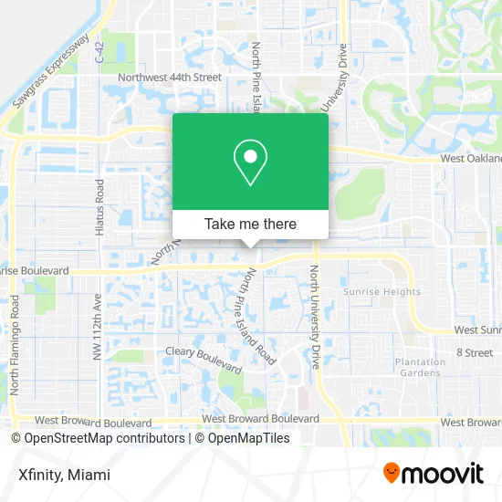
See Xfinity, Plantation, on the map
Public Transit to Xfinity in Plantation
Wondering how to get to Xfinity in Plantation? Moovit helps you find the best way to get to Xfinity with step-by-step directions from the nearest public transit station.
Moovit provides free maps and live directions to help you navigate through your city. View schedules, routes, timetables, and find out how long does it take to get to Xfinity in real time.
Looking for the nearest stop or station to Xfinity? Check out this list of stops closest to your destination: Pine Island Road/Sunrise Boulevard; Sunrise Boulevard/North Pine Island Road (West).
Bus: 36, 88.
Want to see if there’s another route that gets you there at an earlier time? Moovit helps you find alternative routes or times. Get directions from and directions to Xfinity easily from the Moovit App or Website.
We make riding to Xfinity easy, which is why over 1.5 million users, including users in Plantation, trust Moovit as the best app for public transit. You don’t need to download an individual bus app or train app, Moovit is your all-in-one transit app that helps you find the best bus time or train time available.
For information on prices of bus, costs and ride fares to Xfinity, please check the Moovit app.
Use the app to navigate to popular places including to the airport, hospital, stadium, grocery store, mall, coffee shop, school, college, and university.
Xfinity Address: 1909 N Pine Island Rd Fort Lauderdale, FL 33322 street in Plantation
- Miami Direct,
- Cameraman Car Wraps,
- Florida Movement Therapy Centers,
- Golden Krust Caribbean Restaurant,
- Mao Ying Kuen International Federation,
- Dr Ron Ramnath MD,
- Broward Health Urgent Care Center,
- Sylvan Barzey - the Barzey Group,
- Master Group,
- Deocampo House Locksmith,
- Friedman CPA Group,
- Carey Limousine,
- ABC Technology Group,
- Akar Capital Management,
- Broward County Forensic Investigations,
- Anat's Catering,
- Aurora de Landea Aesthetics,
- Pristine Care & Services,
- Little Guilty Pleasure Desserts,
- Jozy Did It
Places Near Xfinity (Plantation)
- Hard Rock Stadium, Miami Gardens,
- Port of Miami Cruise Terminal, Miami,
- Miami-Dade County Courthouse, Miami,
- Sawgrass Mall, Miami,
- Aventura Mall, Miami Beach,
- Miami Design District, Miami,
- Richard E. Gerstein Justice Building, Miami,
- Little Havana, Miami,
- Keiser University Flagship Campus, West Palm Beach,
- Brickell City Centre, Miami,
- Miami VA Hospital, Miami,
- Marlins Park, Miami,
- Zoo Miami, Miami,
- Wynwood, Miami,
- Miami Freedom Park, Miami,
- Dolphin Mall Bus, Miami,
- Bayside Marketplace, Miami,
- Aventura Mall, Miami,
- Sawgrass mall ( FL ), Miami Beach,
- Dolphin Mall, Miami
How to get to popular places in Miami with public transit
Get around Plantation by public transit!
Traveling around Plantation has never been so easy. See step by step directions as you travel to any attraction, street or major public transit station. View bus and train schedules, arrival times, service alerts and detailed routes on a map, so you know exactly how to get to anywhere in Plantation.
When traveling to any destination around Plantation use Moovit's Live Directions with Get Off Notifications to know exactly where and how far to walk, how long to wait for your line, and how many stops are left. Moovit will alert you when it's time to get off — no need to constantly re-check whether yours is the next stop.
Wondering how to use public transit in Plantation or how to pay for public transit in Plantation? Moovit public transit app can help you navigate your way with public transit easily, and at minimum cost. It includes public transit fees, ticket prices, and costs. Looking for a map of Plantation public transit lines? Moovit public transit app shows all public transit maps in Plantation with all Bus, Train, Light Rail and Ferry routes and stops on an interactive map.
Miami has 4 transit type(s), including: Bus, Train, Light Rail and Ferry, operated by several transit agencies, including Broward County Transit, Miami-Dade Transit, Metrorail, Palm Tran, Tri-Rail, Brightline, MARTY, City of Homestead Trolley, Key West Transit, Treasure Coast Connector, GoLine IRT, Amtrak, Greyhound-us, FlixBus-us and Aventura Express Shuttle Bus