How to get to Xfinity by bus?
Click on the bus route to see step by step directions with maps, line arrival times and updated time schedules.
From I-83 Exit 5 (Maryland Ave/Charles St), Baltimore
58 minFrom Medstar Harbor Hospital, Baltimore
63 minFrom Fells Point, Baltimore
51 minFrom Patterson Park, Baltimore
64 minFrom Baltimore Polytechnic Institute, Baltimore
80 minFrom Medstar Union Memorial Hospital, Baltimore
78 minFrom Johns Hopkins University, Baltimore
67 minFrom Canton, Baltimore
78 minFrom Druid Hill Park, Baltimore
84 minFrom Baltimore Greyhound Station, Baltimore
40 min
How to get to Xfinity by train?
Click on the train route to see step by step directions with maps, line arrival times and updated time schedules.
Bus stops near Xfinity in Baltimore County
Train stations near Xfinity in Baltimore County
Bus lines to Xfinity in Baltimore County
What are the closest stations to Xfinity?
The closest stations to Xfinity are:
- Maiden Choice Ln & Westland Blvd Nb is 712 yards away, 9 min walk.
- Linden Ave & Leeds Ave Wb is 864 yards away, 11 min walk.
- Knecht Ave & John Ave Wb Ns is 1012 yards away, 12 min walk.
- Halethorpe Marc Nb is 4872 yards away, 57 min walk.
- St Denis Marc Sb is 4930 yards away, 58 min walk.
Which bus line stops near Xfinity?
76 (Ccbc Catonsville Via Crossroads)
Which train line stops near Xfinity?
MARC (Outbound - Washington)
What’s the nearest bus station to Xfinity in Baltimore County?
The nearest bus station to Xfinity in Baltimore County is Maiden Choice Ln & Westland Blvd Nb. It’s a 9 min walk away.
What time is the first train to Xfinity in Baltimore County?
The MARC is the first train that goes to Xfinity in Baltimore County. It stops nearby at 4:46 AM.
What time is the last train to Xfinity in Baltimore County?
The MARC is the last train that goes to Xfinity in Baltimore County. It stops nearby at 10:46 PM.
What time is the first bus to Xfinity in Baltimore County?
The 76 is the first bus that goes to Xfinity in Baltimore County. It stops nearby at 3:59 AM.
What time is the last bus to Xfinity in Baltimore County?
The 29 is the last bus that goes to Xfinity in Baltimore County. It stops nearby at 1:48 AM.
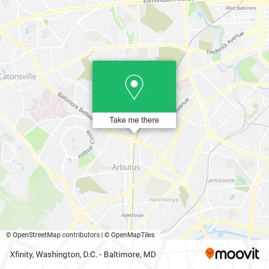
See Xfinity, Baltimore County, on the map
Public Transit to Xfinity in Baltimore County
Wondering how to get to Xfinity in Baltimore County? Moovit helps you find the best way to get to Xfinity with step-by-step directions from the nearest public transit station.
Moovit provides free maps and live directions to help you navigate through your city. View schedules, routes, timetables, and find out how long does it take to get to Xfinity in real time.
Looking for the nearest stop or station to Xfinity? Check out this list of stops closest to your destination: Maiden Choice Ln & Westland Blvd Nb; Linden Ave & Leeds Ave Wb; Knecht Ave & John Ave Wb Ns; Halethorpe Marc Nb; St Denis Marc Sb.
Bus: 76, 32, 29.Train: MARC.
Want to see if there’s another route that gets you there at an earlier time? Moovit helps you find alternative routes or times. Get directions from and directions to Xfinity easily from the Moovit App or Website.
We make riding to Xfinity easy, which is why over 1.5 million users, including users in Baltimore County, trust Moovit as the best app for public transit. You don’t need to download an individual bus app or train app, Moovit is your all-in-one transit app that helps you find the best bus time or train time available.
For information on prices of bus, train and light rail, costs and ride fares to Xfinity, please check the Moovit app.
Use the app to navigate to popular places including to the airport, hospital, stadium, grocery store, mall, coffee shop, school, college, and university.
Xfinity Address: 4713 Leeds Ave Halethorpe, MD 21227 street in Baltimore County
- Bay Properties,
- Coevo Marketing,
- Empire Tattoo,
- Alexandria Pest Services,
- Fish Head Cantina & Rockin' Sushi Bar,
- Michael Cochran,
- Dr Jay Gerstenblith,
- Barton Cotton Religs Products & Services,
- Excell Concrete Construction LLC,
- Diabetes Insipidus Foundation,
- Pioneer Glazing,
- Tobacco Plus,
- Myanmar Christian Church Baltimore,
- Mara Community Church,
- Capable Plumbing Service,
- Southwestern Blvd Baltimore MD,
- Hammer Bge Contractor,
- Amazon Locker-Comasio,
- Amazon Locker-Importance,
- Marathon
Places Near Xfinity (Baltimore County)
- Warner Theatre, Washington,
- M&T Bank Stadium, Baltimore,
- National Zoo, Washington,
- Washington DC VA Medical Center, Washington,
- The Anthem, Washington,
- Rock Creek Tennis Center, Washington,
- Capital One Arena, Washington,
- Westfield Montgomery Mall, Montgomery County,
- National Museum of African American History and Culture, Washington,
- Basilica of the National Shrine, Washington,
- Sibley Memorial Hospital, Washington,
- Amazon Hq2, Arlington County,
- Washington National Cathedral, Washington,
- Marriott Marquis Washington, DC, Washington,
- PG Mall, Prince George's County,
- Georgetown, Washington,
- Pennsylvania Ave NW (3rd st and pennsylvania), Washington,
- Museum Of The Bible, Washington,
- National Theatre, Washington,
- Camden Yards, Baltimore
How to get to popular places in Washington, D.C. - Baltimore, MD with public transit
Get around Baltimore County by public transit!
Traveling around Baltimore County has never been so easy. See step by step directions as you travel to any attraction, street or major public transit station. View bus and train schedules, arrival times, service alerts and detailed routes on a map, so you know exactly how to get to anywhere in Baltimore County.
When traveling to any destination around Baltimore County use Moovit's Live Directions with Get Off Notifications to know exactly where and how far to walk, how long to wait for your line, and how many stops are left. Moovit will alert you when it's time to get off — no need to constantly re-check whether yours is the next stop.
Wondering how to use public transit in Baltimore County or how to pay for public transit in Baltimore County? Moovit public transit app can help you navigate your way with public transit easily, and at minimum cost. It includes public transit fees, ticket prices, and costs. Looking for a map of Baltimore County public transit lines? Moovit public transit app shows all public transit maps in Baltimore County with all Bus, Train, Metro, Light Rail and Ferry routes and stops on an interactive map.
Washington, D.C. - Baltimore, MD has 5 transit type(s), including: Bus, Train, Metro, Light Rail and Ferry, operated by several transit agencies, including WMATA, Montgomery County Ride On, Fairfax Connector, TheBus, PRTC, DASH - Alexandria, Arlington Transit (ART), RTA of Central Maryland, MDOT MTA, MDOT MTA Light RailLink, MDOT MTA Commuter Bus, MDOT MTA Local Bus, FXBGO!, Virginia Railway Express (VRE) and MARC