How to get to Xfinity by bus?
Click on the bus route to see step by step directions with maps, line arrival times and updated time schedules.
From Megabus Stop - White Marsh Park & Ride, Baltimore County
97 minFrom White Marsh Mall, Baltimore County
116 minFrom Middle River, Maryland, Baltimore County
173 minFrom Wayfair Aberdeen Warehouse, Harford County
128 minFrom Kohl's Distribution Center, Harford County
83 minFrom I-95 Exit 80 - Belcamp (MD 543), Harford County
116 minFrom Amazon Fulfillment Center-MTN2, Harford County
90 minFrom Franklin Square Dr (franklin hospital), Baltimore County
123 minFrom Medstar Franklin Square Medical Center, Baltimore County
123 minFrom Edgewood, Maryland, Harford County
70 min
Bus stops near Xfinity in Harford County
What are the closest stations to Xfinity?
The closest stations to Xfinity are:
- Harford County Health Dept (Hays St & Thomas St) is 218 yards away, 4 min walk.
- Bel Air High School is 413 yards away, 6 min walk.
Which bus lines stop near Xfinity?
These bus lines stop near Xfinity: 1, 2, 410.
What’s the nearest bus station to Xfinity in Harford County?
The nearest bus station to Xfinity in Harford County is Harford County Health Dept (Hays St & Thomas St). It’s a 4 min walk away.
What time is the first bus to Xfinity in Harford County?
The 1 is the first bus that goes to Xfinity in Harford County. It stops nearby at 5:32 AM.
What time is the last bus to Xfinity in Harford County?
The 1 is the last bus that goes to Xfinity in Harford County. It stops nearby at 8:19 PM.
See Xfinity, Harford County, on the map
Public Transit to Xfinity in Harford County
Wondering how to get to Xfinity in Harford County? Moovit helps you find the best way to get to Xfinity with step-by-step directions from the nearest public transit station.
Moovit provides free maps and live directions to help you navigate through your city. View schedules, routes, timetables, and find out how long does it take to get to Xfinity in real time.
Looking for the nearest stop or station to Xfinity? Check out this list of stops closest to your destination: Harford County Health Dept (Hays St & Thomas St); Bel Air High School.
Bus: 1, 2, 410, 6.
Want to see if there’s another route that gets you there at an earlier time? Moovit helps you find alternative routes or times. Get directions from and directions to Xfinity easily from the Moovit App or Website.
We make riding to Xfinity easy, which is why over 1.5 million users, including users in Harford County, trust Moovit as the best app for public transit. You don’t need to download an individual bus app or train app, Moovit is your all-in-one transit app that helps you find the best bus time or train time available.
For information on prices of bus and train, costs and ride fares to Xfinity, please check the Moovit app.
Use the app to navigate to popular places including to the airport, hospital, stadium, grocery store, mall, coffee shop, school, college, and university.
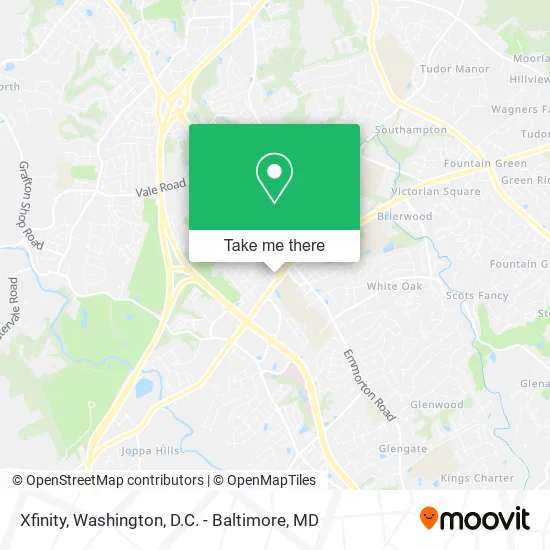
Xfinity Address: 208 S Hays St Bel Air, MD 21014 street in Harford County
- Baltimore MD-924,
- Homeward Bound Veterinary Services,
- Town of Bel Air Maryland,
- Xfinity,
- Romp -N- Groom Doggie Day Spa,
- Bel Air, Maryland,
- Belcove Place,
- Harford Mall,
- Tollgate Marketplace,
- T-Mobile,
- Rug Carpet Cleaning Carpet Cleaning,
- Amazon Locker-Teen,
- Ma and Pa Trail: Harford Mall Spur,
- Mva-Bel Air,
- Bel Air Professional Center,
- Harford County Detention Center,
- Marywood Park Ride,
- Autozone,
- Rt 543 @ Rt 22,
- Justin Dailey, CRNP
Places Near Xfinity (Harford County)
- M&T Bank Stadium, Baltimore,
- Georgetown, Washington,
- Washington National Cathedral, Washington,
- Basilica of the National Shrine, Washington,
- National Museum of African American History and Culture, Washington,
- Marriott Marquis Washington, DC, Washington,
- Camden Yards, Baltimore,
- Pennsylvania Ave NW (3rd st and pennsylvania), Washington,
- Amazon Hq2, Arlington County,
- Sibley Memorial Hospital, Washington,
- Capital One Arena, Washington,
- National Theatre, Washington,
- National Zoo, Washington,
- Washington DC VA Medical Center, Washington,
- The Anthem, Washington,
- PG Mall, Prince George's County,
- Rock Creek Tennis Center, Washington,
- Warner Theatre, Washington,
- Museum Of The Bible, Washington,
- Westfield Montgomery Mall, Montgomery County
How to get to popular places in Washington, D.C. - Baltimore, MD with public transit
Get around Harford County by public transit!
Traveling around Harford County has never been so easy. See step by step directions as you travel to any attraction, street or major public transit station. View bus and train schedules, arrival times, service alerts and detailed routes on a map, so you know exactly how to get to anywhere in Harford County.
When traveling to any destination around Harford County use Moovit's Live Directions with Get Off Notifications to know exactly where and how far to walk, how long to wait for your line, and how many stops are left. Moovit will alert you when it's time to get off — no need to constantly re-check whether yours is the next stop.
Wondering how to use public transit in Harford County or how to pay for public transit in Harford County? Moovit public transit app can help you navigate your way with public transit easily, and at minimum cost. It includes public transit fees, ticket prices, and costs. Looking for a map of Harford County public transit lines? Moovit public transit app shows all public transit maps in Harford County with all Bus, Train, Metro, Light Rail and Ferry routes and stops on an interactive map.
Washington, D.C. - Baltimore, MD has 5 transit type(s), including: Bus, Train, Metro, Light Rail and Ferry, operated by several transit agencies, including WMATA, Montgomery County Ride On, Fairfax Connector, TheBus, PRTC, DASH - Alexandria, Arlington Transit (ART), RTA of Central Maryland, MDOT MTA, MDOT MTA Light RailLink, MDOT MTA Commuter Bus, MDOT MTA Local Bus, FXBGO!, Virginia Railway Express (VRE) and MARC