How to get to Xfinity/Comcast by bus?
Click on the bus route to see step by step directions with maps, line arrival times and updated time schedules.
From Chiropractor Grand Rapids, Kentwood
91 minFrom Living Water CRC, Grand Rapids
64 minFrom Peachy Keen Waxing Studio, Grand Rapids
62 minFrom American Legion Roger B. Chaffee Memorial Post 154, Wyoming
94 minFrom East Beltline Ave SE (M-37) & 28th St SE (M-11), Kentwood
72 minFrom Pilgrims Run Golf Club, Grand Rapids
60 minFrom Bindery House, Kentwood
75 minFrom Centerpointe Mall, Grand Rapids
82 min
Bus stops near Xfinity/Comcast in Grand Rapids
What are the closest stations to Xfinity/Comcast?
The closest stations to Xfinity/Comcast are:
- Fuller/Leonard (Sb) is 502 yards away, 6 min walk.
- Leonard/Fuller (Wb) is 531 yards away, 7 min walk.
Which bus line stops near Xfinity/Comcast?
13 (Veteran's Home)
What’s the nearest bus station to Xfinity/Comcast in Grand Rapids?
The nearest bus station to Xfinity/Comcast in Grand Rapids is Fuller/Leonard (Sb). It’s a 6 min walk away.
What time is the first bus to Xfinity/Comcast in Grand Rapids?
The 13 is the first bus that goes to Xfinity/Comcast in Grand Rapids. It stops nearby at 5:15 AM.
What time is the last bus to Xfinity/Comcast in Grand Rapids?
The 13 is the last bus that goes to Xfinity/Comcast in Grand Rapids. It stops nearby at 11:38 PM.
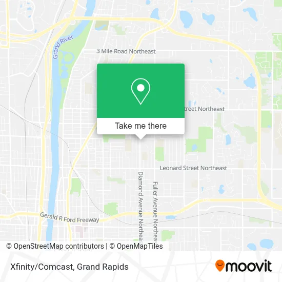
See Xfinity/Comcast, Grand Rapids, on the map
Public Transit to Xfinity/Comcast in Grand Rapids
Wondering how to get to Xfinity/Comcast in Grand Rapids? Moovit helps you find the best way to get to Xfinity/Comcast with step-by-step directions from the nearest public transit station.
Moovit provides free maps and live directions to help you navigate through your city. View schedules, routes, timetables, and find out how long does it take to get to Xfinity/Comcast in real time.
Looking for the nearest stop or station to Xfinity/Comcast? Check out this list of stops closest to your destination: Fuller/Leonard (Sb); Leonard/Fuller (Wb).
Bus: 13, 15.
Want to see if there’s another route that gets you there at an earlier time? Moovit helps you find alternative routes or times. Get directions from and directions to Xfinity/Comcast easily from the Moovit App or Website.
We make riding to Xfinity/Comcast easy, which is why over 1.5 million users, including users in Grand Rapids, trust Moovit as the best app for public transit. You don’t need to download an individual bus app or train app, Moovit is your all-in-one transit app that helps you find the best bus time or train time available.
For information on prices of bus, costs and ride fares to Xfinity/Comcast, please check the Moovit app.
Use the app to navigate to popular places including to the airport, hospital, stadium, grocery store, mall, coffee shop, school, college, and university.
Xfinity/Comcast Address: 1560 Diamond Ave NE street in Grand Rapids
- City High & Middle School,
- City of greenville mi,
- Rest Haven Homes, Inc.,
- Walgreens,
- County Kent,
- M1 Imaging Center,
- North Alano Club,
- Child Haven,
- Lafayette Ave NE / Leonard St NE,
- Ritual Gallery,
- Living Water Church of God in Christ,
- Creston,
- Kent County Animal Shelter,
- Kent County Jail,
- Entrance I-196 W,
- Riverside Middle School,
- Lighthouse Academy the Pier,
- Griff's Ice House at Belknap Park,
- Belknap Baseball Field,
- Monroe Ave NW / Ann St NW
Places Near Xfinity/Comcast (Grand Rapids)
- Union High School, Grand Rapids,
- University of Michigan Health Metro Health Hospital, Wyoming,
- Spectrum Health-Blodgett Hospital, East Grand Rapids,
- Metro Cascade,
- Pine Rest Mental Health, Grand Rapids,
- Byron Center,
- Hudsonville,
- Grand Rapids Community College, Grand Rapids,
- Butterworth Hospital Internal Radiology, Grand Rapids,
- Frederik Meijer Gardens, Grand Rapids,
- Woodland Mall, Kentwood,
- Spectrum Health Butterworth Hospital, Grand Rapids,
- YMCA - David D. Hunting, Grand Rapids,
- Helel DeVos Children's Hospital Food Court, Grand Rapids,
- Van Andel Arena, Grand Rapids,
- Lemmen-Holton Cancer Pavilion, Grand Rapids,
- Grandville, MI, Grandville,
- John Ball Zoo, Grand Rapids,
- Kent County Courthouse, Grand Rapids,
- Blodgett Hospital, East Grand Rapids
How to get to popular places in Grand Rapids with public transit
Get around Grand Rapids by public transit!
Traveling around Grand Rapids has never been so easy. See step by step directions as you travel to any attraction, street or major public transit station. View bus and train schedules, arrival times, service alerts and detailed routes on a map, so you know exactly how to get to anywhere in Grand Rapids.
When traveling to any destination around Grand Rapids use Moovit's Live Directions with Get Off Notifications to know exactly where and how far to walk, how long to wait for your line, and how many stops are left. Moovit will alert you when it's time to get off — no need to constantly re-check whether yours is the next stop.
Wondering how to use public transit in Grand Rapids or how to pay for public transit in Grand Rapids? Moovit public transit app can help you navigate your way with public transit easily, and at minimum cost. It includes public transit fees, ticket prices, and costs. Looking for a map of Grand Rapids public transit lines? Moovit public transit app shows all public transit maps in Grand Rapids with all Bus and Train routes and stops on an interactive map.
Grand Rapids has 2 transit type(s), including: Bus and Train, operated by several transit agencies, including The Rapid, Amtrak and FlixBus-us