How to get to Xfinity Store by Comcast by bus?
Click on the bus route to see step by step directions with maps, line arrival times and updated time schedules.
From Chantilly, VA, Fairfax County
140 minFrom Reston Town Center, Fairfax County
125 minFrom Amazon Iad28, Fairfax County
97 minFrom Dulles Discovery, Fairfax County
118 minFrom Hookers & Blow, Fairfax County
104 minFrom Amazon Web Services - IAD21, Fairfax County
115 minFrom Northern Virginia Community College - Loudoun Campus, Loudoun County
81 minFrom Leesburg Corner Premium Outlet, Loudoun County
64 minFrom Sterling VA USA, Loudoun County
73 min
Bus stops near Xfinity Store by Comcast in Loudoun County
Metro station near Xfinity Store by Comcast in Loudoun County
- Ashburn, 51 min walk,VIEW
Bus lines to Xfinity Store by Comcast in Loudoun County
What are the closest stations to Xfinity Store by Comcast?
The closest stations to Xfinity Store by Comcast are:
- Gloucester Parkway at Grottoes Drive is 1370 yards away, 17 min walk.
- Gloucester Parkway at Ringold Drive is 1427 yards away, 17 min walk.
- Ashburn is 4338 yards away, 51 min walk.
Which bus lines stop near Xfinity Store by Comcast?
These bus lines stop near Xfinity Store by Comcast: 331, 341, 342, 62, 70.
What time is the first metro to Xfinity Store by Comcast in Loudoun County?
The SILVER is the first metro that goes to Xfinity Store by Comcast in Loudoun County. It stops nearby at 5:00 AM.
What time is the last metro to Xfinity Store by Comcast in Loudoun County?
The SILVER is the last metro that goes to Xfinity Store by Comcast in Loudoun County. It stops nearby at 1:11 AM.
What time is the first bus to Xfinity Store by Comcast in Loudoun County?
The 342 is the first bus that goes to Xfinity Store by Comcast in Loudoun County. It stops nearby at 4:41 AM.
What time is the last bus to Xfinity Store by Comcast in Loudoun County?
The 341 is the last bus that goes to Xfinity Store by Comcast in Loudoun County. It stops nearby at 11:10 PM.
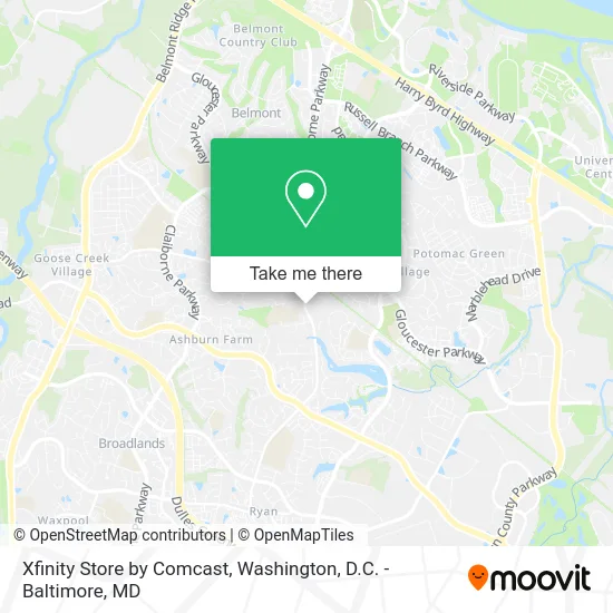
See Xfinity Store by Comcast, Loudoun County, on the map
Public Transit to Xfinity Store by Comcast in Loudoun County
Wondering how to get to Xfinity Store by Comcast in Loudoun County? Moovit helps you find the best way to get to Xfinity Store by Comcast with step-by-step directions from the nearest public transit station.
Moovit provides free maps and live directions to help you navigate through your city. View schedules, routes, timetables, and find out how long does it take to get to Xfinity Store by Comcast in real time.
Looking for the nearest stop or station to Xfinity Store by Comcast? Check out this list of stops closest to your destination: Gloucester Parkway at Grottoes Drive; Gloucester Parkway at Ringold Drive; Ashburn.
Bus: 331, 341, 342, 62, 70.Metro: SILVER.
Want to see if there’s another route that gets you there at an earlier time? Moovit helps you find alternative routes or times. Get directions from and directions to Xfinity Store by Comcast easily from the Moovit App or Website.
We make riding to Xfinity Store by Comcast easy, which is why over 1.5 million users, including users in Loudoun County, trust Moovit as the best app for public transit. You don’t need to download an individual bus app or train app, Moovit is your all-in-one transit app that helps you find the best bus time or train time available.
For information on prices of bus and metro, costs and ride fares to Xfinity Store by Comcast, please check the Moovit app.
Use the app to navigate to popular places including to the airport, hospital, stadium, grocery store, mall, coffee shop, school, college, and university.
Xfinity Store by Comcast Address: 20932 Ashburn Rd Ashburn, VA 20147 street in Loudoun County
- Amy Aesthetics & Wellness,
- Four Season Pastry,
- Whitesummer Flowers & Decor,
- Greenlight Personal Training - Ashburn,
- United Refrigeration,
- Oxus 7 Cilantro Kitchen,
- Bilstad's Beignets,
- RE/MAX,
- JC Haircuts,
- Efesus Cafe,
- FedEx,
- James Stakem-Re / Max Select Properties,
- 37 Media and Marketing Group,
- Music Loft,
- GG's Frozen Treats,
- Belmont Station Elementary,
- Hands2clean,
- Air Conditioning and Heating Services Tactical Hvac,
- Capital Area Orthodox Family Conference,
- Ashburn Appliance
Places Near Xfinity Store by Comcast (Loudoun County)
- Rock Creek Tennis Center, Washington,
- National Museum of African American History and Culture, Washington,
- Washington National Cathedral, Washington,
- The Anthem, Washington,
- National Zoo, Washington,
- M&T Bank Stadium, Baltimore,
- Marriott Marquis Washington, DC, Washington,
- Capital One Arena, Washington,
- Westfield Montgomery Mall, Montgomery County,
- Basilica of the National Shrine, Washington,
- Pennsylvania Ave NW (3rd st and pennsylvania), Washington,
- National Theatre, Washington,
- Sibley Memorial Hospital, Washington,
- Museum Of The Bible, Washington,
- PG Mall, Prince George's County,
- Amazon Hq2, Arlington County,
- Warner Theatre, Washington,
- Washington DC VA Medical Center, Washington,
- Georgetown, Washington,
- Camden Yards, Baltimore
How to get to popular places in Washington, D.C. - Baltimore, MD with public transit
Get around Loudoun County by public transit!
Traveling around Loudoun County has never been so easy. See step by step directions as you travel to any attraction, street or major public transit station. View bus and train schedules, arrival times, service alerts and detailed routes on a map, so you know exactly how to get to anywhere in Loudoun County.
When traveling to any destination around Loudoun County use Moovit's Live Directions with Get Off Notifications to know exactly where and how far to walk, how long to wait for your line, and how many stops are left. Moovit will alert you when it's time to get off — no need to constantly re-check whether yours is the next stop.
Wondering how to use public transit in Loudoun County or how to pay for public transit in Loudoun County? Moovit public transit app can help you navigate your way with public transit easily, and at minimum cost. It includes public transit fees, ticket prices, and costs. Looking for a map of Loudoun County public transit lines? Moovit public transit app shows all public transit maps in Loudoun County with all Bus, Train, Metro, Light Rail and Ferry routes and stops on an interactive map.
Washington, D.C. - Baltimore, MD has 5 transit type(s), including: Bus, Train, Metro, Light Rail and Ferry, operated by several transit agencies, including WMATA, Montgomery County Ride On, Fairfax Connector, TheBus, PRTC, DASH - Alexandria, Arlington Transit (ART), RTA of Central Maryland, MDOT MTA, MDOT MTA Light RailLink, MDOT MTA Commuter Bus, MDOT MTA Local Bus, FXBGO!, Virginia Railway Express (VRE) and MARC