How to get to YGAOR by bus?
Click on the bus route to see step by step directions with maps, line arrival times and updated time schedules.
From First Fruit House, Tianxin District
43 minFrom Traditional Chinese Medicine University Affiliated Hospital, Yuhua District
40 minFrom Guizhou Maotai Town, Furong District
32 minFrom China Merchants Bank (Sifangping Branch), Kaifu District
43 minFrom Changsha City Business Walking Street Association, Tianxin District
28 minFrom Xinxin Zen Temple, Wangcheng District
49 minFrom Hunan Province Second People's Hospital - Underground Parking, Yuhua District
50 minFrom Changsha Central Hospital (Branch) Ground Parking Lot - Entrance/Exit, Kaifu District
30 minFrom First Hospital Affiliated with Changsha Medical College - Driver Physical Examination Center, Wangcheng District
35 minFrom Bank of China 24-Hour Self-Service Bank (Sifangping Branch), Kaifu District
33 min
How to get to YGAOR by metro?
Click on the metro route to see step by step directions with maps, line arrival times and updated time schedules.
From First Fruit House, Tianxin District
41 minFrom Traditional Chinese Medicine University Affiliated Hospital, Yuhua District
47 minFrom Guizhou Maotai Town, Furong District
26 minFrom China Merchants Bank (Sifangping Branch), Kaifu District
46 minFrom Changsha City Business Walking Street Association, Tianxin District
27 minFrom Hunan Province Second People's Hospital - Underground Parking, Yuhua District
45 minFrom Changsha Central Hospital (Branch) Ground Parking Lot - Entrance/Exit, Kaifu District
32 minFrom Bank of China 24-Hour Self-Service Bank (Sifangping Branch), Kaifu District
46 min
Bus stops near YGAOR in Yuelu District
Metro station near YGAOR in Yuelu District
- Wangcheng Slope, 30 min walk,VIEW
Bus lines to YGAOR in Yuelu District
- Route W116, Tulip Building Materials City - Wangcheng Bus Station,VIEW
- Temporary Route 315, Taozihu Intersection - Lei Feng Bus Station,VIEW
- 902 Limited Route, Hexinyuan - West Bus Station,VIEW
- Route 902, Dongfanghong Town - Central South University Student Apartments,VIEW
- Route W203, West Bus Station,VIEW
- Route 211, Meixi Lake Temporary Bus Terminal,VIEW
- High-Tech Park Shuttle, West Auto Station,VIEW
- Route W201, Changsha West Railway Station,VIEW
- Line 18 West Branch, Dongfanghong Road Terminal,VIEW
- Route 916, Leigao Road Terminal,VIEW
- Route 18 Express, Dongfanghong Road Bus Terminal,VIEW
- High-Tech 1 Inner Loop, Dabazu,VIEW
- Route W105, Linke Foreign Studies College,VIEW
- Route 18, Dongfanghong Road Terminal,VIEW
- 309, Jinnan Garden Bus Terminal,VIEW
- Route 909, Food and Drug College,VIEW
- Route W107, Zhounan Meixi Lake School,VIEW
- Route W109, Hunan Finance College,VIEW
- Route W115, Zhonghua Ridge,VIEW
- High-Tech 1 Outer Ring, Dabazu,VIEW
What are the closest stations to YGAOR?
The closest stations to YGAOR are:
- West Bus Station is 0 meters away, 1 min walk.
- Xiangjiang New District Transport Hub is 189 meters away, 4 min walk.
- Xiangyi Road Intersection is 226 meters away, 4 min walk.
- West of West Bus Station is 266 meters away, 4 min walk.
- Yulan Road is 327 meters away, 5 min walk.
- Wangcheng Slope is 2272 meters away, 30 min walk.
Which bus lines stop near YGAOR?
These bus lines stop near YGAOR: Route 18, Route 203, 309, Route 66, Route 918, Route W204.
Which metro line stops near YGAOR?
Line 2 (Meixi Lake West)
What’s the nearest metro station to YGAOR in Yuelu District?
The nearest metro station to YGAOR in Yuelu District is Wangcheng Slope. It’s a 30 min walk away.
What’s the nearest bus station to YGAOR in Yuelu District?
The nearest bus station to YGAOR in Yuelu District is West Bus Station. It’s a 1 min walk away.
What time is the first metro to YGAOR in Yuelu District?
The Line 2 is the first metro that goes to YGAOR in Yuelu District. It stops nearby at 6:30 AM.
What time is the last metro to YGAOR in Yuelu District?
The Line 2 is the last metro that goes to YGAOR in Yuelu District. It stops nearby at 11:43 PM.
What time is the first bus to YGAOR in Yuelu District?
The Route W203 is the first bus that goes to YGAOR in Yuelu District. It stops nearby at 6:00 AM.
What time is the last bus to YGAOR in Yuelu District?
The High-Tech 1 Outer Ring is the last bus that goes to YGAOR in Yuelu District. It stops nearby at 10:24 PM.
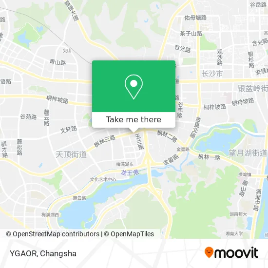
See YGAOR, Yuelu District, on the map
Public Transit to YGAOR in Yuelu District
Wondering how to get to YGAOR in Yuelu District? Moovit helps you find the best way to get to YGAOR with step-by-step directions from the nearest public transit station.
Moovit provides free maps and live directions to help you navigate through your city. View schedules, routes, timetables, and find out how long does it take to get to YGAOR in real time.
Looking for the nearest stop or station to YGAOR? Check out this list of stops closest to your destination: West Bus Station; Xiangjiang New District Transport Hub; Xiangyi Road Intersection; West of West Bus Station; Yulan Road; Wangcheng Slope.
Bus: Route 18, Route 203, 309, Route 66, Route 918, Route W204, Route W116, Temporary Route 315, 902 Limited Route, Route 902, Route W203, Route 211, High-Tech Park Shuttle, Route W201, Line 18 West Branch, Route 916, Route 18 Express, High-Tech 1 Inner Loop, Route W105, Route 18, 309, Route 909, Route W107, Route W109, Route W115, High-Tech 1 Outer Ring.Metro: Line 2, Line 2.
Want to see if there’s another route that gets you there at an earlier time? Moovit helps you find alternative routes or times. Get directions from and directions to YGAOR easily from the Moovit App or Website.
We make riding to YGAOR easy, which is why over 1.5 million users, including users in Yuelu District, trust Moovit as the best app for public transit. You don’t need to download an individual bus app or train app, Moovit is your all-in-one transit app that helps you find the best bus time or train time available.
For information on prices of bus and metro, costs and ride fares to YGAOR, please check the Moovit app.
Use the app to navigate to popular places including to the airport, hospital, stadium, grocery store, mall, coffee shop, school, college, and university.
YGAOR Address: 长沙市岳麓区枫林三路109号湘浙市场F3 street in Yuelu District
- Xiangzhe Market - Parking Lot,
- Bangdeng (Xiangzhe Market Store),
- Nolin (Xiangzhe Market Branch),
- Cowboys Are Idle (Xiangzhe Market Branch),
- QIU&YI (Xiangzhe Market Store),
- QIU&YI,
- Happyz,
- Hunan Wangcheng Rural Commercial Bank Lujing Branch,
- Zongji Underwear (Xiangzhe Market Store),
- Abbott Maternal and Child Specialty Store,
- Carnival Children's Playground,
- New Balance (Xiangzhe Market Branch),
- PRIDE MAN,
- Changsha Rural Commercial Bank 24-Hour Self-Service Bank (Lujing Road),
- OU H,
- Su San Says (Xiangzhe Market Branch),
- Baixing Inn (Fenglin Third Road Auxiliary Road),
- Tiger Auto Repair Workshop (Changsha Lujing Road Branch),
- WK Trendy Digital Lifestyle Hall (Xiangzhe Market Branch),
- Xiang Zhe Hotel
Places Near YGAOR (Yuelu District)
- Du Fu River Pavilion, Tianxin District,
- First Club, Kaifu District,
- First Affiliated Hospital of Hunan University of Traditional Chinese Medicine - Outpatient Department, Yuhua District,
- Central South University Xiangya Second Hospital, Furong District,
- Xingsha Police Station Songya Community Police Room, Changsha County,
- Hunan Province Tumor Hospital, Yuelu District,
- Yuelu Mountain Juzizhou Tourist Area, Yuelu District,
- Hunan University of Traditional Chinese Medicine First Affiliated Hospital, Yuhua District,
- Apple Authorized Dealer (Sam Changsha Store), Yuhua District,
- Hunan Provincial Museum - Multipurpose Hall, Kaifu District,
- Hunan Provincial Maternal and Child Health Hospital - Outpatient Department, Kaifu District,
- Wanjiali International Mall, Furong District,
- Desiqin City Square, Yuhua District,
- Changsha Yangming Mountain Funeral Home, Yuhua District,
- Changsha South Station, Yuhua District,
- National University of Defense Technology (North Gate), Kaifu District,
- Changsha Bank (Sifang Branch), Kaifu District,
- Changsha Bank ATM (Sifang Branch), Kaifu District,
- Zhongnan University Xiangya Hospital, Kaifu District,
- Changsha South Station Square, Yuelu District
How to get to popular places in Changsha with public transit
Get around Yuelu District by public transit!
Traveling around Yuelu District has never been so easy. See step by step directions as you travel to any attraction, street or major public transit station. View bus and train schedules, arrival times, service alerts and detailed routes on a map, so you know exactly how to get to anywhere in Yuelu District.
When traveling to any destination around Yuelu District use Moovit's Live Directions with Get Off Notifications to know exactly where and how far to walk, how long to wait for your line, and how many stops are left. Moovit will alert you when it's time to get off — no need to constantly re-check whether yours is the next stop.
Wondering how to use public transit in Yuelu District or how to pay for public transit in Yuelu District? Moovit public transit app can help you navigate your way with public transit easily, and at minimum cost. It includes public transit fees, ticket prices, and costs. Looking for a map of Yuelu District public transit lines? Moovit public transit app shows all public transit maps in Yuelu District with all Bus and Metro routes and stops on an interactive map.
Changsha has 2 transit type(s), including: Bus and Metro, operated by several transit agencies, including Changsha Metro and Changsha Bus Group
Public transit lines with stations closest to YGAOR in Yuelu District
Metro lines with stations closest to YGAOR in Yuelu District
Bus lines with stations closest to YGAOR in Yuelu District
Xiangyi Road Intersection
 Route W201Normal University Affiliated Meixi Lake Middle School - Changsha West Railway Station (Zhonghualing)
- Line 18 West BranchWest Bus Station - Dongfanghong Road Terminal
- Route 916Xuelin West Bank - Leigao Road Bus Terminal
- Route 18 ExpressWest Bus Station - Dongfanghong Road Bus Terminal
- High-Tech 1 Inner LoopDabazui - Dabazui