How to get to Yablen Valiente by bus?
Click on the bus route to see step by step directions with maps, line arrival times and updated time schedules.
From Tri Rail Metrorail Transfer Station, Miami
57 minFrom Miami Escorts, Miami Beach
69 minFrom Camillus House, Miami
64 minFrom NW 62nd St / NW 27th Ave, Miami
57 minFrom Kendall, FL, Kendall-Palmetto Bay
88 minFrom Miami Dade College-Wolfson, Miami
50 minFrom JW Marriott Hotel Miami, Miami
49 minFrom Hobie Island Beach, Miami
51 minFrom Northside Station, Miami
61 minFrom Holiday Inn Express Hotel & Suites-Miami Airport East, Miami
33 min
How to get to Yablen Valiente by train?
Click on the train route to see step by step directions with maps, line arrival times and updated time schedules.
From Tri Rail Metrorail Transfer Station, Miami
68 minFrom Camillus House, Miami
68 minFrom NW 62nd St / NW 27th Ave, Miami
64 minFrom Kendall, FL, Kendall-Palmetto Bay
54 minFrom Miami Dade College-Wolfson, Miami
53 minFrom JW Marriott Hotel Miami, Miami
52 minFrom Northside Station, Miami
63 minFrom Holiday Inn Express Hotel & Suites-Miami Airport East, Miami
69 min
Bus stops near Yablen Valiente in Miami
Train station near Yablen Valiente in Miami
- Coconut Grove, 30 min walk,VIEW
Bus lines to Yablen Valiente in Miami
What are the closest stations to Yablen Valiente?
The closest stations to Yablen Valiente are:
- Ponce De Leon Blvd@madeira Av is 63 yards away, 1 min walk.
- Aragon Av & Ponce De Leon Bd is 110 yards away, 2 min walk.
- Ponce De Leon Bd@aragon Av is 115 yards away, 2 min walk.
- Coconut Grove is 2508 yards away, 30 min walk.
Which bus lines stop near Yablen Valiente?
These bus lines stop near Yablen Valiente: 24, 42, CGABLE, MIACOR.
Which train lines stop near Yablen Valiente?
These train lines stop near Yablen Valiente: GREEN, ORANGE.
What’s the nearest train station to Yablen Valiente in Miami?
The nearest train station to Yablen Valiente in Miami is Coconut Grove. It’s a 30 min walk away.
What’s the nearest bus station to Yablen Valiente in Miami?
The nearest bus station to Yablen Valiente in Miami is Ponce De Leon Blvd@madeira Av. It’s a 1 min walk away.
What time is the first train to Yablen Valiente in Miami?
The GREEN is the first train that goes to Yablen Valiente in Miami. It stops nearby at 5:09 AM.
What time is the last train to Yablen Valiente in Miami?
The GREEN is the last train that goes to Yablen Valiente in Miami. It stops nearby at 12:55 AM.
What time is the first bus to Yablen Valiente in Miami?
The 24 is the first bus that goes to Yablen Valiente in Miami. It stops nearby at 6:02 AM.
What time is the last bus to Yablen Valiente in Miami?
The 24 is the last bus that goes to Yablen Valiente in Miami. It stops nearby at 12:25 AM.
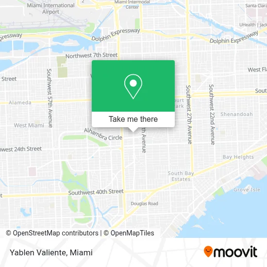
See Yablen Valiente, Miami, on the map
Public Transit to Yablen Valiente in Miami
Wondering how to get to Yablen Valiente in Miami? Moovit helps you find the best way to get to Yablen Valiente with step-by-step directions from the nearest public transit station.
Moovit provides free maps and live directions to help you navigate through your city. View schedules, routes, timetables, and find out how long does it take to get to Yablen Valiente in real time.
Looking for the nearest stop or station to Yablen Valiente? Check out this list of stops closest to your destination: Ponce De Leon Blvd@madeira Av; Aragon Av & Ponce De Leon Bd; Ponce De Leon Bd@aragon Av; Coconut Grove.
Bus: 24, 42, CGABLE, MIACOR, CGABDT.Train: GREEN, ORANGE.
Want to see if there’s another route that gets you there at an earlier time? Moovit helps you find alternative routes or times. Get directions from and directions to Yablen Valiente easily from the Moovit App or Website.
We make riding to Yablen Valiente easy, which is why over 1.7 million users, including users in Miami, trust Moovit as the best app for public transit. You don’t need to download an individual bus app or train app, Moovit is your all-in-one transit app that helps you find the best bus time or train time available.
For information on prices of bus and train, costs and ride fares to Yablen Valiente, please check the Moovit app.
Use the app to navigate to popular places including to the airport, hospital, stadium, grocery store, mall, coffee shop, school, college, and university.
Yablen Valiente Address: 2121 Ponce de Leon Blvd Ste 600 street in Miami
- Humberto - Canvas Real Estate,
- Enrichment Wealth Management,
- Doctors Healthcare Plans,
- Patino & Assoc., P.A.,
- Perform Md Ortho,
- Elite Body Sculpting,
- Alonso Appeals,
- Balsera Communications Group,
- Ludert,
- Lines Law,
- Candela Eig Jurgens Llc,
- Torres Financial Group,
- Ser,
- Synovus Bank,
- Casariego Financial Group,
- Health Of Mind,
- Maggie Curiel,
- Hemisphere Media Group,
- Piedra & Associates,
- Wealthwise Capital
Places Near Yablen Valiente (Miami)
- Brickell City Centre, Miami,
- Hard Rock Stadium, Miami Gardens,
- Miami-Dade County Courthouse, Miami,
- Aventura Mall, Miami,
- Sawgrass Mall, Miami,
- Aventura Mall, Miami Beach,
- Wynwood, Miami,
- Miami Design District, Miami,
- Port of Miami Cruise Terminal, Miami,
- Keiser University Flagship Campus, West Palm Beach,
- Miami VA Hospital, Miami,
- Sawgrass mall ( FL ), Miami Beach,
- Little Havana, Miami,
- Dolphin Mall, Miami,
- Zoo Miami, Miami,
- Richard E. Gerstein Justice Building, Miami,
- Dolphin Mall Bus, Miami,
- Bayside Marketplace, Miami,
- Miami Freedom Park, Miami,
- Marlins Park, Miami
How to get to popular places in Miami with public transit
Get around Miami by public transit!
Traveling around Miami has never been so easy. See step by step directions as you travel to any attraction, street or major public transit station. View bus and train schedules, arrival times, service alerts and detailed routes on a map, so you know exactly how to get to anywhere in Miami.
When traveling to any destination around Miami use Moovit's Live Directions with Get Off Notifications to know exactly where and how far to walk, how long to wait for your line, and how many stops are left. Moovit will alert you when it's time to get off — no need to constantly re-check whether yours is the next stop.
Wondering how to use public transit in Miami or how to pay for public transit in Miami? Moovit public transit app can help you navigate your way with public transit easily, and at minimum cost. It includes public transit fees, ticket prices, and costs. Looking for a map of Miami public transit lines? Moovit public transit app shows all public transit maps in Miami with all Bus, Train, Light Rail and Ferry routes and stops on an interactive map.
Miami has 4 transit type(s), including: Bus, Train, Light Rail and Ferry, operated by several transit agencies, including Broward County Transit, Miami-Dade Transit, Metrorail, Palm Tran, Tri-Rail, Brightline, MARTY, City of Homestead Trolley, Key West Transit, Treasure Coast Connector, GoLine IRT, Amtrak, Greyhound-us, FlixBus-us and Aventura Express Shuttle Bus