Directions to Yale Institute For Network Science (New Haven) with public transportation
The following transit lines have routes that pass near Yale Institute For Network Science
 Bus: 255, 271, 272, 278, GREYHOUND US0240.
- Train: 3, HARTFORD LINE, NORTHEAST REGIONAL, VERMONTER, AMTRAK HARTFORD LINE.
How to get to Yale Institute For Network Science by bus?
Click on the bus route to see step by step directions with maps, line arrival times and updated time schedules.
How to get to Yale Institute For Network Science by train?
Click on the train route to see step by step directions with maps, line arrival times and updated time schedules.
Bus stops near Yale Institute For Network Science in New Haven
Train stations near Yale Institute For Network Science in New Haven
Bus lines to Yale Institute For Network Science in New Haven
- 212, 212x - New Haven Via I-91,VIEW
- 213, 213x - New Haven Via I-91,VIEW
- 215, 215 - New Haven Via Universal Dr,VIEW
- 228, 228c - Whitney Ave-Centerville-Quinnipiac Univ,VIEW
- 229, 229 - Waterbury-Centerville Via Whitney Ave,VIEW
- 234, 234 - Winchester Ave-Mill Rock Rd,VIEW
- 278, 278 - New Haven Connector-Downtown New Haven State St Rr Stn,VIEW
- 224, 224 - State St-Downtown New Haven,VIEW
- 950, 950 - Meriden-New Haven Express,VIEW
What are the closest stations to Yale Institute For Network Science?
The closest stations to Yale Institute For Network Science are:
- Temple St @ Trumbull St is 171 yards away, 3 min walk.
- Prospect St @ Trumbull St is 225 yards away, 3 min walk.
- Whitney Ave @ Trumbull St is 253 yards away, 4 min walk.
- Temple St & Grove St is 296 yards away, 4 min walk.
- New Haven State Street is 2371 yards away, 29 min walk.
- New Haven is 3505 yards away, 42 min walk.
Which bus lines stop near Yale Institute For Network Science?
These bus lines stop near Yale Institute For Network Science: 255, 271, 272, 278, GREYHOUND US0240, GREYHOUND US0255S, USS.
Which train lines stop near Yale Institute For Network Science?
These train lines stop near Yale Institute For Network Science: 3, HARTFORD LINE, NORTHEAST REGIONAL, VERMONTER.
What’s the nearest train station to Yale Institute For Network Science in New Haven?
The nearest train station to Yale Institute For Network Science in New Haven is New Haven State Street. It’s a 29 min walk away.
What’s the nearest bus station to Yale Institute For Network Science in New Haven?
The nearest bus stations to Yale Institute For Network Science in New Haven are Temple St @ Trumbull St and Prospect St @ Trumbull St. The closest one is a 3 min walk away.
What time is the first train to Yale Institute For Network Science in New Haven?
The 3 is the first train that goes to Yale Institute For Network Science in New Haven. It stops nearby at 3:17 AM.
What time is the last train to Yale Institute For Network Science in New Haven?
The 3 is the last train that goes to Yale Institute For Network Science in New Haven. It stops nearby at 3:56 AM.
What time is the first bus to Yale Institute For Network Science in New Haven?
The 224 is the first bus that goes to Yale Institute For Network Science in New Haven. It stops nearby at 5:07 AM.
What time is the last bus to Yale Institute For Network Science in New Haven?
The 228 is the last bus that goes to Yale Institute For Network Science in New Haven. It stops nearby at 1:47 AM.
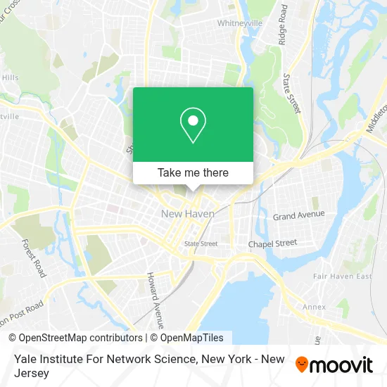
See Yale Institute For Network Science, New Haven, on the map
Public Transit to Yale Institute For Network Science in New Haven
Wondering how to get to Yale Institute For Network Science in New Haven? Moovit helps you find the best way to get to Yale Institute For Network Science with step-by-step directions from the nearest public transit station.
Moovit provides free maps and live directions to help you navigate through your city. View schedules, routes, timetables, and find out how long does it take to get to Yale Institute For Network Science in real time.
Looking for the nearest stop or station to Yale Institute For Network Science? Check out this list of stops closest to your destination: Temple St @ Trumbull St; Prospect St @ Trumbull St; Whitney Ave @ Trumbull St; Temple St & Grove St; New Haven State Street; New Haven.
Bus: 255, 271, 272, 278, GREYHOUND US0240, GREYHOUND US0255S, USS, 212, 213, 215, 228, 229, 234, 224, 950.Train: 3, HARTFORD LINE, NORTHEAST REGIONAL, VERMONTER, AMTRAK HARTFORD LINE, COMMUTER RAIL, VALLEY FLYER, ACELA, COMMUTER RAIL.
Want to see if there’s another route that gets you there at an earlier time? Moovit helps you find alternative routes or times. Get directions from and directions to Yale Institute For Network Science easily from the Moovit App or Website.
We make riding to Yale Institute For Network Science easy, which is why over 1.5 million users, including users in New Haven, trust Moovit as the best app for public transit. You don’t need to download an individual bus app or train app, Moovit is your all-in-one transit app that helps you find the best bus time or train time available.
For information on prices of bus and train, costs and ride fares to Yale Institute For Network Science, please check the Moovit app.
Use the app to navigate to popular places including to the airport, hospital, stadium, grocery store, mall, coffee shop, school, college, and university.
Yale Institute For Network Science Address: 17 Hillhouse Ave street in New Haven
- Alcantara Cadi Delly K MD - Yale University Health Service,
- Yale Quantum Institute,
- Yale School Of Engineering & Applied Science,
- Yale 17 Hillhouse Avenue,
- Farmington Canal Trail,
- Yale University Collection Of Musical Instruments,
- Mathematics Leet Memorial Library,
- Yale Department Of Statistics and Data Science,
- New Haven Institute Of Religion,
- ATM New Haven,
- Howard Avenue Historic District,
- Yale Housing,
- Donlin Law,
- Yale University - Dunham Laboratory,
- Rudolph Hall,
- Yale Art and Architecture Building,
- Yale Ventures,
- William Reese Company,
- Yale Watson Hall,
- Ct Mediation Center, Llc
Places Near Yale Institute For Network Science (New Haven)
- Hudson Yards, Manhattan,
- Rockefeller Center, Manhattan,
- 26 Federal Plaza, Manhattan,
- San Gennaro Feast, Manhattan,
- 1 Police Plaza, Manhattan,
- 66 John Street, Manhattan,
- Chinatown, Manhattan,
- Wall Street, Manhattan,
- Pier 83, Manhattan,
- 376 Hudson Street, Manhattan,
- Mountainside Hospital, Glen Ridge,
- 3 Stone St, Manhattan,
- Times Square, Manhattan,
- qqqq, Manhattan,
- 111 Centre New York City Supreme Court, Manhattan,
- Bellevue Hospital, Manhattan,
- 911 Memorial, Manhattan,
- SoHo, Manhattan,
- Katz's Deli, Manhattan,
- Queens Center Mall, Queens
How to get to popular places in New York - New Jersey with public transit
Get around New Haven by public transit!
Traveling around New Haven has never been so easy. See step by step directions as you travel to any attraction, street or major public transit station. View bus and train schedules, arrival times, service alerts and detailed routes on a map, so you know exactly how to get to anywhere in New Haven.
When traveling to any destination around New Haven use Moovit's Live Directions with Get Off Notifications to know exactly where and how far to walk, how long to wait for your line, and how many stops are left. Moovit will alert you when it's time to get off — no need to constantly re-check whether yours is the next stop.
Wondering how to use public transit in New Haven or how to pay for public transit in New Haven? Moovit public transit app can help you navigate your way with public transit easily, and at minimum cost. It includes public transit fees, ticket prices, and costs. Looking for a map of New Haven public transit lines? Moovit public transit app shows all public transit maps in New Haven with all Bus, Train, Subway, Light Rail, Ferry and Cable Car routes and stops on an interactive map.
New York - New Jersey has 6 transit type(s), including: Bus, Train, Subway, Light Rail, Ferry and Cable Car, operated by several transit agencies, including MTA Subway, Metro-North Railroad, LIRR, PATH, MTA New York City Transit - Express routes, MTA Bus, NJ Transit, NYC Ferry, NICE bus, Bee-Line Bus, NJ Transit Rail, Norwalk Transit District, Hartford Line, River Valley Transit and HART