How to get to Yard by bus?
Click on the bus route to see step by step directions with maps, line arrival times and updated time schedules.
From Orbita Shopping Center, Voroshilovsky District
47 minFrom Rehabilitation Doctor Galkina Tatiana Ivanovna, Proletarsky District
50 minFrom Oncological Dispensary of Rostov Region, Kirovsky District
49 minFrom Uro-Pro, Kirovsky District
43 minFrom Telman Street, Kirovsky District
47 minFrom Beregovaya Street, Leninsky District
39 minFrom 80 Budennovsky, Leninsky District
44 minFrom Polyclinic #16, Voroshilovsky District
56 min
Shuttle stations near Yard in Sovetsky District
What are the closest stations to Yard?
The closest stations to Yard are:
- Malinovsky Street is 296 meters away, 5 min walk.
- Eremenko St is 609 meters away, 9 min walk.
Which bus lines stop near Yard?
These bus lines stop near Yard: 26, 67, 71, 94.
Which shuttle lines stop near Yard?
These shuttle lines stop near Yard: 10, 55, 56, 59, 94.
What’s the nearest shuttle station to Yard in Sovetsky District?
The nearest shuttle station to Yard in Sovetsky District is Malinovsky Street. It’s a 5 min walk away.
What time is the first bus to Yard in Sovetsky District?
The 71 is the first bus that goes to Yard in Sovetsky District. It stops nearby at 5:03 AM.
What time is the last bus to Yard in Sovetsky District?
The 71 is the last bus that goes to Yard in Sovetsky District. It stops nearby at 12:06 AM.
What time is the first shuttle to Yard in Sovetsky District?
The 59 is the first shuttle that goes to Yard in Sovetsky District. It stops nearby at 5:02 AM.
What time is the last shuttle to Yard in Sovetsky District?
The 67 is the last shuttle that goes to Yard in Sovetsky District. It stops nearby at 12:09 AM.
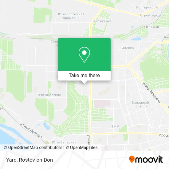
See Yard, Sovetsky District, on the map
Public Transit to Yard in Sovetsky District
Wondering how to get to Yard in Sovetsky District? Moovit helps you find the best way to get to Yard with step-by-step directions from the nearest public transit station.
Moovit provides free maps and live directions to help you navigate through your city. View schedules, routes, timetables, and find out how long does it take to get to Yard in real time.
Looking for the nearest stop or station to Yard? Check out this list of stops closest to your destination: Malinovsky Street; Eremenko St.
Bus: 26, 67, 71, 94.Shuttle: 10, 55, 56, 59, 94, 16, 26, 40, 48, 67, 67, 71, 73, 71, 96.
Want to see if there’s another route that gets you there at an earlier time? Moovit helps you find alternative routes or times. Get directions from and directions to Yard easily from the Moovit App or Website.
We make riding to Yard easy, which is why over 1.7 million users, including users in Sovetsky District, trust Moovit as the best app for public transit. You don’t need to download an individual bus app or train app, Moovit is your all-in-one transit app that helps you find the best bus time or train time available.
For information on prices of bus and shuttle, costs and ride fares to Yard, please check the Moovit app.
Use the app to navigate to popular places including to the airport, hospital, stadium, grocery store, mall, coffee shop, school, college, and university.
Yard Address: улица Малиновского 25, Ростов-на-Дону, Россия, 344000 street in Sovetsky District
- Bubble Tea,
- Coffeetown, Cafe Network,
- Sela Gold Vavilon,
- Vitacci Kids,
- Lero Accessories,
- Vavilon,
- Glance,
- Primadonna,
- Fast And Shine Detailing Studio,
- Nelson's Fast Food Store,
- Shoes Empire Store on Malinovsky Street,
- TC Golden Babylon,
- Gotham,
- Kroshka Kartoshka,
- 5D Cinema,
- Polish Yolki,
- Vip-Fone 1,
- Drymax,
- 5 Season,
- Mvideo S782
Places Near Yard (Sovetsky District)
- BSMP-2, Voroshilovsky District,
- Rostov-on-Don Embankment,
- UFPS Military Unit 71609, Pervomaisky District,
- 14 Line Street 63, Proletarsky District,
- Rostov Regional Clinical Hospital, Sovetsky District,
- Regional Hospital #2,
- City Clinical Hospital #20, Sovetsky District,
- Blagodatnaya Street 170, Sovetsky District,
- Pervomayskaya Station, Sovetsky District,
- Regional Clinical Hospital #2, Pervomaisky District,
- Temernik Market, Pervomaisky District,
- Gaidara Street, Leninsky District,
- Sailors Hospital, Pervomaisky District,
- Rostov Zoo, Oktyabrsky District,
- Rostov Research Oncology Institute, Proletarsky District,
- Pushkinskaya Street, 174, Kirovsky District,
- Central Market,
- Shopping Center "Horizon", Voroshilovsky District,
- CDC "Health", Pervomaisky District,
- Sholokhov Avenue
How to get to popular places in Rostov-on-Don with public transit
Get around Sovetsky District by public transit!
Traveling around Sovetsky District has never been so easy. See step by step directions as you travel to any attraction, street or major public transit station. View bus and train schedules, arrival times, service alerts and detailed routes on a map, so you know exactly how to get to anywhere in Sovetsky District.
When traveling to any destination around Sovetsky District use Moovit's Live Directions with Get Off Notifications to know exactly where and how far to walk, how long to wait for your line, and how many stops are left. Moovit will alert you when it's time to get off — no need to constantly re-check whether yours is the next stop.
Wondering how to use public transit in Sovetsky District or how to pay for public transit in Sovetsky District? Moovit public transit app can help you navigate your way with public transit easily, and at minimum cost. It includes public transit fees, ticket prices, and costs. Looking for a map of Sovetsky District public transit lines? Moovit public transit app shows all public transit maps in Sovetsky District with all Bus, Light Rail, Trolleybus and Shuttle routes and stops on an interactive map.
Rostov-on-Don has 4 transit type(s), including: Bus, Light Rail, Trolleybus and Shuttle, operated by several transit agencies, including MUP MTK Rostovpassazhirtrans, MUP RTK, LLC RTK Ruseltrans and Minibuses