How to get to Yeglashtech by bus?
Click on the bus route to see step by step directions with maps, line arrival times and updated time schedules.
From Epl Edmonton Public Library, Edmonton
112 minFrom Strathcona, Edmonton
84 minFrom ATB Place, Edmonton
62 minFrom Aurora Wild, Edmonton
95 minFrom Walterdale Hill & Queen Elizabeth Park Road, Edmonton
69 minFrom Westfield Medical Clinic, Edmonton
93 minFrom Ajm Plumbing and Home Reno, Edmonton
54 minFrom Archbishop Jordan High School (ABJ), Strathcona County
99 minFrom 에드먼튼 순복음 교회 - Ekfgc, Edmonton
104 minFrom The Westin Edmonton, Edmonton
63 min
Bus stops near Yeglashtech in Edmonton
Light Rail stations near Yeglashtech in Edmonton
- Dl Macdonald Platform, 22 min walk,VIEW
Bus lines to Yeglashtech in Edmonton
What are the closest stations to Yeglashtech?
The closest stations to Yeglashtech are:
- 34 Street & 132a Avenue is 288 meters away, 5 min walk.
- Victoria Trail & 130 Avenue is 649 meters away, 9 min walk.
- Dl Macdonald Platform is 1654 meters away, 22 min walk.
Which bus lines stop near Yeglashtech?
These bus lines stop near Yeglashtech: 053, 108, 116.
Which light rail line stops near Yeglashtech?
CAPITAL (Clareview)
What’s the nearest light rail station to Yeglashtech in Edmonton?
The nearest light rail station to Yeglashtech in Edmonton is Dl Macdonald Platform. It’s a 22 min walk away.
What’s the nearest bus station to Yeglashtech in Edmonton?
The nearest bus station to Yeglashtech in Edmonton is 34 Street & 132a Avenue. It’s a 5 min walk away.
What time is the first bus to Yeglashtech in Edmonton?
The 108 is the first bus that goes to Yeglashtech in Edmonton. It stops nearby at 6:00 AM.
What time is the last bus to Yeglashtech in Edmonton?
The 108 is the last bus that goes to Yeglashtech in Edmonton. It stops nearby at 12:03 AM.
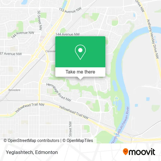
See Yeglashtech, Edmonton, on the map
Public Transit to Yeglashtech in Edmonton
Wondering how to get to Yeglashtech in Edmonton? Moovit helps you find the best way to get to Yeglashtech with step-by-step directions from the nearest public transit station.
Moovit provides free maps and live directions to help you navigate through your city. View schedules, routes, timetables, and find out how long does it take to get to Yeglashtech in real time.
Looking for the nearest stop or station to Yeglashtech? Check out this list of stops closest to your destination: 34 Street & 132a Avenue; Victoria Trail & 130 Avenue; Dl Macdonald Platform.
Bus: 053, 108, 116, 627.Light Rail: CAPITAL.
Want to see if there’s another route that gets you there at an earlier time? Moovit helps you find alternative routes or times. Get directions from and directions to Yeglashtech easily from the Moovit App or Website.
We make riding to Yeglashtech easy, which is why over 1.5 million users, including users in Edmonton, trust Moovit as the best app for public transit. You don’t need to download an individual bus app or train app, Moovit is your all-in-one transit app that helps you find the best bus time or train time available.
For information on prices of bus and light rail, costs and ride fares to Yeglashtech, please check the Moovit app.
Use the app to navigate to popular places including to the airport, hospital, stadium, grocery store, mall, coffee shop, school, college, and university.
Yeglashtech Address: 34 St NW Edmonton, AB T5A 5G7 street in Edmonton
- Energize Tree Maintenance,
- Rsi,
- Gingerfully Cozy,
- Belmont,
- Dubsen Developments,
- Carson Dunlop Wuestner Team,
- Multi Service Jireh,
- McDonald Bros Electric,
- Vogel Residential,
- Intuitive Hair Studio,
- St. Elizabeth Seton Catholic Elementary,
- Dynamic System Contracting,
- Yvo-Clothing-Label,
- All Seasons Lawn Care and Snow Removal,
- Midwest Property,
- Harrow Court Apartments,
- Victoria Trail Physiotherapy,
- Saint-Elizabeth Seton Catholic School,
- St Elizabeth Seton Elem Jr HS,
- Andys Lawn Maintnence
Places Near Yeglashtech (Edmonton)
- Londonderry Mall, Edmonton,
- Cross Cancer Institute, Edmonton,
- University of Alberta, Edmonton,
- Kingsway Mall, Edmonton,
- Grey Nuns Community Hospital, Edmonton,
- Edmonton Commonwealth Stadium, Edmonton,
- Fort Edmonton Park, Edmonton,
- Whyte Avenue, Edmonton,
- Canada Place Service Canada Centre, Edmonton,
- Royal Alexandra Hospital, Edmonton,
- Edmonton EXPO Centre, Edmonton,
- Northgate Centre, Edmonton,
- Edmonton VIA Rail Station, Edmonton,
- Alberta Legislature Building, Edmonton,
- West Edmonton Mall, Edmonton,
- Rogers Place, Edmonton,
- Edmonton Valley Zoo, Edmonton,
- Borden Park, Edmonton,
- Kaye Edmonton Clinic, Edmonton,
- MacEwan University, Edmonton
How to get to popular places in Edmonton with public transit
Get around Edmonton by public transit!
Traveling around Edmonton has never been so easy. See step by step directions as you travel to any attraction, street or major public transit station. View bus and train schedules, arrival times, service alerts and detailed routes on a map, so you know exactly how to get to anywhere in Edmonton.
When traveling to any destination around Edmonton use Moovit's Live Directions with Get Off Notifications to know exactly where and how far to walk, how long to wait for your line, and how many stops are left. Moovit will alert you when it's time to get off — no need to constantly re-check whether yours is the next stop.
Wondering how to use public transit in Edmonton or how to pay for public transit in Edmonton? Moovit public transit app can help you navigate your way with public transit easily, and at minimum cost. It includes public transit fees, ticket prices, and costs. Looking for a map of Edmonton public transit lines? Moovit public transit app shows all public transit maps in Edmonton with all Bus and Light Rail routes and stops on an interactive map.
Edmonton has 2 transit type(s), including: Bus and Light Rail, operated by several transit agencies, including ETS LRT, ETS, Strathcona County Transit, St. Albert Transit, Spruce Grove Transit, Fort Saskatchewan Transit, Beaumont Transit and Leduc Transit