How to get to Yeshiva Ateres Eitz Chaim by bus?
Click on the bus route to see step by step directions with maps, line arrival times and updated time schedules.
From Plattduetsche Park, Franklin Square
82 minFrom Valley Stream, NY, Valley Stream
63 minFrom Belmont Park, Elmont
82 minFrom Jfk Building 14, Queens
61 minFrom Springfield Gardens, NY, Queens
53 minFrom Mercy Hospital, Rockville Centre
89 minFrom Ohel Chabad Lubavitch, Queens
67 minFrom Howard Beach, Queens
113 minFrom Walmart, Queens
62 minFrom Jamaica, NY, Queens
59 min
How to get to Yeshiva Ateres Eitz Chaim by train?
Click on the train route to see step by step directions with maps, line arrival times and updated time schedules.
How to get to Yeshiva Ateres Eitz Chaim by subway?
Click on the subway route to see step by step directions with maps, line arrival times and updated time schedules.
Bus stops near Yeshiva Ateres Eitz Chaim in Cedarhurst
Train station near Yeshiva Ateres Eitz Chaim in Cedarhurst
- Lawrence, 18 min walk,VIEW
Bus lines to Yeshiva Ateres Eitz Chaim in Cedarhurst
What are the closest stations to Yeshiva Ateres Eitz Chaim?
The closest stations to Yeshiva Ateres Eitz Chaim are:
- Central Ave & Cedarhurst Ave. is 68 yards away, 1 min walk.
- W Broadway & Cedarhurst Ave is 825 yards away, 10 min walk.
- Lawrence is 1451 yards away, 18 min walk.
Which bus lines stop near Yeshiva Ateres Eitz Chaim?
These bus lines stop near Yeshiva Ateres Eitz Chaim: N31, N32, Q114.
Which train line stops near Yeshiva Ateres Eitz Chaim?
FAR ROCKAWAY BRANCH (Far Rockaway)
Which subway line stops near Yeshiva Ateres Eitz Chaim?
A (Downtown & Far Rockaway)
What’s the nearest train station to Yeshiva Ateres Eitz Chaim in Cedarhurst?
The nearest train station to Yeshiva Ateres Eitz Chaim in Cedarhurst is Lawrence. It’s a 18 min walk away.
What’s the nearest bus station to Yeshiva Ateres Eitz Chaim in Cedarhurst?
The nearest bus station to Yeshiva Ateres Eitz Chaim in Cedarhurst is Central Ave & Cedarhurst Ave.. It’s a 1 min walk away.
What time is the first train to Yeshiva Ateres Eitz Chaim in Cedarhurst?
The FAR ROCKAWAY BRANCH is the first train that goes to Yeshiva Ateres Eitz Chaim in Cedarhurst. It stops nearby at 3:05 AM.
What time is the last train to Yeshiva Ateres Eitz Chaim in Cedarhurst?
The FAR ROCKAWAY BRANCH is the last train that goes to Yeshiva Ateres Eitz Chaim in Cedarhurst. It stops nearby at 3:15 AM.
What time is the first bus to Yeshiva Ateres Eitz Chaim in Cedarhurst?
The N32 is the first bus that goes to Yeshiva Ateres Eitz Chaim in Cedarhurst. It stops nearby at 4:44 AM.
What time is the last bus to Yeshiva Ateres Eitz Chaim in Cedarhurst?
The N32 is the last bus that goes to Yeshiva Ateres Eitz Chaim in Cedarhurst. It stops nearby at 12:13 AM.
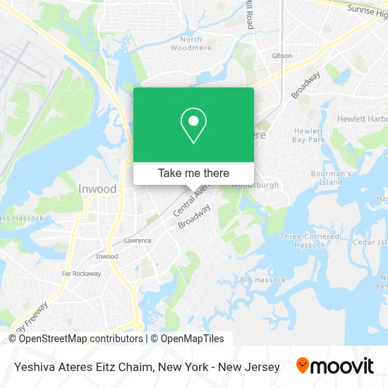
See Yeshiva Ateres Eitz Chaim, Cedarhurst, on the map
Public Transit to Yeshiva Ateres Eitz Chaim in Cedarhurst
Wondering how to get to Yeshiva Ateres Eitz Chaim in Cedarhurst? Moovit helps you find the best way to get to Yeshiva Ateres Eitz Chaim with step-by-step directions from the nearest public transit station.
Moovit provides free maps and live directions to help you navigate through your city. View schedules, routes, timetables, and find out how long does it take to get to Yeshiva Ateres Eitz Chaim in real time.
Looking for the nearest stop or station to Yeshiva Ateres Eitz Chaim? Check out this list of stops closest to your destination: Central Ave & Cedarhurst Ave.; W Broadway & Cedarhurst Ave; Lawrence.
Bus: N31, N32, Q114, N31X/M.Train: FAR ROCKAWAY BRANCH.Subway: A.
Want to see if there’s another route that gets you there at an earlier time? Moovit helps you find alternative routes or times. Get directions from and directions to Yeshiva Ateres Eitz Chaim easily from the Moovit App or Website.
We make riding to Yeshiva Ateres Eitz Chaim easy, which is why over 1.5 million users, including users in Cedarhurst, trust Moovit as the best app for public transit. You don’t need to download an individual bus app or train app, Moovit is your all-in-one transit app that helps you find the best bus time or train time available.
For information on prices of bus, train and subway, costs and ride fares to Yeshiva Ateres Eitz Chaim, please check the Moovit app.
Use the app to navigate to popular places including to the airport, hospital, stadium, grocery store, mall, coffee shop, school, college, and university.
Yeshiva Ateres Eitz Chaim Address: 530 Central Ave street in Cedarhurst
- Citi,
- Prestigio Wigs by Adina,
- Bridal Secrets,
- Ira Thomas Creations,
- Poppy Medi-Boutique,
- Event Planner NY,
- Dunkin',
- Microblading by Hanna,
- Tcby,
- The Joneses,
- Rouge Beauty Bar,
- The Golden Child,
- Rentastic Party & Chair Rental,
- Fashionnail&Spa,
- Miri,
- Central Hype,
- Mod Shop New York,
- Yaeli Home,
- Makeup Essentials Inc.,
- Central Aid Pharmacy
Places Near Yeshiva Ateres Eitz Chaim (Cedarhurst)
- qqqq, Manhattan,
- Bellevue Hospital, Manhattan,
- 26 Federal Plaza, Manhattan,
- Rockefeller Center, Manhattan,
- SoHo, Manhattan,
- 376 Hudson Street, Manhattan,
- Pier 83, Manhattan,
- 1 Police Plaza, Manhattan,
- Times Square, Manhattan,
- Wall Street, Manhattan,
- San Gennaro Feast, Manhattan,
- Katz's Deli, Manhattan,
- 911 Memorial, Manhattan,
- Chinatown, Manhattan,
- Mountainside Hospital, Glen Ridge,
- 66 John Street, Manhattan,
- 3 Stone St, Manhattan,
- Hudson Yards, Manhattan,
- Queens Center Mall, Queens,
- 111 Centre New York City Supreme Court, Manhattan
How to get to popular places in New York - New Jersey with public transit
Get around Cedarhurst by public transit!
Traveling around Cedarhurst has never been so easy. See step by step directions as you travel to any attraction, street or major public transit station. View bus and train schedules, arrival times, service alerts and detailed routes on a map, so you know exactly how to get to anywhere in Cedarhurst.
When traveling to any destination around Cedarhurst use Moovit's Live Directions with Get Off Notifications to know exactly where and how far to walk, how long to wait for your line, and how many stops are left. Moovit will alert you when it's time to get off — no need to constantly re-check whether yours is the next stop.
Wondering how to use public transit in Cedarhurst or how to pay for public transit in Cedarhurst? Moovit public transit app can help you navigate your way with public transit easily, and at minimum cost. It includes public transit fees, ticket prices, and costs. Looking for a map of Cedarhurst public transit lines? Moovit public transit app shows all public transit maps in Cedarhurst with all Bus, Train, Subway, Light Rail, Ferry and Cable Car routes and stops on an interactive map.
New York - New Jersey has 6 transit type(s), including: Bus, Train, Subway, Light Rail, Ferry and Cable Car, operated by several transit agencies, including MTA Subway, Metro-North Railroad, LIRR, PATH, MTA New York City Transit - Express routes, MTA Bus, NJ Transit, NYC Ferry, NICE bus, Bee-Line Bus, NJ Transit Rail, Norwalk Transit District, Hartford Line, River Valley Transit and HART