Directions to Ying Spa (Wichita) with public transportation
The following transit lines have routes that pass near Ying Spa
How to get to Ying Spa by bus?
Click on the bus route to see step by step directions with maps, line arrival times and updated time schedules.
From Penske Auto Center, Maize
60 minFrom Brooks Magnet Middle School, Wichita
85 minFrom Riverside Custom Painting, Wichita
58 minFrom Cos Ins, Wichita
54 minFrom Hilltop Manor, Kansas, Wichita
56 minFrom Alvin E. Morris Administration Building, Wichita
61 minFrom Coleman Company, Wichita
82 minFrom Zavala Plus, LL, Wichita
33 minFrom Farmers Insurance - Cody Nelson, Wichita
32 min
Bus stops near Ying Spa in Wichita
Bus lines to Ying Spa in Wichita
What are the closest stations to Ying Spa?
The closest stations to Ying Spa are:
- Douglas And West Ib is 195 yards away, 3 min walk.
- Maple And Mccomas Ob is 483 yards away, 6 min walk.
- Douglas And Sheridan Outbd is 652 yards away, 8 min walk.
Which bus lines stop near Ying Spa?
These bus lines stop near Ying Spa: ROUTE11: MAPLE-R, ROUTE12: DOUGLAS, ROUTE15: DOUGLAS.
What’s the nearest bus station to Ying Spa in Wichita?
The nearest bus station to Ying Spa in Wichita is Douglas And West Ib. It’s a 3 min walk away.
What time is the first bus to Ying Spa in Wichita?
The ROUTE11: MAPLE-R is the first bus that goes to Ying Spa in Wichita. It stops nearby at 5:13 AM.
What time is the last bus to Ying Spa in Wichita?
The ROUTE14: DOUGLAS is the last bus that goes to Ying Spa in Wichita. It stops nearby at 7:19 PM.
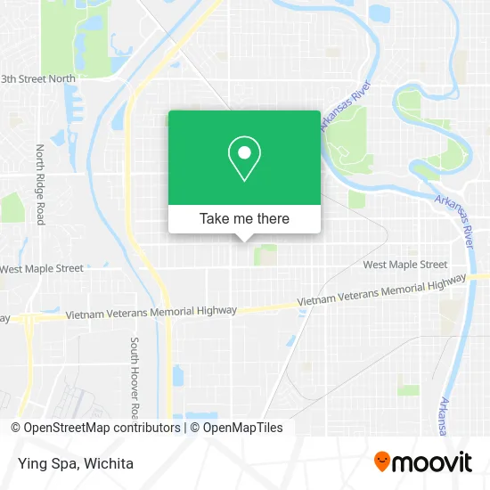
See Ying Spa, Wichita, on the map
Public Transit to Ying Spa in Wichita
Wondering how to get to Ying Spa in Wichita? Moovit helps you find the best way to get to Ying Spa with step-by-step directions from the nearest public transit station.
Moovit provides free maps and live directions to help you navigate through your city. View schedules, routes, timetables, and find out how long does it take to get to Ying Spa in real time.
Looking for the nearest stop or station to Ying Spa? Check out this list of stops closest to your destination: Douglas And West Ib; Maple And Mccomas Ob; Douglas And Sheridan Outbd.
Bus: ROUTE11: MAPLE-R, ROUTE12: DOUGLAS, ROUTE15: DOUGLAS, ROUTE14: DOUGLAS.
Want to see if there’s another route that gets you there at an earlier time? Moovit helps you find alternative routes or times. Get directions from and directions to Ying Spa easily from the Moovit App or Website.
We make riding to Ying Spa easy, which is why over 1.5 million users, including users in Wichita, trust Moovit as the best app for public transit. You don’t need to download an individual bus app or train app, Moovit is your all-in-one transit app that helps you find the best bus time or train time available.
For information on prices of bus, costs and ride fares to Ying Spa, please check the Moovit app.
Use the app to navigate to popular places including to the airport, hospital, stadium, grocery store, mall, coffee shop, school, college, and university.
Ying Spa Address: 3719 W Douglas Ave Wichita, KS 67213 street in Wichita
- No Pressure Barbershop,
- Hoots,
- Midway Oil,
- Tortilleria Car,
- Douglas and Kessler,
- 660 Raceworx,
- Psychic Readings by Tabitha,
- Richard Martin,
- SONIC,
- Wichita Pet Parlor,
- Foot Spa & Massage Therapy,
- Jerarms,
- Concrete Accessories,
- RG Construction,
- Amazon Counter-Ribbit Computers,
- Brothers That Just do Gutters,
- B&C Seamless Guttering,
- BB Airsoft World,
- Rene's Mexican Restaurant,
- Envy Dental, Implant & Esthetics
Places Near Ying Spa (Wichita)
- Wichita Dwight D. Eisenhower National Airport (ICT) (Wichita Eisenhower National Airport), Wichita,
- Cookies by Design, Wichita,
- Towne East Mall, Wichita,
- McConnell Air Force Base, Mcconnell Afb,
- Four Corners Cafe @ Wesley Medical Center, Wichita,
- Spirit Aerosystems Inc, Building 1-198D,
- Total Card Solutions, Wichita,
- Ratcliff Auto and Truck Repair, Wichita,
- Paige Place Apartments, Wichita,
- Ascencion Via Christi Hospital St Francis, Wichita,
- Sena African Hair Braiding LLC, Wichita,
- Afghan Halal Market, Wichita,
- North High School, Wichita,
- Hubb's glory hole, Wichita,
- Bmer Tech Automotive, Wichita,
- Spirit Aerosystems,
- Spirit AeroSystems, Bldg 2-280J (Section 9),
- winfield, Wichita,
- Westside Athletic Field (Friends University Baseball Field), Wichita,
- East 21st Street North and Webb Road, Wichita
How to get to popular places in Wichita with public transit
Get around Wichita by public transit!
Traveling around Wichita has never been so easy. See step by step directions as you travel to any attraction, street or major public transit station. View bus and train schedules, arrival times, service alerts and detailed routes on a map, so you know exactly how to get to anywhere in Wichita.
When traveling to any destination around Wichita use Moovit's Live Directions with Get Off Notifications to know exactly where and how far to walk, how long to wait for your line, and how many stops are left. Moovit will alert you when it's time to get off — no need to constantly re-check whether yours is the next stop.
Wondering how to use public transit in Wichita or how to pay for public transit in Wichita? Moovit public transit app can help you navigate your way with public transit easily, and at minimum cost. It includes public transit fees, ticket prices, and costs. Looking for a map of Wichita public transit lines? Moovit public transit app shows all public transit maps in Wichita with all bus routes and stops on an interactive map.
Wichita has 1 transit type(s), including: bus, operated by several transit agencies, including Wichita Transit, Greyhound-us and FlixBus-us