Directions to Your Inner Flow (Reno) with public transportation
The following transit lines have routes that pass near Your Inner Flow
 Bus: 11, 16, 4, 6.
- Train: CALIFORNIA ZEPHYR.
How to get to Your Inner Flow by bus?
Click on the bus route to see step by step directions with maps, line arrival times and updated time schedules.
From R&M House Cleaning Services, Sparks
38 minFrom Yawnys Auto Repair, Sparks
37 minFrom Trepp Enterprises, Reno
59 minFrom Double Diamond, Reno
63 minFrom Tile Liquidators, Reno
62 minFrom Mr Hot Dog, Reno
41 minFrom Bus Stop @robb/mae Anne, Reno
30 minFrom Keep Wireless, Sparks
32 minFrom Fit Shuffle, Reno
59 min
Bus stops near Your Inner Flow in Reno
Train station near Your Inner Flow in Reno
- Reno, 57 min walk,VIEW
Bus lines to Your Inner Flow in Reno
What are the closest stations to Your Inner Flow?
The closest stations to Your Inner Flow are:
- N Arlington Avenue And W 2nd Street is 238 yards away, 3 min walk.
- W 4th Street And Washington Street is 277 yards away, 4 min walk.
- Keystone Avenue And W 1st Street is 317 yards away, 4 min walk.
- Reno is 4791 yards away, 57 min walk.
Which bus lines stop near Your Inner Flow?
These bus lines stop near Your Inner Flow: 11, 16, 4.
What’s the nearest bus station to Your Inner Flow in Reno?
The nearest bus station to Your Inner Flow in Reno is N Arlington Avenue And W 2nd Street. It’s a 3 min walk away.
What time is the first train to Your Inner Flow in Reno?
The CALIFORNIA ZEPHYR is the first train that goes to Your Inner Flow in Reno. It stops nearby at 3:37 PM.
What time is the last train to Your Inner Flow in Reno?
The CALIFORNIA ZEPHYR is the last train that goes to Your Inner Flow in Reno. It stops nearby at 9:24 AM.
What time is the first bus to Your Inner Flow in Reno?
The 11 is the first bus that goes to Your Inner Flow in Reno. It stops nearby at 4:34 AM.
What time is the last bus to Your Inner Flow in Reno?
The 11 is the last bus that goes to Your Inner Flow in Reno. It stops nearby at 2:39 AM.
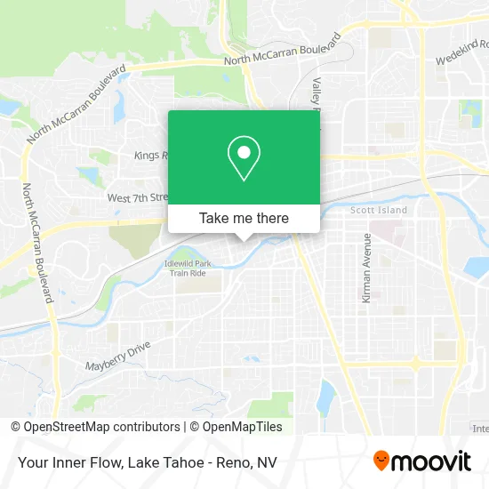
See Your Inner Flow, Reno, on the map
Public Transit to Your Inner Flow in Reno
Wondering how to get to Your Inner Flow in Reno? Moovit helps you find the best way to get to Your Inner Flow with step-by-step directions from the nearest public transit station.
Moovit provides free maps and live directions to help you navigate through your city. View schedules, routes, timetables, and find out how long does it take to get to Your Inner Flow in real time.
Looking for the nearest stop or station to Your Inner Flow? Check out this list of stops closest to your destination: N Arlington Avenue And W 2nd Street; W 4th Street And Washington Street; Keystone Avenue And W 1st Street; Reno.
Bus: 11, 16, 4, 6.Train: CALIFORNIA ZEPHYR.
Want to see if there’s another route that gets you there at an earlier time? Moovit helps you find alternative routes or times. Get directions from and directions to Your Inner Flow easily from the Moovit App or Website.
We make riding to Your Inner Flow easy, which is why over 1.5 million users, including users in Reno, trust Moovit as the best app for public transit. You don’t need to download an individual bus app or train app, Moovit is your all-in-one transit app that helps you find the best bus time or train time available.
For information on prices of bus, costs and ride fares to Your Inner Flow, please check the Moovit app.
Use the app to navigate to popular places including to the airport, hospital, stadium, grocery store, mall, coffee shop, school, college, and university.
Your Inner Flow Address: 85 Washington St street in Reno
- Aic,
- Itc,
- MPR,
- Homewatch Caregivers,
- Respin,
- Teresa Chavez MD,
- Starlight & Sphinx,
- John L Arrascada Esq,
- Matt Dion & Associates,
- Food for Kids, Inc.,
- Crisis Collection Management,
- Dharmakaya Buddhist Center,
- brandcraft Inc.,
- Aston Patterning Center,
- Innovations Big Picture High School,
- Accident Lawyers,
- Peak Performance Chiropractic,
- Richard P. Davies Law,
- Ken McKenna,
- Paradiso Communities
Places Near Your Inner Flow (Reno)
- Department of Motor Vehicles (DMV), Reno,
- Tesla, Reno,
- University of Nevada, Reno, Reno,
- Grand Sierra Resort, Reno,
- Hidden Beach, Incline Village,
- Tesla, Carson City,
- Emerald Bay, South Lake Tahoe,
- Tesla, Reno,
- The Summit (Summit Shopping Center), Reno,
- Social Security Administration, Reno,
- Mount Rose Ski Resort Entrance, Reno,
- Boomtown Hotel, Reno,
- Boreal Mountain Resort, Truckee,
- Peppermill, Reno,
- 2777 usa Parkway, Sparks,
- Walmart Supercenter, Reno,
- Meadowood Mall, Reno,
- The Nugget Sparks - Tesla Destination, Sparks,
- DMV, Reno,
- Reno, Nevada, Reno
How to get to popular places in Lake Tahoe - Reno, NV with public transit
Get around Reno by public transit!
Traveling around Reno has never been so easy. See step by step directions as you travel to any attraction, street or major public transit station. View bus and train schedules, arrival times, service alerts and detailed routes on a map, so you know exactly how to get to anywhere in Reno.
When traveling to any destination around Reno use Moovit's Live Directions with Get Off Notifications to know exactly where and how far to walk, how long to wait for your line, and how many stops are left. Moovit will alert you when it's time to get off — no need to constantly re-check whether yours is the next stop.
Wondering how to use public transit in Reno or how to pay for public transit in Reno? Moovit public transit app can help you navigate your way with public transit easily, and at minimum cost. It includes public transit fees, ticket prices, and costs. Looking for a map of Reno public transit lines? Moovit public transit app shows all public transit maps in Reno with all Bus and Train routes and stops on an interactive map.
Lake Tahoe - Reno, NV has 2 transit type(s), including: Bus and Train, operated by several transit agencies, including RTC RIDE, Tahoe Truckee Area Regional Transit, North Lake Tahoe Express - 24 hour advance reservations required, Tahoe Transportation District, Amtrak and Greyhound-us