How to get to Ys Notes Pop-Up by bus?
Click on the bus route to see step by step directions with maps, line arrival times and updated time schedules.
How to get to Ys Notes Pop-Up by train?
Click on the train route to see step by step directions with maps, line arrival times and updated time schedules.
How to get to Ys Notes Pop-Up by subway?
Click on the subway route to see step by step directions with maps, line arrival times and updated time schedules.
Bus stops near Ys Notes Pop-Up in Manhattan
Subway stations near Ys Notes Pop-Up in Manhattan
Train station near Ys Notes Pop-Up in Manhattan
- 23rd Street, 4 min walk,VIEW
Bus lines to Ys Notes Pop-Up in Manhattan
- X27, Bay Ridge - Manhattan Express,VIEW
- X28, Sea Gate / Bensonhurst - Manhattan Express,VIEW
- X37, Bay Ridge - Midtown Manhattan Express,VIEW
- X38, Sea Gate / Bensonhurst - Midtown Manhattan Express,VIEW
- M23-SBS, Select Bus East Side Avenue C Crosstown,VIEW
- SIM4C, Huguenot Via Richmond Av Via Arthur Kill,VIEW
- SIM10, Eltingville Trans Ctr Via Hylan Via Rich,VIEW
- SIM31, Eltingville Trans Ctr Via Forest Hill Rd,VIEW
- SIM33C, Midtown Via Church Via Madison Av,VIEW
- DOWNTOWN LOCAL, W Houston & Mercer St,VIEW
- SIM1C, Eltngvlle Trans Ctr Via Hylan Via Rich,VIEW
- SIM3, Port Richmond Via Watchogue Rd,VIEW
- SIM3C, Pt Rchmnd Via Narrows Rd N Via Watchogue,VIEW
- 28, 23rd St @ 5th Ave,VIEW
- M1, Harlem - East Village,VIEW
- M2, Washington Heights - East Village,VIEW
- M3, Fort George - East Village,VIEW
- M55, W 44 St - South Ferry,VIEW
- BXM6, Parkchester - Midtown,VIEW
- BXM7, Co-Op City - Midtown,VIEW
What are the closest stations to Ys Notes Pop-Up?
The closest stations to Ys Notes Pop-Up are:
- E 23 St/Broadway is 211 yards away, 3 min walk.
- E 23rd St & Broadway is 226 yards away, 3 min walk.
- 23rd St @ 5th Ave is 261 yards away, 4 min walk.
- 5 Av/W 23 St is 280 yards away, 4 min walk.
- Madison Av/E 23 St is 283 yards away, 4 min walk.
- 5th Ave & W 23rd St is 299 yards away, 4 min walk.
- 23 St is 301 yards away, 4 min walk.
- 23rd Street is 327 yards away, 4 min walk.
- 23 St-Baruch College is 422 yards away, 6 min walk.
Which bus lines stop near Ys Notes Pop-Up?
These bus lines stop near Ys Notes Pop-Up: 28, BM3, BM4, M1, M2.
Which train lines stop near Ys Notes Pop-Up?
These train lines stop near Ys Notes Pop-Up: 1, BLU, YEL.
Which subway lines stop near Ys Notes Pop-Up?
These subway lines stop near Ys Notes Pop-Up: R, W.
What’s the nearest subway station to Ys Notes Pop-Up in Manhattan?
The nearest subway station to Ys Notes Pop-Up in Manhattan is 23 St. It’s a 4 min walk away.
What’s the nearest train station to Ys Notes Pop-Up in Manhattan?
The nearest train station to Ys Notes Pop-Up in Manhattan is 23rd Street. It’s a 4 min walk away.
What’s the nearest bus station to Ys Notes Pop-Up in Manhattan?
The nearest bus stations to Ys Notes Pop-Up in Manhattan are E 23 St/Broadway and E 23rd St & Broadway. The closest one is a 3 min walk away.
What time is the first subway to Ys Notes Pop-Up in Manhattan?
The Q is the first subway that goes to Ys Notes Pop-Up in Manhattan. It stops nearby at 3:00 AM.
What time is the last subway to Ys Notes Pop-Up in Manhattan?
The N is the last subway that goes to Ys Notes Pop-Up in Manhattan. It stops nearby at 3:58 AM.
What time is the first train to Ys Notes Pop-Up in Manhattan?
The ATW is the first train that goes to Ys Notes Pop-Up in Manhattan. It stops nearby at 3:18 AM.
What time is the last train to Ys Notes Pop-Up in Manhattan?
The ATW is the last train that goes to Ys Notes Pop-Up in Manhattan. It stops nearby at 3:18 AM.
What time is the first bus to Ys Notes Pop-Up in Manhattan?
The M23-SBS is the first bus that goes to Ys Notes Pop-Up in Manhattan. It stops nearby at 3:09 AM.
What time is the last bus to Ys Notes Pop-Up in Manhattan?
The M2 is the last bus that goes to Ys Notes Pop-Up in Manhattan. It stops nearby at 2:55 AM.
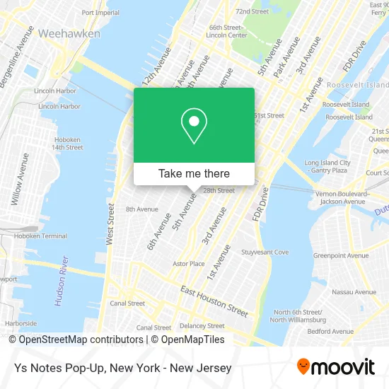
See Ys Notes Pop-Up, Manhattan, on the map
Public Transit to Ys Notes Pop-Up in Manhattan
Wondering how to get to Ys Notes Pop-Up in Manhattan? Moovit helps you find the best way to get to Ys Notes Pop-Up with step-by-step directions from the nearest public transit station.
Moovit provides free maps and live directions to help you navigate through your city. View schedules, routes, timetables, and find out how long does it take to get to Ys Notes Pop-Up in real time.
Looking for the nearest stop or station to Ys Notes Pop-Up? Check out this list of stops closest to your destination: E 23 St/Broadway; E 23rd St & Broadway; 23rd St @ 5th Ave; 5 Av/W 23 St; Madison Av/E 23 St; 5th Ave & W 23rd St; 23 St; 23rd Street; 23 St-Baruch College.
Bus: 28, BM3, BM4, M1, M2, X27, X28, X37, X38, M23-SBS.Train: 1, BLU, YEL, ATW.Subway: R, W, N, Q, 4, 6, 6X, D, F, FX, M.
Want to see if there’s another route that gets you there at an earlier time? Moovit helps you find alternative routes or times. Get directions from and directions to Ys Notes Pop-Up easily from the Moovit App or Website.
We make riding to Ys Notes Pop-Up easy, which is why over 1.5 million users, including users in Manhattan, trust Moovit as the best app for public transit. You don’t need to download an individual bus app or train app, Moovit is your all-in-one transit app that helps you find the best bus time or train time available.
For information on prices of subway, bus and train, costs and ride fares to Ys Notes Pop-Up, please check the Moovit app.
Use the app to navigate to popular places including to the airport, hospital, stadium, grocery store, mall, coffee shop, school, college, and university.
Ys Notes Pop-Up Address: 174 5th Ave street in Manhattan
- Mark Nelson Designs,
- S&P,
- Comite la I Desfile de la Hispanidad,
- Indiecollect,
- Reservoir Films,
- Westbeth Entertainment,
- Titan Commercial Doors Nyc,
- Orion Star King,
- 熨斗大厦,
- Hoka Store,
- Flatironresidential,
- Edificio Flatiron,
- Studio Dima,
- W 22nd St y 5th,
- Flatiron Building,
- Daily Bulge,
- Telos,
- Cheddar Tv,
- Joe Coffee Company,
- Mac Millan Audio
Places Near Ys Notes Pop-Up (Manhattan)
- qqqq, Manhattan,
- Chinatown, Manhattan,
- 26 Federal Plaza, Manhattan,
- 66 John Street, Manhattan,
- Bellevue Hospital, Manhattan,
- 911 Memorial, Manhattan,
- 3 Stone St, Manhattan,
- San Gennaro Feast, Manhattan,
- 1 Police Plaza, Manhattan,
- Times Square, Manhattan,
- Katz's Deli, Manhattan,
- SoHo, Manhattan,
- Mountainside Hospital, Glen Ridge,
- Rockefeller Center, Manhattan,
- Pier 83, Manhattan,
- Queens Center Mall, Queens,
- Hudson Yards, Manhattan,
- 111 Centre New York City Supreme Court, Manhattan,
- 376 Hudson Street, Manhattan,
- Wall Street, Manhattan
How to get to popular places in New York - New Jersey with public transit
Get around Manhattan by public transit!
Traveling around Manhattan has never been so easy. See step by step directions as you travel to any attraction, street or major public transit station. View bus and train schedules, arrival times, service alerts and detailed routes on a map, so you know exactly how to get to anywhere in Manhattan.
When traveling to any destination around Manhattan use Moovit's Live Directions with Get Off Notifications to know exactly where and how far to walk, how long to wait for your line, and how many stops are left. Moovit will alert you when it's time to get off — no need to constantly re-check whether yours is the next stop.
Wondering how to use public transit in Manhattan or how to pay for public transit in Manhattan? Moovit public transit app can help you navigate your way with public transit easily, and at minimum cost. It includes public transit fees, ticket prices, and costs. Looking for a map of Manhattan public transit lines? Moovit public transit app shows all public transit maps in Manhattan with all Bus, Train, Subway, Light Rail, Ferry and Cable Car routes and stops on an interactive map.
New York - New Jersey has 6 transit type(s), including: Bus, Train, Subway, Light Rail, Ferry and Cable Car, operated by several transit agencies, including MTA Subway, Metro-North Railroad, LIRR, PATH, MTA New York City Transit - Express routes, MTA Bus, NJ Transit, NYC Ferry, NICE bus, Bee-Line Bus, NJ Transit Rail, Norwalk Transit District, Hartford Line, River Valley Transit and HART