Directions to Yumecode (Fanny) with public transportation
The following transit lines have routes that pass near Yumecode
How to get to Yumecode by bus?
Click on the bus route to see step by step directions with maps, line arrival times and updated time schedules.
From Hospital e Maternidade São José, São José Dos Pinhais
72 minFrom Estação Tubo Jardim Botânico, Jardim Botânico
43 minFrom Hospital Pilar, São Francisco
45 minFrom Terminal Angélica, Araucária
48 minFrom Parque da Fonte Em Sao Jose dos Pinhais PR, São José Dos Pinhais
72 minFrom Rodovia Deputado João Leopoldo Jacomel 12813, Pinhais
64 minFrom Jardim das Americas, Jardim Das Américas
41 minFrom 20° Batalhão de Infantaria Blindado, Bacacheri
55 minFrom Hospital e Maternidade Santa Cruz, Centro
44 minFrom Estação Tubo Praça Eufrásio Correia, Centro
30 min
Bus stops near Yumecode in Fanny
Bus lines to Yumecode in Fanny
What are the closest stations to Yumecode?
The closest stations to Yumecode are:
- Rua Padre Manuel Da Nóbrega, 1357-1395 is 154 meters away, 3 min walk.
- Rua Eloy De Assis Fabris, 143 is 213 meters away, 3 min walk.
- R. Major Vicente De Castro, 2009 is 385 meters away, 5 min walk.
- Dom Ático - R. Santa Joana D'Arc, 748 is 778 meters away, 10 min walk.
Which bus lines stop near Yumecode?
These bus lines stop near Yumecode: 561 GUILHERMINA, 621 FANNY, 662 DOM ÁTICO.
What’s the nearest bus station to Yumecode in Fanny?
The nearest bus stations to Yumecode in Fanny are Rua Padre Manuel Da Nóbrega, 1357-1395 and Rua Eloy De Assis Fabris, 143. The closest one is a 3 min walk away.
What time is the first bus to Yumecode in Fanny?
The 689 MAD. SÃO PEDRO / RIO NEGRO is the first bus that goes to Yumecode in Fanny. It stops nearby at 3:21 AM.
What time is the last bus to Yumecode in Fanny?
The 689 MAD. SÃO PEDRO / RIO NEGRO is the last bus that goes to Yumecode in Fanny. It stops nearby at 3:23 AM.
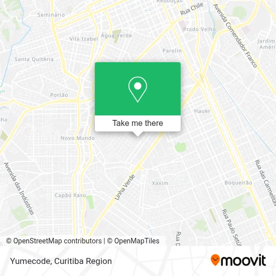
See Yumecode, Fanny, on the map
Public Transit to Yumecode in Fanny
Wondering how to get to Yumecode in Fanny? Moovit helps you find the best way to get to Yumecode with step-by-step directions from the nearest public transit station.
Moovit provides free maps and live directions to help you navigate through your city. View schedules, routes, timetables, and find out how long does it take to get to Yumecode in real time.
Looking for the nearest stop or station to Yumecode? Check out this list of stops closest to your destination: Rua Padre Manuel Da Nóbrega; Rua Eloy De Assis Fabris; R. Major Vicente De Castro; Dom Ático - R. Santa Joana D'Arc.
Bus: 561 GUILHERMINA, 621 FANNY, 662 DOM ÁTICO, 663 VILA CUBAS, 689 MAD. SÃO PEDRO / RIO NEGRO.
Want to see if there’s another route that gets you there at an earlier time? Moovit helps you find alternative routes or times. Get directions from and directions to Yumecode easily from the Moovit App or Website.
We make riding to Yumecode easy, which is why over 1.5 million users, including users in Fanny, trust Moovit as the best app for public transit. You don’t need to download an individual bus app or train app, Moovit is your all-in-one transit app that helps you find the best bus time or train time available.
For information on prices of bus, costs and ride fares to Yumecode, please check the Moovit app.
Use the app to navigate to popular places including to the airport, hospital, stadium, grocery store, mall, coffee shop, school, college, and university.
Yumecode Address: Rua Capitão José Maria Sobrinho, 1782 Fanny Curitiba-PR 81030-300 street in Fanny
- Rua Hassib Jezzini 610,
- Leonardo Brazil Lara,
- Futuro Feliz,
- Anyrlan Industria & Comercio,
- Comunidade São Francisco Xavier,
- Betal Marc Despachantes,
- Chaveiro Lau,
- Imperio da Pizza,
- Ponto de Ônibus Fanny / Guilhermina,
- Moacyr Robetti & Cia,
- Pet Shop Snoop Dog,
- Açougue Frimais,
- Precisão Comércio de Balanças Ltda,
- Igreja Evangélica O Brasil Para Cristo,
- Material de Construcao Campo Belo,
- Rua Padre Manuel da Nóbrega,
- Rua Hassib Jezzini 317,
- Praça Vila Fanny,
- Escola Estadual João De Oliveira Franco - Jof,
- Marruá Uniformes Profissionais
Places Near Yumecode (Fanny)
- Shopping Estação, Rebouças,
- Hospital Erasto Gaertner, Jardim Das Américas,
- Hospital Angelina Caron, Campina Grande Do Sul,
- Campo Largo, Campo,
- Jockey Plaza Shopping Center, Tarumã,
- Parque Barigui, Mercês,
- Hospital Madalena Sofia, Bairro Alto,
- Shopping Palladium, Portão,
- Hospital Universitário Evangélico de Curitiba, Bigorrilho,
- Hospital Da Cruz Vermelha, Batel,
- Rua Martim Afonso 558, Mercês,
- Hospital Nossa Senhora Das Graças, Mercês,
- Arena Da Baixada - Curitiba,
- Hhhhh, Fazendinha,
- Jardim Botânico de Curitiba PR, Centro,
- Hospital de Clínicas (HC - UFPR), Centro,
- Rua General Mário Tourinho, Campina Do Siqueira,
- Hospital do Rocio, Campo,
- Pontifícia Universidade Católica do Paraná (PUCPR), Prado Velho,
- Park Shopping Barigüi, Mossunguê
How to get to popular places in Curitiba Region with public transit
Get around Fanny by public transit!
Traveling around Fanny has never been so easy. See step by step directions as you travel to any attraction, street or major public transit station. View bus and train schedules, arrival times, service alerts and detailed routes on a map, so you know exactly how to get to anywhere in Fanny.
When traveling to any destination around Fanny use Moovit's Live Directions with Get Off Notifications to know exactly where and how far to walk, how long to wait for your line, and how many stops are left. Moovit will alert you when it's time to get off — no need to constantly re-check whether yours is the next stop.
Wondering how to use public transit in Fanny or how to pay for public transit in Fanny? Moovit public transit app can help you navigate your way with public transit easily, and at minimum cost. It includes public transit fees, ticket prices, and costs. Looking for a map of Fanny public transit lines? Moovit public transit app shows all public transit maps in Fanny with all Bus and Cable Car routes and stops on an interactive map.
Curitiba Region has 2 transit type(s), including: Bus and Cable Car, operated by several transit agencies, including Sistema Integrado de Mobilidade (URBS), Sistema Integrado de Mobilidade (AMEP), URBS (Cartões bancários e Dinheiro), URBS (Cartões bancários / Cartão URBS), AMEP (Cartões bancários / Cartão MetroCard), AMEP (Cartões bancários / Cartão MetroCard / Dinheiro), Viação Colombo (Dinheiro), TRIAR (Cartão TRIAR / Dinheiro), Empresa Curitiba Cerro Azul (Dinheiro), Expresso Nossa Senhora da Penha (Dinheiro), Empresa Campo Alto Tijucas (Dinheiro), Auto Viação São José (Cartão VEM / Dinheiro), BRT S/A (Cartão VEM / Dinheiro), TransPiedade (Cartão Cidadão / Dinheiro) and Oceânica Sul (Cartão Transporte / Dinheiro)