How to get to ZG Key Medical by bus?
Click on the bus route to see step by step directions with maps, line arrival times and updated time schedules.
From Lorton, VA, Fairfax County
242 minFrom Rose Gaming Resort, Prince William County
258 minFrom Potomac Mills Mall, Prince William County
233 minFrom Busch Gardens Williamsburg (Employee Parking Lot), James City County
174 minFrom Lorton, VA - Amtrak Auto Train Station (LOR), Fairfax County
248 minFrom UVA Hospital Medical Center, Charlottesville
322 minFrom Amazon Fulfillment Center-Ric3, Richmond
86 minFrom Woodbridge, VA, Prince William County
166 min
Bus stops near ZG Key Medical in Richmond
Bus lines to ZG Key Medical in Richmond
What are the closest stations to ZG Key Medical?
The closest stations to ZG Key Medical are:
- Chamberlayne + Melrose is 753 yards away, 10 min walk.
- W Laburnum Ave + Brook Rd is 790 yards away, 10 min walk.
- Hermitage + Palmyra is 947 yards away, 12 min walk.
Which bus lines stop near ZG Key Medical?
These bus lines stop near ZG Key Medical: 1, 14.
What’s the nearest bus station to ZG Key Medical in Richmond?
The nearest bus stations to ZG Key Medical in Richmond are Chamberlayne + Melrose and W Laburnum Ave + Brook Rd. The closest one is a 10 min walk away.
What time is the first bus to ZG Key Medical in Richmond?
The 1 is the first bus that goes to ZG Key Medical in Richmond. It stops nearby at 4:49 AM.
What time is the last bus to ZG Key Medical in Richmond?
The 14 is the last bus that goes to ZG Key Medical in Richmond. It stops nearby at 12:14 AM.
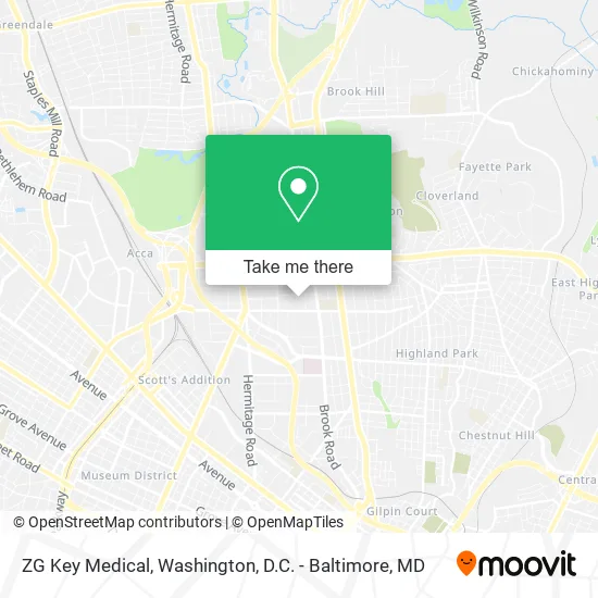
See ZG Key Medical, Richmond, on the map
Public Transit to ZG Key Medical in Richmond
Wondering how to get to ZG Key Medical in Richmond? Moovit helps you find the best way to get to ZG Key Medical with step-by-step directions from the nearest public transit station.
Moovit provides free maps and live directions to help you navigate through your city. View schedules, routes, timetables, and find out how long does it take to get to ZG Key Medical in real time.
Looking for the nearest stop or station to ZG Key Medical? Check out this list of stops closest to your destination: Chamberlayne + Melrose; W Laburnum Ave + Brook Rd; Hermitage + Palmyra.
Bus: 1, 14, 91.
Want to see if there’s another route that gets you there at an earlier time? Moovit helps you find alternative routes or times. Get directions from and directions to ZG Key Medical easily from the Moovit App or Website.
We make riding to ZG Key Medical easy, which is why over 1.5 million users, including users in Richmond, trust Moovit as the best app for public transit. You don’t need to download an individual bus app or train app, Moovit is your all-in-one transit app that helps you find the best bus time or train time available.
For information on prices of bus and train, costs and ride fares to ZG Key Medical, please check the Moovit app.
Use the app to navigate to popular places including to the airport, hospital, stadium, grocery store, mall, coffee shop, school, college, and university.
ZG Key Medical Address: 1311 Palmyra Ave Richmond, VA 23227 street in Richmond
- Health Institute,
- Richmond Memorial Foundation,
- Ginter Place,
- Assembly Training School,
- Paisley Hall,
- Lingle Hall,
- Cokesbury Campus Bookstore,
- Laburnum Park Historic District,
- Garland N Creighton Certified Public Accountant,
- Debbie Hinkle,
- Watts Chapel,
- Early,
- Inspired by the Dress,
- Harvest Custom Wine Cellars and Saunas,
- Wright Investments General Contracting,
- Richmond Hall,
- Providence Montessori Christian School,
- Center for Congregational Ministry,
- Eternity Music Academy,
- Ginter Park Baptist Church
Places Near ZG Key Medical (Richmond)
- Basilica of the National Shrine, Washington,
- National Theatre, Washington,
- Pennsylvania Ave NW (3rd st and pennsylvania), Washington,
- Museum Of The Bible, Washington,
- National Zoo, Washington,
- Sibley Memorial Hospital, Washington,
- M&T Bank Stadium, Baltimore,
- Amazon Hq2, Arlington County,
- Washington National Cathedral, Washington,
- Rock Creek Tennis Center, Washington,
- Capital One Arena, Washington,
- Georgetown, Washington,
- The Anthem, Washington,
- Warner Theatre, Washington,
- Westfield Montgomery Mall, Montgomery County,
- Marriott Marquis Washington, DC, Washington,
- Washington DC VA Medical Center, Washington,
- National Museum of African American History and Culture, Washington,
- PG Mall, Prince George's County,
- Camden Yards, Baltimore
How to get to popular places in Washington, D.C. - Baltimore, MD with public transit
Get around Richmond by public transit!
Traveling around Richmond has never been so easy. See step by step directions as you travel to any attraction, street or major public transit station. View bus and train schedules, arrival times, service alerts and detailed routes on a map, so you know exactly how to get to anywhere in Richmond.
When traveling to any destination around Richmond use Moovit's Live Directions with Get Off Notifications to know exactly where and how far to walk, how long to wait for your line, and how many stops are left. Moovit will alert you when it's time to get off — no need to constantly re-check whether yours is the next stop.
Wondering how to use public transit in Richmond or how to pay for public transit in Richmond? Moovit public transit app can help you navigate your way with public transit easily, and at minimum cost. It includes public transit fees, ticket prices, and costs. Looking for a map of Richmond public transit lines? Moovit public transit app shows all public transit maps in Richmond with all Bus, Train, Metro, Light Rail and Ferry routes and stops on an interactive map.
Washington, D.C. - Baltimore, MD has 5 transit type(s), including: Bus, Train, Metro, Light Rail and Ferry, operated by several transit agencies, including WMATA, Montgomery County Ride On, Fairfax Connector, TheBus, PRTC, DASH - Alexandria, Arlington Transit (ART), RTA of Central Maryland, MDOT MTA, MDOT MTA Light RailLink, MDOT MTA Commuter Bus, MDOT MTA Local Bus, FXBGO!, Virginia Railway Express (VRE) and MARC