How to get to Zagall by bus?
Click on the bus route to see step by step directions with maps, line arrival times and updated time schedules.
From Bus La 22, Magdalena
35 minFrom Salamanca, Ate
56 minFrom Centro Comercial Open Plaza Angamos, Surquillo
46 minFrom Polideportivo Limatambo, San Borja
55 minFrom Mala al Sur de Lima, Miraflores
53 minFrom Av Jose Pardo, Miraflores
53 minFrom Corpac, San Isidro
47 minFrom Universidad Continental, Los Olivos
19 minFrom PENTAGONITO, San Borja
54 minFrom AV SALAVERRY JESUS MARIA, Jesus Mari
27 min
Bus stops near Zagall in San Martin
Bus lines to Zagall in San Martin
- 1010, Pte. Piedra - Magdalena - Pte. Piedra,VIEW
- 1016, La Florida (Ancon) - Aviación (La Victoria),VIEW
- 1024, Los Sauces - Cerro Candela,VIEW
- 1030, Canta Callao (San Martin De Porres) - San Diego (San Martin De Porres),VIEW
- 1131, Gamarra (La Victoria),VIEW
- 1160, Pachacútec (Ventanilla) - Gamarra (La Victoria),VIEW
- 1168, Ventanilla - Panam. Norte - Alfonso Ugarte - Salaverry - Panamericana Norte - Ancón,VIEW
- 1176, Collique (Comas) - Faraday (Ate),VIEW
- 1177, Torre Blanca (Carabayllo) - Metropolitana (Ate),VIEW
- 1178, Tagore (Ate) - Km.22 (Carabayllo),VIEW
- 1179, Miramar (Ancón) - Upc (Santiago De Surco),VIEW
- 1180, Pamplona Alta (San Juan De Miraflores) - Torre Blanca (Carabayllo),VIEW
- 1181, Ensenada (Puente Piedra) - Pumacahua (Chorrillos),VIEW
- 1183, Carabayllo - Surco - Carabayllo,VIEW
- 1184, Las Palmas (Pachacamac) - Profam (Santa Rosa),VIEW
- 1185, Ensenada (Puente Piedra) - Av. Lima (Villa El Salvador),VIEW
- 1189, Izaguirre (San Martin De Porres) - Bravo Chico (El Agustino) ,VIEW
- 1199, Villarán (Surquillo) - Puente Camote (San Martin De Porres),VIEW
- 1235, Manchay (Pachacamac) - Santo Domingo (Carabayllo),VIEW
- 1237, Santo Domingo (Carabayllo) - Velasco Alvarado (Villa El Salvador),VIEW
What are the closest stations to Zagall?
The closest stations to Zagall are:
- Habich is 18 meters away, 1 min walk.
- Avenida Augusto B. Leguia 491 is 272 meters away, 4 min walk.
- Puente Control is 319 meters away, 5 min walk.
- Óvalo Habich is 377 meters away, 5 min walk.
Which bus lines stop near Zagall?
These bus lines stop near Zagall: 1176, 1180, 1226, 1237, 1261, 1262, 1471, 1476.
What’s the nearest bus station to Zagall in San Martin?
The nearest bus station to Zagall in San Martin is Habich. It’s a 1 min walk away.
What time is the first bus to Zagall in San Martin?
The 1471 is the first bus that goes to Zagall in San Martin. It stops nearby at 3:49 AM.
What time is the last bus to Zagall in San Martin?
The OM23 is the last bus that goes to Zagall in San Martin. It stops nearby at 2:54 AM.
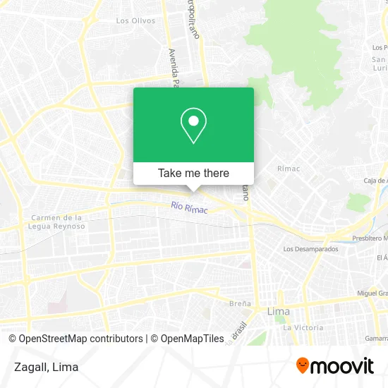
See Zagall, San Martin, on the map
Public Transit to Zagall in San Martin
Wondering how to get to Zagall in San Martin? Moovit helps you find the best way to get to Zagall with step-by-step directions from the nearest public transit station.
Moovit provides free maps and live directions to help you navigate through your city. View schedules, routes, timetables, and find out how long does it take to get to Zagall in real time.
Looking for the nearest stop or station to Zagall? Check out this list of stops closest to your destination: Habich; Avenida Augusto B. Leguia 491; Puente Control; Óvalo Habich.
Bus: 1176, 1180, 1226, 1237, 1261, 1262, 1471, 1476, 1010, 1016, 1024, 1030, 1131, 1197, CR24, CR25, CR44, 2407, 1012, CR07, CR43, CR62, IO27.
Want to see if there’s another route that gets you there at an earlier time? Moovit helps you find alternative routes or times. Get directions from and directions to Zagall easily from the Moovit App or Website.
We make riding to Zagall easy, which is why over 1.5 million users, including users in San Martin, trust Moovit as the best app for public transit. You don’t need to download an individual bus app or train app, Moovit is your all-in-one transit app that helps you find the best bus time or train time available.
For information on prices of bus, costs and ride fares to Zagall, please check the Moovit app.
Use the app to navigate to popular places including to the airport, hospital, stadium, grocery store, mall, coffee shop, school, college, and university.
Zagall Address: Jirón San Martín de Porres 28 de Julio, 15101 San Martín de Porres street in San Martin
- Banco de la Nación,
- Galeria Tomás Valle,
- Ñutricao,
- Esther Salón Spa,
- Guevara de la Cruz Rosa Luz,
- Bodega Mercy,
- Xxhd1020xx para Sub,
- Estudio Contable Lideres Contables - Estudio Contable en San Martín de Porres,
- Av Zarumilla 855,
- Pasaje San Jose,
- Colegio 3024 josé Antonio Encinas,
- Av San Martin 121 A SMP,
- C.E.P Nuestra Señora de la Natividad,
- Bodega Sonaly,
- Mega Chicken,
- Flores Fernández Carlos Alfonso,
- Omnisalud Medicenter E.I.R.L.,
- Jr Aquia en SMP,
- Business Services-Taculi de Toledo Irma Micaela,
- J.H Catering, fiestas & Eventos
Places Near Zagall (San Martin)
- Centro Comercial Plaza Norte, Independen,
- Parque de las Leyendas, San Miguel,
- av arequipa, Lima,
- Aeropuerto Internacional Jorge Chávez, Ventanilla,
- Av. Abancay, Lima,
- Paradero Av.Brasil,
- Pontificia Universidad Católica del Perú - PUCP, San Miguel,
- Mall Del Sur,
- Real Plaza Puruchuco, Ate,
- Av. Salaverry, Jesus Mari,
- Parque Kennedy, Miraflores,
- Miraflores, Miraflores,
- Gamarra,
- Circuito Mágico Del Agua, Lima,
- Hospital Edgardo Rebagliati Martins, Jesus Mari,
- Barranco, Barranco,
- Jockey Plaza, Santiago D,
- Plaza San Miguel, San Miguel,
- Av. La Marina, San Miguel,
- Larcomar, Miraflores
How to get to popular places in Lima with public transit
Get around San Martin by public transit!
Traveling around San Martin has never been so easy. See step by step directions as you travel to any attraction, street or major public transit station. View bus and train schedules, arrival times, service alerts and detailed routes on a map, so you know exactly how to get to anywhere in San Martin.
When traveling to any destination around San Martin use Moovit's Live Directions with Get Off Notifications to know exactly where and how far to walk, how long to wait for your line, and how many stops are left. Moovit will alert you when it's time to get off — no need to constantly re-check whether yours is the next stop.
Wondering how to use public transit in San Martin or how to pay for public transit in San Martin? Moovit public transit app can help you navigate your way with public transit easily, and at minimum cost. It includes public transit fees, ticket prices, and costs. Looking for a map of San Martin public transit lines? Moovit public transit app shows all public transit maps in San Martin with all Bus, Metro and Ferry routes and stops on an interactive map.
Lima has 3 transit type(s), including: Bus, Metro and Ferry, operated by several transit agencies, including Metro de Lima Línea 2 , Metro de Lima, Corredor Rojo, Metropolitano, Metropolitano - Alimentadores, Corredor Morado, Corredor Azul, Rutas Tradicionales, Transportes y Servicios La Esperanza S.A., Las Flores S.A., Virgen de la Asunción S.A., Consorcio HAM, Transportes y Service Canadá S.A., ETUL4SA and ETUCHISA