How to get to Zahli Modas by bus?
Click on the bus route to see step by step directions with maps, line arrival times and updated time schedules.
From terminal brt jardim oceânico, Barra Da Tijuca
37 minFrom Recreio dos Bandeirantes, Recreio Dos Bandeirantes
34 minFrom Taquara (Jacarepagua), Taquara
34 minFrom BRT - Estação Afrânio Costa, Barra Da Tijuca
41 minFrom Av. Das Américas 500, Barra Da Tijuca
45 minFrom Downtown, Barra Da Tijuca
44 minFrom Avenida José Silva De Azevedo Neto, Barra Da Tijuca
45 minFrom Shopping Downtown, Barra Da Tijuca
44 minFrom brt barra, Barra Da Tijuca
41 minFrom Brt Ricardo Marinho - Sentido Jardim Oceânico, Barra Da Tijuca
37 min
Bus stops near Zahli Modas in Camorim
Bus lines to Zahli Modas in Camorim
- 51, Terminal Recreio (Parador - Noturno),VIEW
- 348, Riocentro - Candelária (Brs 5 - Via Linha Amarela),VIEW
- 352, Riocentro - Candelária (Brs 5 - Via Linha Amarela),VIEW
- 368, Riocentro - Candelária (Brs 5 - Via Maracanã),VIEW
- SN 368, Riocentro - Candelária (BRS 5 - via Maracanã),VIEW
- SPA 613, Riocentro - Del Castilho (via Linha Amarela),VIEW
- 2613, Riocentro - Nova América / Del Castilho (Via Parque Olímpico),VIEW
- 611, Riocentro,VIEW
- 613, Vargem Grande,VIEW
- 881, Taquara,VIEW
- 407T, Nova Iguaçu,VIEW
- 961, Recreio,VIEW
- 810, Taquara - Pontal (Via César Maia),VIEW
- SN 810, Taquara - Pontal (Via Estrada do Guerenguê),VIEW
- SP 810, Taquara - Vargem Grande (Via César Maia),VIEW
- 954, Taquara - Recreio (via Benvindo de Novaes),VIEW
What are the closest stations to Zahli Modas?
The closest stations to Zahli Modas are:
- Olof Palme is 444 meters away, 6 min walk.
- Ponto Final - Riocentro is 456 meters away, 14 min walk.
- Riocentro Pavilhão 3 is 456 meters away, 15 min walk.
- Av. Salvador Allende | Riocentro | Parque Dos Atletas | Lagune is 501 meters away, 9 min walk.
- Riocentro is 1129 meters away, 15 min walk.
Which bus line stops near Zahli Modas?
51 (Deodoro (Parador))
What’s the nearest bus station to Zahli Modas in Camorim?
The nearest bus station to Zahli Modas in Camorim is Olof Palme. It’s a 6 min walk away.
What time is the first bus to Zahli Modas in Camorim?
The 368 is the first bus that goes to Zahli Modas in Camorim. It stops nearby at 3:00 AM.
What time is the last bus to Zahli Modas in Camorim?
The SN 368 is the last bus that goes to Zahli Modas in Camorim. It stops nearby at 4:03 AM.
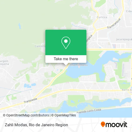
See Zahli Modas, Camorim, on the map
Public Transit to Zahli Modas in Camorim
Wondering how to get to Zahli Modas in Camorim? Moovit helps you find the best way to get to Zahli Modas with step-by-step directions from the nearest public transit station.
Moovit provides free maps and live directions to help you navigate through your city. View schedules, routes, timetables, and find out how long does it take to get to Zahli Modas in real time.
Looking for the nearest stop or station to Zahli Modas? Check out this list of stops closest to your destination: Olof Palme; Ponto Final - Riocentro; Riocentro Pavilhão 3; Av. Salvador Allende | Riocentro | Parque Dos Atletas | Lagune; Riocentro.
Bus: 51, 407T, 961, 348, 352, 368, SN 368, SPA 613, 611, 613, 881, 810, SN 810, SP 810, 954.
Want to see if there’s another route that gets you there at an earlier time? Moovit helps you find alternative routes or times. Get directions from and directions to Zahli Modas easily from the Moovit App or Website.
We make riding to Zahli Modas easy, which is why over 1.5 million users, including users in Camorim, trust Moovit as the best app for public transit. You don’t need to download an individual bus app or train app, Moovit is your all-in-one transit app that helps you find the best bus time or train time available.
For information on prices of bus, costs and ride fares to Zahli Modas, please check the Moovit app.
Use the app to navigate to popular places including to the airport, hospital, stadium, grocery store, mall, coffee shop, school, college, and university.
Zahli Modas Address: Rua Rodrigo Melo Franco, Camorim Rio de Janeiro-RJ 22780-160 street in Camorim
- Rua Rodrigo Mello Franco 160,
- Virtual Motors Paginas Eletronicas Ltda,
- Facfacil,
- Marcel Tur,
- Telco do Brasil Call Center Ltda,
- Flor & Arte,
- Natural Garden,
- Lpr Locações,
- Costasul,
- Terminal de Carregamento EV,
- Bar do Seu Tomé,
- Avenida Salvador Allende Próximo ao 43,
- Isjubiju,
- Ilha Pura,
- Avenida Salvador Allende,
- Parque do Atetlas,
- Ilha Pura - Odebrecht,
- Lagom Material Hospitalar Ltda,
- Avenida Abraham Medina,
- Ilha Pura
Places Near Zahli Modas (Camorim)
- Hospital Federal Do Andaraí, Andaraí,
- Feirão De Malhas, Duque De Caxias,
- Museu Do Amanhã, Centro,
- Avenida Rio Branco, Centro,
- Hospital Federal Cardoso Fontes, Jacarepaguá,
- Rodoviária Novo Rio (Rodoviária do Rio de Janeiro), Santo Cristo,
- Niterói, Niterói,
- Feira Livre da Gloria, Glória,
- Shopping Downtown, Barra Da Tijuca,
- Rio De Janeiro,
- Hospital Pedro Ernesto, Vila Isabel,
- Shopping RioSul, Botafogo,
- Rua Licínio Cardoso, São Francisco Xavier,
- Praia do Arpoador, Ipanema,
- Norte Shopping, Cachambi,
- Avenida Venezuela 134, Saúde,
- Shopping Nova América, Del Castilho,
- Rua Ulysses Guimarães 16, Cidade Nova,
- Shopping Rio Sul, Botafogo,
- Hospital Municipal Ronaldo Gazolla, Acari
How to get to popular places in Rio de Janeiro Region with public transit
Get around Camorim by public transit!
Traveling around Camorim has never been so easy. See step by step directions as you travel to any attraction, street or major public transit station. View bus and train schedules, arrival times, service alerts and detailed routes on a map, so you know exactly how to get to anywhere in Camorim.
When traveling to any destination around Camorim use Moovit's Live Directions with Get Off Notifications to know exactly where and how far to walk, how long to wait for your line, and how many stops are left. Moovit will alert you when it's time to get off — no need to constantly re-check whether yours is the next stop.
Wondering how to use public transit in Camorim or how to pay for public transit in Camorim? Moovit public transit app can help you navigate your way with public transit easily, and at minimum cost. It includes public transit fees, ticket prices, and costs. Looking for a map of Camorim public transit lines? Moovit public transit app shows all public transit maps in Camorim with all Bus, Train, Metro, Light Rail, Ferry, Cable Car, Gondola and Funicular routes and stops on an interactive map.
Rio de Janeiro Region has 8 transit type(s), including: Bus, Train, Metro, Light Rail, Ferry, Cable Car, Gondola and Funicular, operated by several transit agencies, including TrensRJ, Metrô Rio, VLT Carioca, Barcas Rio, BRT MOBI-Rio, Auto Viação Alpha, Auto Viação Tijuca, Gire Transportes, Transurb, Viação Nossa Senhora das Graças, Consórcio INTERSUL, Braso Lisboa (Municipal), Caprichosa Auto Ônibus, Auto Viação Três Amigos and Rodoviária Âncora Matias