How to get to Zeichensetzen by bus?
Click on the bus route to see step by step directions with maps, line arrival times and updated time schedules.
How to get to Zeichensetzen by train?
Click on the train route to see step by step directions with maps, line arrival times and updated time schedules.
Bus stops near Zeichensetzen in Dresden
Train station near Zeichensetzen in Dresden
- Ilsenburg, 10 min walk,VIEW
Bus lines to Zeichensetzen in Dresden
What are the closest stations to Zeichensetzen?
The closest stations to Zeichensetzen are:
- Drübeck, Kloster is 325 meters away, 5 min walk.
- Drübeck, Ost is 751 meters away, 10 min walk.
- Ilsenburg is 760 meters away, 10 min walk.
Which bus lines stop near Zeichensetzen?
These bus lines stop near Zeichensetzen: 270, 274.
Which train line stops near Zeichensetzen?
RE21 (Goslar, Bahnhof)
What’s the nearest train station to Zeichensetzen in Dresden?
The nearest train station to Zeichensetzen in Dresden is Ilsenburg. It’s a 10 min walk away.
What’s the nearest bus station to Zeichensetzen in Dresden?
The nearest bus station to Zeichensetzen in Dresden is Drübeck, Kloster. It’s a 5 min walk away.
What time is the first train to Zeichensetzen in Dresden?
The RE21 is the first train that goes to Zeichensetzen in Dresden. It stops nearby at 4:08 AM.
What time is the last train to Zeichensetzen in Dresden?
The RE21 is the last train that goes to Zeichensetzen in Dresden. It stops nearby at 1:01 AM.
What time is the first bus to Zeichensetzen in Dresden?
The 270 is the first bus that goes to Zeichensetzen in Dresden. It stops nearby at 4:36 AM.
What time is the last bus to Zeichensetzen in Dresden?
The 270 is the last bus that goes to Zeichensetzen in Dresden. It stops nearby at 8:34 PM.
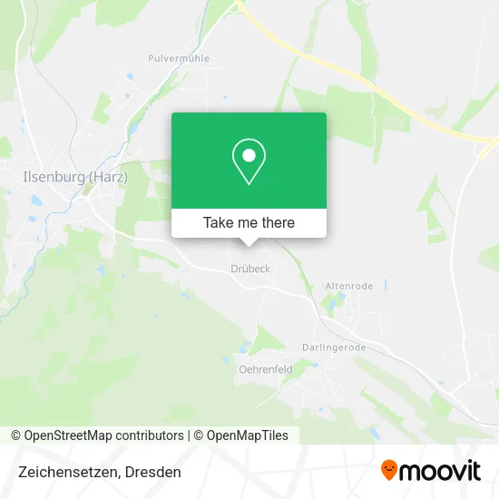
See Zeichensetzen, Dresden, on the map
Public Transit to Zeichensetzen in Dresden
Wondering how to get to Zeichensetzen in Dresden? Moovit helps you find the best way to get to Zeichensetzen with step-by-step directions from the nearest public transit station.
Moovit provides free maps and live directions to help you navigate through your city. View schedules, routes, timetables, and find out how long does it take to get to Zeichensetzen in real time.
Looking for the nearest stop or station to Zeichensetzen? Check out this list of stops closest to your destination: Drübeck; Drübeck; Ilsenburg.
Bus: 270, 274.Train: RE21, HBX, RE4.
Want to see if there’s another route that gets you there at an earlier time? Moovit helps you find alternative routes or times. Get directions from and directions to Zeichensetzen easily from the Moovit App or Website.
We make riding to Zeichensetzen easy, which is why over 1.5 million users, including users in Dresden, trust Moovit as the best app for public transit. You don’t need to download an individual bus app or train app, Moovit is your all-in-one transit app that helps you find the best bus time or train time available.
For information on prices of bus and train, costs and ride fares to Zeichensetzen, please check the Moovit app.
Use the app to navigate to popular places including to the airport, hospital, stadium, grocery store, mall, coffee shop, school, college, and university.
Zeichensetzen Address: Am Kamp 5 Drübeck, 38871 Ilsenburg (Harz) street in Dresden
- Gemeindeverwaltung Drübeck,
- Dera-Automotive,
- Pbw Lsa de,
- Paritätische Bildungswerk Sachsen-Anhalt,
- Kindertagesstätte Kunterbunt,
- Thielemann Contor-Managment Marco,
- Mobile Cafe-Bar Drübeck,
- 17,
- Drübeck,
- Trauerhalle,
- Gasthof Gemeindekrug,
- Thorsten Henk,
- Gemeindekrug Drübeck,
- Heimatverein auf dem Gutshof Wasserleben,
- Tel-Dis,
- Baugebiet,
- Kloster Drübeck,
- Gartenträume,
- St.-Bartholomäus-Kirche,
- Stefan Furtner Musiklehrer
Places Near Zeichensetzen (Dresden)
- Elbepark, Dresden,
- Pfunds Molkerei, Dresden,
- Schloß Übigau, Dresden,
- Dresden, Hauptbahnhof (Strehlener Straße), Dresden,
- Amedia Hotel Dresden Elbpromenade, Dresden,
- Hans-Erlwein-Gymnasium, Dresden,
- Carolaschlösschen, Dresden,
- Kaufpark Dresden-Nickern, Dresden,
- Weisser Hirsch, Dresden,
- Heinz-Steyer-Stadion, Dresden,
- Altstadt, Dresden,
- Waldmax, Dresden,
- Freilichtbühne Junge Garde, Dresden,
- Dresden Hbf, Dresden,
- Landschloß Zuschendorf, Pirna,
- Ikea, Dresden,
- Schloss Pillnitz, Dresden,
- Krankenhaus St. Joseph-Stift, Dresden,
- Biergarten "Gohliser Windmühle", Dresden,
- Oskarshausen, Freital
How to get to popular places in Dresden with public transit
Get around Dresden by public transit!
Traveling around Dresden has never been so easy. See step by step directions as you travel to any attraction, street or major public transit station. View bus and train schedules, arrival times, service alerts and detailed routes on a map, so you know exactly how to get to anywhere in Dresden.
When traveling to any destination around Dresden use Moovit's Live Directions with Get Off Notifications to know exactly where and how far to walk, how long to wait for your line, and how many stops are left. Moovit will alert you when it's time to get off — no need to constantly re-check whether yours is the next stop.
Wondering how to use public transit in Dresden or how to pay for public transit in Dresden? Moovit public transit app can help you navigate your way with public transit easily, and at minimum cost. It includes public transit fees, ticket prices, and costs. Looking for a map of Dresden public transit lines? Moovit public transit app shows all public transit maps in Dresden with all Bus, Train, Light Rail, Ferry, Cable Car and Gondola routes and stops on an interactive map.
Dresden has 6 transit type(s), including: Bus, Train, Light Rail, Ferry, Cable Car and Gondola, operated by several transit agencies, including Trilex, DB AG - S-Bahn, DVB AG, alita, RVSOE, Müller.Bus.Reisen, SATRA Eberhardt, VGM, RBO, DB AG, MRB, SDG, Sächsisch-Oberlausitzer Eisenbahngesellschaft, DB Fernverkehr (Codesharing) and Hanseatische Eisenbahn GmbH